All Available Networks - other tables for NE include: CWOP/APRS, METAR, NEDOT, RAWS, see our homepage.
|
Also try the full-featured calculator/DD model | |
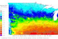
Disease Alert Movies: fireblight: 2010 2011 2012 2013 | ||
|
| |||||||||||||||||||||||||||
|
Nebraska USA Weather Data, Plant Disease Risk and Degree-Day Models All Available Networks - other tables for NE include: CWOP/APRS, METAR, NEDOT, RAWS, see our homepage. | |||||||||||||||||||||||||||
| |||||||||||||||||||||||||||
| # | Location linked to hourly weather, plant disease models and forecasts using "Mypest Page" |
County |
Re- cent data QA |
Fore- cast based virt data |
Nearby station based virt data |
Station code, links to NWS recent weather |
Links to NWS fore- casts |
Net- work Elev. (ft) |
Lat./ Long. (Dec. Deg.) |
Max-min temperature data and degree-days (click radio button to calc.) |
10 yr avgs |
30 yr avgs |
nmme fcast |
cfs fcast |
||||||||||||
|---|---|---|---|---|---|---|---|---|---|---|---|---|---|---|---|---|---|---|---|---|---|---|---|---|---|---|
| 1 | AGATE | Sioux |
|
na na |
na na |
|
|
4400 | 42.42472 -103.73556 |
2021
|
2020
|
2019
|
2018
|
2017
|
2016
|
2015
|
2014
|
2013
|
AVG | AVG | nmme | |||||
| 2 | Ainsworth Municipal | Brown |
|
na na |
na na |
|
|
2589 | 42.58306 -100.00000 |
2021
|
2020
|
2019
|
2018
|
2017
|
2016
|
2015
|
2014
|
2013
|
|
AVG | AVG | nmme | ||||
| 3 | AJ0A Papillion | Sarpy County |
|
na na |
na na |
|
|
1043 | 41.15167 -96.05944 |
2021
|
nmme | |||||||||||||||
| 4 | Albion Muni Apt | Boone |
|
na na |
na na |
|
|
1808 | 41.72806 -98.05556 |
2021
|
2020
|
2019
|
2018
|
2017
|
2016
|
2015
|
2014
|
2013
|
|
AVG | AVG | nmme | ||||
| 5 | ALDA1 | Hall |
|
na na |
na na |
|
|
1891 | 40.89444 -98.41306 |
2021
|
2020
|
2019
|
2018
|
2017
|
2016
|
2015
|
2014
|
2013
|
|
AVG | AVG | nmme | ||||
| 6 | ALDA2 | Hall County |
|
na na |
na na |
|
|
1900 | 40.89417 -98.41306 | |||||||||||||||||
| 7 | ALEXR1 | Jefferson |
|
na na |
na na |
|
|
1398 | 40.23750 -97.36056 |
2021
|
2020
|
2019
|
2018
|
2017
|
2016
|
2015
|
2014
|
2013
|
|
AVG | AVG | nmme | ||||
| 8 | ALEXR2 | Jefferson Co |
|
na na |
na na |
|
|
1404 | 40.23722 -97.36056 |
2021
|
nmme | |||||||||||||||
| 9 | Alliance Muni Apt | Box Butte |
|
na na |
na na |
|
|
3927 | 42.05694 -102.80000 |
2021
|
2020
|
2019
|
2018
|
2017
|
2016
|
2015
|
2014
|
2013
|
|
AVG | AVG | nmme | ||||
| 10 | ANAN1 | Clay |
|
na na |
na na |
|
|
1797 | 40.44528 -98.13944 |
2021
|
2020
|
2019
|
2018
|
2017
|
2016
|
2015
|
2014
|
2013
|
|
AVG | AVG | nmme | ||||
| 11 | ANAN2 | Clay County |
|
na na |
na na |
|
|
1794 | 40.44528 -98.13944 |
2021
|
nmme | |||||||||||||||
| 12 | Arcadia HWY 70 | Custer |
|
na na |
na na |
|
|
2300 | 41.39472 -99.21111 |
2021
|
2020
|
2019
|
2018
|
2017
|
2016
|
2015
|
2014
|
2013
|
|
AVG | AVG | nmme | ||||
| 13 | Ash Hollow on US 26 @ | Garden |
|
na na |
na na |
|
|
3298 | 41.31083 -102.12528 |
2021
|
2020
|
2019
|
2018
|
2017
|
2016
|
2015
|
2014
|
2013
|
|
AVG | AVG | nmme | ||||
| 14 | Auburn Nebraska City | Nemaha |
|
na na |
na na |
|
|
1097 | 40.50861 -95.85778 |
2021
|
2020
|
2019
|
2018
|
2017
|
2016
|
2015
|
2014
|
2013
|
|
AVG | AVG | nmme | ||||
| 15 | Aurora Muni Apt | Merrick |
|
na na |
na na |
|
|
1804 | 40.89389 -97.99417 |
2021
|
2020
|
2019
|
2018
|
2017
|
2016
|
2015
|
2014
|
2013
|
|
AVG | AVG | nmme | ||||
| 16 | Banner Rd on N 71 @ MP | Banner |
|
na na |
na na |
|
|
4952 | 41.49472 -103.65889 |
2021
|
2020
|
2019
|
2018
|
2017
|
2016
|
2015
|
2014
|
2013
|
|
AVG | AVG | nmme | ||||
| 17 | BARTN1 | Deuel County |
|
na na |
na na |
|
|
3406 | 41.04806 -102.13417 |
2021
|
nmme | |||||||||||||||
| 18 | BARTN2 | Deuel |
|
na na |
na na |
|
|
3413 | 41.04806 -102.13417 |
2021
|
2020
|
2019
|
2018
|
2017
|
2016
|
2015
|
2014
|
2013
|
AVG | AVG | nmme | |||||
| 19 | BAZILE CREEK AT CENTER | Knox County |
|
na na |
na na |
|
|
1381 | 42.61639 -97.87806 | nmme | ||||||||||||||||
| 20 | Beatrice Municipal | Gage |
|
na na |
na na |
|
|
1322 | 40.30000 -96.75000 |
2021
|
2020
|
2019
|
2018
|
2017
|
2016
|
2015
|
2014
|
2013
|
|
AVG | AVG | nmme | ||||
| 21 | Bellevue CW3318 | Sarpy |
|
na na |
na na |
|
|
1160 | 41.09944 -95.96111 |
2021
|
2020
|
2019
|
2018
|
2017
|
2016
|
2015
|
2014
|
2013
|
|
AVG | AVG | nmme | ||||
| 22 | Bellevue DW0809 | Sarpy |
|
na na |
na na |
|
|
1112 | 41.10444 -95.94444 |
2021
|
2020
|
2019
|
2018
|
2017
|
2016
|
2015
|
2014
|
2013
|
|
AVG | AVG | nmme | ||||
| 23 | Bellevue DW1234 | Pottawattami |
|
na na |
na na |
|
|
1171 | 41.16694 -95.94944 |
2021
|
2020
|
2019
|
2018
|
2017
|
2016
|
2015
|
2014
|
2013
|
|
AVG | AVG | nmme | ||||
| 24 | BELVI1 | Thayer |
|
na na |
na na |
|
|
1532 | 40.28000 -97.61500 |
2021
|
2020
|
2019
|
2018
|
2017
|
2016
|
2015
|
2014
|
2013
|
AVG | AVG | nmme | |||||
| 25 | BELVI2 | Thayer Count |
|
na na |
na na |
|
|
1532 | 40.28000 -97.61500 |
2021
|
nmme | |||||||||||||||
| 26 | Bennington CW8198 | Douglas |
|
na na |
na na |
|
|
1204 | 41.37194 -96.21083 |
2021
|
2020
|
2019
|
2018
|
2017
|
2016
|
2015
|
2013
|
|
AVG | AVG | nmme | |||||
| 27 | BESSEY | Thomas |
|
na na |
na na |
|
|
2873 | 41.89694 -100.31056 |
2021
|
2020
|
2019
|
2018
|
2017
|
2016
|
2015
|
2014
|
2013
|
|
AVG | AVG | nmme | ||||
| 28 | Big Sprs on I80 @ MP 9 | Deuel |
|
na na |
na na |
|
|
3641 | 41.04583 -102.29722 |
2021
|
2020
|
2019
|
2018
|
2017
|
2016
|
2015
|
2014
|
2013
|
|
AVG | AVG | nmme | ||||
| 29 | BIGSWS | Keith County |
|
na na |
na na |
|
|
3357 | 41.07333 -102.02083 |
2021
|
2020
|
2019
|
2018
|
2017
|
2016
|
2015
|
2014
|
AVG | AVG | nmme | ||||||
| 30 | Blair DW5858 | Washington |
|
na na |
na na |
|
|
1086 | 41.55778 -96.14667 |
2021
|
2020
|
2019
|
2018
|
2017
|
2016
|
2015
|
2014
|
2013
|
|
AVG | AVG | nmme | ||||
| 31 | Blair Muni Apt | Washington |
|
na na |
na na |
|
|
1325 | 41.41472 -96.10889 |
2021
|
2020
|
2019
|
2018
|
2017
|
2016
|
2015
|
2014
|
2013
|
|
AVG | AVG | nmme | ||||
| 32 | BRADY1 | Lincoln |
|
na na |
na na |
|
|
2650 | 41.01639 -100.36139 |
2021
|
2020
|
2019
|
2018
|
2017
|
2016
|
2015
|
2014
|
2013
|
|
AVG | AVG | nmme | ||||
| 33 | BRADY2 | Lincoln Coun |
|
na na |
na na |
|
|
2657 | 41.01639 -100.36139 |
2021
|
nmme | |||||||||||||||
| 34 | BRADY3 | Lincoln Coun |
|
na na |
na na |
|
|
2657 | 41.01639 -100.36139 |
2021
|
nmme | |||||||||||||||
| 35 | Brewster Field Airport | Phelps |
|
na na |
na na |
|
|
2310 | 40.45000 -99.33306 |
2021
|
2020
|
2019
|
2018
|
2017
|
2016
|
2015
|
2014
|
2013
|
|
AVG | AVG | nmme | ||||
| 36 | Brewster | Blaine |
|
na na |
na na |
|
|
2503 | 41.93194 -99.86028 |
2021
|
2020
|
2019
|
2018
|
2017
|
2016
|
2015
|
2014
|
2013
|
|
AVG | AVG | nmme | ||||
| 37 | BRGPT1 | Morrill |
|
na na |
na na |
|
|
3721 | 41.71361 -103.23028 |
2021
|
2020
|
2019
|
2018
|
2017
|
2016
|
2015
|
2014
|
2013
|
AVG | AVG | nmme | |||||
| 38 | BRGPT2 | Morrill Coun |
|
na na |
na na |
|
|
3724 | 41.71361 -103.23028 |
2021
|
nmme | |||||||||||||||
| 39 | Bridgeport CW2360 | Morrill Coun |
|
na na |
na na |
|
|
3665 | 41.66278 -103.09611 |
2021
|
2020
|
2019
|
nmme | |||||||||||||
| 40 | Broken Bow Muni Apt | Custer |
|
na na |
na na |
|
|
2546 | 41.43306 -99.65000 |
2021
|
2020
|
2019
|
2018
|
2017
|
2016
|
2015
|
2014
|
2013
|
|
AVG | AVG | nmme | ||||
| 41 | BROWN1 | Cheyenne Cou |
|
na na |
na na |
|
|
4219 | 41.19167 -103.12778 |
2021
|
nmme | |||||||||||||||
| 42 | BROWN2 | Cheyenne |
|
na na |
na na |
|
|
4229 | 41.19167 -103.12778 |
2021
|
2020
|
2019
|
2018
|
2017
|
2016
|
2015
|
2014
|
2013
|
|
AVG | AVG | nmme | ||||
| 43 | BRULE1 | Keith |
|
na na |
na na |
|
|
3281 | 41.09556 -101.86417 |
2021
|
2020
|
2019
|
2018
|
2017
|
2016
|
2015
|
2014
|
2013
|
|
AVG | AVG | nmme | ||||
| 44 | BRULE2 | Keith County |
|
na na |
na na |
|
|
3281 | 41.09556 -101.86417 |
2021
|
nmme | |||||||||||||||
| 45 | BUSH2 | Kimball |
|
na na |
na na |
|
|
4840 | 41.23278 -103.84778 |
2021
|
2020
|
2019
|
2018
|
2017
|
2016
|
2015
|
2014
|
2013
|
|
AVG | AVG | nmme | ||||
| 46 | BUSH2 | Kimball Coun |
|
na na |
na na |
|
|
4793 | 41.22944 -103.79611 |
2021
|
nmme | |||||||||||||||
| 47 | Campbell HWY 4 @ MP 49 | Webster |
|
na na |
na na |
|
|
2035 | 40.29167 -98.70861 |
2021
|
2020
|
2019
|
2018
|
2017
|
2016
|
2015
|
2014
|
2013
|
|
AVG | AVG | nmme | ||||
| 48 | KINGS CANYON | Dawes |
|
na na |
na na |
|
|
4080 | 42.72333 -102.97167 |
2021
|
2020
|
2019
|
2018
|
2017
|
2016
|
2015
|
2014
|
2013
|
|
AVG | AVG | nmme | ||||
| 49 | Cedar Rapids CW6004 | Boone |
|
na na |
na na |
|
|
1788 | 41.56083 -98.14806 |
2021
|
2020
|
2019
|
2018
|
2017
|
2016
|
2015
|
2014
|
2013
|
|
AVG | AVG | nmme | ||||
| 50 | Cedar Rapids on HWY 56 | Boone |
|
na na |
na na |
|
|
1899 | 41.55250 -98.17194 |
2021
|
2020
|
2019
|
2018
|
2017
|
2016
|
2015
|
2014
|
2013
|
|
AVG | AVG | nmme | ||||
| 51 | CENTL1 | Merrick |
|
na na |
na na |
|
|
1672 | 41.15000 -97.94639 |
2021
|
2020
|
2019
|
2018
|
2017
|
2016
|
2015
|
2014
|
2013
|
AVG | AVG | nmme | |||||
| 52 | CENTL2 | Merrick Coun |
|
na na |
na na |
|
|
1670 | 41.15000 -97.94639 |
2021
|
nmme | |||||||||||||||
| 53 | Chadron Muni Apt | Dawes |
|
na na |
na na |
|
|
3297 | 42.83722 -103.09528 |
2021
|
2020
|
2019
|
2018
|
2017
|
2016
|
2015
|
2014
|
2013
|
|
AVG | AVG | nmme | ||||
| 54 | CHAPL2 | Deuel |
|
na na |
na na |
|
|
3582 | 41.00639 -102.38222 |
2021
|
2020
|
2019
|
2018
|
2017
|
2016
|
2015
|
2014
|
2013
|
|
AVG | AVG | nmme | ||||
| 55 | Charlie (Gering) | Banner Count |
|
na na |
na na |
|
|
4498 | 41.59000 -103.67000 |
2021
|
nmme | |||||||||||||||
| 56 | CHPMN1 | Merrick |
|
na na |
na na |
|
|
1780 | 41.00556 -98.18611 |
2021
|
2020
|
2019
|
2018
|
2017
|
2016
|
2015
|
2014
|
2013
|
AVG | AVG | nmme | |||||
| 57 | CHPMN2 | Merrick Coun |
|
na na |
na na |
|
|
1782 | 41.00556 -98.18611 |
2021
|
||||||||||||||||
| 58 | Clay Ct HWY 14 & HWY 7 | Clay |
|
na na |
na na |
|
|
1757 | 40.42306 -98.05111 |
2021
|
2020
|
2019
|
2018
|
2017
|
2016
|
2015
|
2014
|
2013
|
|
AVG | AVG | nmme | ||||
| 59 | Clearwater on HWY 275 | Antelope |
|
na na |
na na |
|
|
1774 | 42.17000 -98.15833 |
2021
|
2020
|
2019
|
2018
|
2017
|
2016
|
2015
|
2014
|
2013
|
|
AVG | AVG | nmme | ||||
| 60 | Columbus Muni Apt | Platte |
|
na na |
na na |
|
|
1444 | 41.45000 -97.33306 |
2021
|
2020
|
2019
|
2018
|
2017
|
2016
|
2015
|
2014
|
2013
|
|
AVG | AVG | nmme | ||||
| 61 | N0RHM Columbus | Platte Count |
|
na na |
na na |
|
|
1447 | 41.44806 -97.35444 |
2021
|
2020
|
2019
|
2018
|
2017
|
2016
|
2015
|
2014
|
AVG | AVG | nmme | ||||||
| 62 | CORY1 | Hall |
|
na na |
na na |
|
|
1990 | 40.80139 -98.66139 |
2021
|
2020
|
2019
|
2018
|
2017
|
2016
|
2015
|
2014
|
2013
|
|
AVG | AVG | nmme | ||||
| 63 | CORY2 | Hall County |
|
na na |
na na |
|
|
1995 | 40.80139 -98.66139 |
2021
|
nmme | |||||||||||||||
| 64 | CRESCENT LAKE FTS | Garden |
|
na na |
na na |
|
|
3900 | 41.76083 -102.43778 |
2021
|
2020
|
2019
|
2018
|
2017
|
2016
|
2015
|
2014
|
2013
|
|
AVG | AVG | nmme | ||||
| 65 | CRN SITE @ HARRISON 20 | Sioux |
|
na na |
na na |
|
|
4425 | 42.42472 -103.74306 |
2021
|
2020
|
2019
|
2018
|
2017
|
2016
|
2015
|
2014
|
2013
|
|
AVG | AVG | nmme | ||||
| 66 | CRN SITE @ WHITMAN 5EN | Grant |
|
na na |
na na |
|
|
3740 | 42.06806 -101.44472 |
2021
|
2020
|
2019
|
2018
|
2017
|
2016
|
2015
|
2014
|
2013
|
|
AVG | AVG | nmme | ||||
| 67 | Custer DW4989 | Keya Paha |
|
na na |
na na |
|
|
2054 | 42.73583 -99.73833 |
2021
|
2020
|
2019
|
2018
|
2017
|
2016
|
2015
|
2014
|
2013
|
|
AVG | AVG | nmme | ||||
| 68 | CYUGA1 | Platte Count |
|
na na |
na na |
|
|
1460 | 41.41750 -97.42583 |
2021
|
2020
|
2019
|
2018
|
2017
|
2016
|
2015
|
2014
|
AVG | AVG | nmme | ||||||
| 69 | CYUGA2 | Platte Count |
|
na na |
na na |
|
|
1457 | 41.41750 -97.42583 |
2021
|
nmme | |||||||||||||||
| 70 | D2RWIS 50 6994 | Cass County |
|
na na |
na na |
|
|
1294 | 40.91472 -96.17972 |
2021
|
2020
|
2019
|
2018
|
2017
|
2016
|
2015
|
2014
|
AVG | AVG | nmme | ||||||
| 71 | D3RWIS 81 21348 | Yankton Coun |
|
na na |
na na |
|
|
1182 | 42.84444 -97.40028 |
2021
|
nmme | |||||||||||||||
| 72 | D5RWIS 385 187 | Scotts Bluff |
|
na na |
na na |
|
|
3879 | 41.84917 -103.67528 |
2021
|
nmme | |||||||||||||||
| 73 | D5RWIS 385 8470 | Morrill Coun |
|
na na |
na na |
|
|
4216 | 41.80389 -103.15972 |
2021
|
2020
|
2019
|
2018
|
2017
|
2016
|
2015
|
2014
|
AVG | AVG | nmme | ||||||
| 74 | D7RWIS 6 17424 | Kearney Coun |
|
na na |
na na |
|
|
2171 | 40.49833 -98.94750 |
2021
|
2020
|
2019
|
2018
|
2017
|
2016
|
2015
|
2014
|
AVG | AVG | nmme | ||||||
| 75 | Dalton on HWY 385 @ MP | Cheyenne |
|
na na |
na na |
|
|
4263 | 41.39528 -102.97250 |
2021
|
2020
|
2019
|
2018
|
2017
|
2016
|
2015
|
2014
|
2013
|
|
AVG | AVG | nmme | ||||
| 76 | David City | Butler |
|
na na |
na na |
|
|
1605 | 41.20667 -97.12944 |
2021
|
2020
|
2019
|
2018
|
2017
|
2016
|
2015
|
2014
|
2013
|
|
AVG | AVG | nmme | ||||
| 77 | Delta Kimball | Kimball Coun |
|
na na |
na na |
|
|
5072 | 41.36972 -103.80000 |
2021
|
nmme | |||||||||||||||
| 78 | DENMN1 | Buffalo |
|
na na |
na na |
|
|
2025 | 40.72778 -98.74972 |
2021
|
2020
|
2019
|
2018
|
2017
|
2016
|
2015
|
2014
|
2013
|
|
AVG | AVG | nmme | ||||
| 79 | DENMN2 | Buffalo Coun |
|
na na |
na na |
|
|
2024 | 40.72750 -98.74972 |
2021
|
nmme | |||||||||||||||
| 80 | Dismal Rvr Hill on US | Thomas |
|
na na |
na na |
|
|
2972 | 41.78389 -100.53444 |
2021
|
2020
|
2019
|
2018
|
2017
|
2016
|
2015
|
2014
|
2013
|
|
AVG | AVG | nmme | ||||
| 81 | DIX1 | Kimball |
|
na na |
na na |
|
|
4539 | 41.23389 -103.46889 |
2021
|
2020
|
2019
|
2018
|
2017
|
2016
|
2015
|
2014
|
2013
|
|
AVG | AVG | nmme | ||||
| 82 | DIX1 | Kimball Coun |
|
na na |
na na |
|
|
4541 | 41.23389 -103.46889 |
2021
|
nmme | |||||||||||||||
| 83 | N9WHM Dodge | Dodge County |
|
na na |
na na |
|
|
1404 | 41.72111 -96.88278 |
2021
|
nmme | |||||||||||||||
| 84 | Duncan CW2071 | Platte |
|
na na |
na na |
|
|
1463 | 41.43556 -97.45028 |
2021
|
2020
|
2019
|
2018
|
2017
|
2016
|
2015
|
2014
|
2013
|
|
AVG | AVG | nmme | ||||
| 85 | DunningMiddle Loup Br | Blaine |
|
na na |
na na |
|
|
2613 | 41.83056 -100.10000 |
2021
|
2020
|
2019
|
2018
|
2017
|
2016
|
2015
|
2014
|
2013
|
|
AVG | AVG | nmme | ||||
| 86 | Kearney DW1352 | Buffalo |
|
na na |
na na |
|
|
2224 | 40.71944 -99.07611 |
2021
|
2020
|
2019
|
2018
|
2017
|
2016
|
2015
|
2014
|
2013
|
|
AVG | AVG | nmme | ||||
| 87 | Chambers DW6767 | Holt County |
|
na na |
na na |
|
|
2119 | 42.20417 -98.74917 |
2021
|
2020
|
2019
|
2018
|
2017
|
2016
|
2015
|
2014
|
AVG | AVG | nmme | ||||||
| 88 | Chadron DW6827 | Dawes County |
|
na na |
na na |
|
|
3366 | 42.82750 -103.00917 |
2021
|
2020
|
2019
|
2018
|
2017
|
2016
|
2015
|
2014
|
AVG | AVG | nmme | ||||||
| 89 | Bellevue DW9161 | Pottawattami |
|
na na |
na na |
|
|
1171 | 41.15944 -95.91500 |
2021
|
2020
|
2019
|
2018
|
2017
|
2016
|
2015
|
2014
|
AVG | AVG | |||||||
| 90 | La Vista DW9498 | Sarpy County |
|
na na |
na na |
|
|
1152 | 41.18639 -96.06028 |
2021
|
2020
|
2019
|
2018
|
2017
|
2016
|
2015
|
2014
|
AVG | AVG | nmme | ||||||
| 91 | Columbus DW9727 | Platte Count |
|
na na |
na na |
|
|
1457 | 41.44806 -97.39278 |
2021
|
2020
|
2019
|
2018
|
2017
|
2016
|
2015
|
2014
|
AVG | AVG | nmme | ||||||
| 92 | Echo (Pine Bluffs) | Kimball Coun |
|
na na |
na na |
|
|
5279 | 41.11972 -103.98000 |
2021
|
nmme | |||||||||||||||
| 93 | ELKHR2 | Douglas Coun |
|
na na |
na na |
|
|
1129 | 41.27556 -96.20444 |
2021
|
nmme | |||||||||||||||
| 94 | Elm Cr on I80 @ MP 257 | Buffalo |
|
na na |
na na |
|
|
2249 | 40.68944 -99.37972 |
2021
|
2020
|
2019
|
2018
|
2017
|
2016
|
2015
|
2014
|
2013
|
|
AVG | AVG | nmme | ||||
| 95 | Lincoln EW0351 | Lancaster Co |
|
na na |
na na |
|
|
1312 | 40.73250 -96.66639 |
2021
|
2020
|
2019
|
2018
|
2017
|
2016
|
2015
|
2014
|
AVG | AVG | nmme | ||||||
| 96 | Cedar Creek EW0466 | Sarpy County |
|
na na |
na na |
|
|
1102 | 41.03861 -96.07972 |
2021
|
2020
|
2019
|
2018
|
2017
|
2016
|
2015
|
AVG | AVG | nmme | |||||||
| 97 | Milford EW0651 | Seward Count |
|
na na |
na na |
|
|
1470 | 40.82806 -97.05556 |
2021
|
2020
|
2019
|
2018
|
2017
|
2016
|
2015
|
2014
|
AVG | AVG | nmme | ||||||
| 98 | Spring Ranch EW1566 | Clay County |
|
na na |
na na |
|
|
1788 | 40.42083 -98.26222 |
2021
|
2020
|
2019
|
2018
|
2017
|
2016
|
2015
|
2014
|
AVG | AVG | nmme | ||||||
| 99 | Bellevue EW2971 | Sarpy County |
|
na na |
na na |
|
|
1050 | 41.11278 -95.94306 |
2021
|
2020
|
2019
|
2018
|
2017
|
2016
|
2015
|
AVG | AVG | nmme | |||||||
| 100 | Valentine EW3958 | Cherry Count |
|
na na |
na na |
|
|
2582 | 42.87500 -100.56306 |
2021
|
2020
|
2019
|
2018
|
2017
|
2016
|
2015
|
AVG | AVG | nmme | |||||||
| 101 | Union EW4760 | Cass County |
|
na na |
na na |
|
|
942 | 40.84667 -95.85028 |
2021
|
2020
|
2019
|
2018
|
2017
|
2016
|
2015
|
AVG | AVG | nmme | |||||||
| 102 | North Platte EW5818 | Lincoln Coun |
|
na na |
na na |
|
|
2867 | 41.20444 -100.93194 |
2021
|
nmme | |||||||||||||||
| 103 | North Platte EW6000 | Lincoln Coun |
|
na na |
na na |
|
|
2812 | 41.12528 -100.75111 |
2021
|
2020
|
2019
|
2018
|
2017
|
2016
|
2015
|
AVG | AVG | ||||||||
| 104 | North Platte EW7234 | Lincoln Coun |
|
na na |
na na |
|
|
2808 | 41.14028 -100.77028 |
2021
|
2020
|
2019
|
2018
|
2017
|
2016
|
2015
|
AVG | AVG | ||||||||
| 105 | North Platte EW7235 | Lincoln Coun |
|
na na |
na na |
|
|
2923 | 41.19028 -100.74944 |
2021
|
2020
|
2019
|
2018
|
2017
|
2016
|
2015
|
AVG | AVG | nmme | |||||||
| 106 | Keystone EW7246 | Keith County |
|
na na |
na na |
|
|
10065 | 41.20250 -101.47889 |
2021
|
2020
|
2019
|
2018
|
2017
|
AVG | AVG | nmme | |||||||||
| 107 | Stapleton EW7579 | Logan County |
|
na na |
na na |
|
|
2976 | 41.48028 -100.51778 |
2021
|
2020
|
2019
|
2018
|
2017
|
2016
|
2015
|
AVG | AVG | nmme | |||||||
| 108 | Garland EW7633 | Seward Count |
|
na na |
na na |
|
|
1433 | 40.89833 -96.96944 |
2021
|
2020
|
2019
|
nmme | |||||||||||||
| 109 | Springfield EW9007 | Sarpy County |
|
na na |
na na |
|
|
1141 | 41.08250 -96.12806 |
2021
|
2020
|
2019
|
2018
|
2017
|
AVG | AVG | nmme | |||||||||
| 110 | Omaha EW9485 | Douglas Coun |
|
na na |
na na |
|
|
4110 | 41.19917 -96.21972 |
2021
|
2020
|
2019
|
2018
|
2017
|
AVG | AVG | nmme | |||||||||
| 111 | Mc Cook EW9525 | Hitchcock Co |
|
na na |
na na |
|
|
2721 | 40.12917 -100.77778 |
2021
|
2020
|
2019
|
2018
|
2017
|
AVG | AVG | nmme | |||||||||
| 112 | Harrison EW9698 | Sioux County |
|
na na |
na na |
|
|
4862 | 42.69000 -103.87889 |
2021
|
2020
|
2019
|
2018
|
2017
|
AVG | AVG | nmme | |||||||||
| 113 | Ewing CW9774 | Antelope |
|
na na |
na na |
|
|
1929 | 42.24222 -98.24194 |
2021
|
2020
|
2019
|
2018
|
2017
|
2016
|
2015
|
2014
|
2013
|
|
AVG | AVG | nmme | ||||
| 114 | FAIRB1 | Jefferson |
|
na na |
na na |
|
|
1322 | 40.14583 -97.19306 |
2021
|
2020
|
2019
|
2018
|
2017
|
2016
|
2015
|
2014
|
2013
|
|
AVG | AVG | nmme | ||||
| 115 | FAIRB1 | Jefferson Co |
|
na na |
na na |
|
|
1332 | 40.14583 -97.19306 |
2021
|
nmme | |||||||||||||||
| 116 | FALCTY | Richardson C |
|
na na |
na na |
|
|
936 | 40.06000 -95.61222 |
2021
|
2020
|
2019
|
2018
|
2017
|
2016
|
2015
|
2014
|
AVG | AVG | nmme | ||||||
| 117 | Flahertys on HWY 71 @ | Sioux |
|
na na |
na na |
|
|
4572 | 42.32222 -103.44444 |
2021
|
2020
|
2019
|
2018
|
2017
|
2016
|
2015
|
2014
|
2013
|
|
AVG | AVG | nmme | ||||
| 118 | Fls Cty Brenner Fld Ap | Richardson |
|
na na |
na na |
|
|
984 | 40.07889 -95.59167 |
2021
|
2020
|
2019
|
2018
|
2017
|
2016
|
2015
|
2014
|
2013
|
|
AVG | AVG | nmme | ||||
| 119 | Fremont Muni Apt | Dodge |
|
na na |
na na |
|
|
1243 | 41.45000 -96.51667 |
2021
|
2020
|
2019
|
2018
|
2017
|
2016
|
2015
|
2014
|
2013
|
|
AVG | AVG | nmme | ||||
| 120 | Friend CW4746 | Seward |
|
na na |
na na |
|
|
1591 | 40.72556 -97.23444 |
2021
|
2020
|
2019
|
2018
|
2017
|
2016
|
2015
|
2014
|
2013
|
|
AVG | AVG | nmme | ||||
| 121 | Friend CW7409 | Saline |
|
na na |
na na |
|
|
1532 | 40.65806 -97.21861 |
2021
|
2020
|
2019
|
2018
|
2017
|
2016
|
2015
|
2014
|
2013
|
|
AVG | AVG | nmme | ||||
| 122 | FW0394 Omaha | Douglas Coun |
|
na na |
na na |
|
|
1154 | 41.19028 -96.13111 |
2021
|
2020
|
2019
|
2018
|
nmme | ||||||||||||
| 123 | FW1433 Gering | Scotts Bluff |
|
na na |
na na |
|
|
4477 | 41.71750 -103.67278 |
2021
|
2020
|
2019
|
2018
|
nmme | ||||||||||||
| 124 | FW1912 Firth | Lancaster Co |
|
na na |
na na |
|
|
1391 | 40.56278 -96.63361 |
2021
|
2020
|
2019
|
nmme | |||||||||||||
| 125 | FW2695 Milford | Seward Count |
|
na na |
na na |
|
|
1444 | 40.76722 -97.05139 |
2021
|
2020
|
2019
|
nmme | |||||||||||||
| 126 | FW2980 S Sioux Cty | Woodbury Cou |
|
na na |
na na |
|
|
1096 | 42.45694 -96.40556 |
2021
|
2020
|
2019
|
nmme | |||||||||||||
| 127 | FW4554 Lincoln | Lancaster Co |
|
na na |
na na |
|
|
1200 | 40.82167 -96.66250 |
2021
|
2020
|
2019
|
nmme | |||||||||||||
| 128 | FW5765 Alliance | Box Butte Co |
|
na na |
na na |
|
|
4019 | 42.14806 -102.90667 |
2021
|
2020
|
2019
|
nmme | |||||||||||||
| 129 | FW5980 Lincoln | Lancaster Co |
|
na na |
na na |
|
|
1318 | 40.79944 -96.59944 |
2021
|
2020
|
2019
|
nmme | |||||||||||||
| 130 | FW7499 Omaha | Douglas Coun |
|
na na |
na na |
|
|
1112 | 41.23556 -96.06694 |
2021
|
nmme | |||||||||||||||
| 131 | FW8155 Sidney | Cheyenne Cou |
|
na na |
na na |
|
|
4383 | 41.04667 -103.06667 |
2021
|
nmme | |||||||||||||||
| 132 | FW8225 Sidney | Cheyenne Cou |
|
na na |
na na |
|
|
4438 | 41.07056 -103.16306 |
2021
|
nmme | |||||||||||||||
| 133 | FW8226 Sidney | Cheyenne Cou |
|
na na |
na na |
|
|
4471 | 41.01917 -103.17333 |
2021
|
nmme | |||||||||||||||
| 134 | FW8560 Sidney | Cheyenne Cou |
|
na na |
na na |
|
|
4146 | 41.14694 -103.05611 | nmme | ||||||||||||||||
| 135 | FW9034 North Platte | Lincoln Coun |
|
na na |
na na |
|
|
2946 | 41.07083 -100.78917 |
2021
|
||||||||||||||||
| 136 | FW9346 Davenport | Thayer Count |
|
na na |
na na |
|
|
1660 | 40.30806 -97.81194 |
2021
|
nmme | |||||||||||||||
| 137 | FW9521 Plattsmouth | Mills County |
|
na na |
na na |
|
|
1174 | 40.96667 -95.87944 |
2021
|
nmme | |||||||||||||||
| 138 | FW9543 Harrison | Sioux County |
|
na na |
na na |
|
|
5127 | 42.77611 -103.99417 |
2021
|
nmme | |||||||||||||||
| 139 | FW9572 Gering | Scotts Bluff |
|
na na |
na na |
|
|
3950 | 41.81361 -103.67222 |
2021
|
nmme | |||||||||||||||
| 140 | FW9575 Lincoln | Lancaster Co |
|
na na |
na na |
|
|
1247 | 40.81806 -96.64083 |
2021
|
nmme | |||||||||||||||
| 141 | FW9893 Murdock | Cass County |
|
na na |
na na |
|
|
1227 | 40.93361 -96.32528 |
2021
|
nmme | |||||||||||||||
| 142 | Gordon Municipal | Sheridan Cou |
|
na na |
na na |
|
|
3560 | 42.80000 -102.16667 |
2021
|
2020
|
2019
|
2018
|
2017
|
AVG | nmme | ||||||||||
| 143 | Gordon on HWY 20 @ MP | Sheridan |
|
na na |
na na |
|
|
3651 | 42.80000 -102.07833 |
2021
|
2020
|
2019
|
2018
|
2017
|
2016
|
2015
|
2014
|
2013
|
|
AVG | AVG | nmme | ||||
| 144 | Grand Is Central Nebra | Hall |
|
na na |
na na |
|
|
1844 | 40.95806 -98.31250 |
2021
|
2020
|
2019
|
2018
|
2017
|
2016
|
2015
|
2014
|
2013
|
|
AVG | AVG | nmme | ||||
| 145 | KC0MWM2 Grand Island | Hall County |
|
na na |
na na |
|
|
1868 | 40.93306 -98.36806 |
2021
|
2020
|
2019
|
2018
|
2017
|
AVG | AVG | ||||||||||
| 146 | Gretna @ HWY 31 and | Sarpy |
|
na na |
na na |
|
|
1274 | 41.09306 -96.25389 |
2021
|
2020
|
2019
|
2018
|
2017
|
2016
|
2015
|
2014
|
2013
|
|
AVG | AVG | nmme | ||||
| 147 | GW1126 NORTH PLATTE | Lincoln Coun |
|
na na |
na na |
|
|
2824 | 41.13167 -100.79750 | |||||||||||||||||
| 148 | GW1175 OMAHA | Douglas Coun |
|
na na |
na na |
|
|
1102 | 41.26722 -96.02833 | nmme | ||||||||||||||||
| 149 | GW1647 Bennington | Douglas Coun |
|
na na |
na na |
|
|
1253 | 41.32861 -96.17639 | nmme | ||||||||||||||||
| 150 | GW1678 LINCOLN | Lancaster Co |
|
na na |
na na |
|
|
1263 | 40.74833 -96.67611 | nmme | ||||||||||||||||
| 151 | GW1771 ASHLAND | Saunders Cou |
|
na na |
na na |
|
|
1062 | 41.08278 -96.34111 | nmme | ||||||||||||||||
| 152 | GW1811 GURLEY | Cheyenne Cou |
|
na na |
na na |
|
|
4058 | 41.35556 -102.73694 | nmme | ||||||||||||||||
| 153 | GW2746 Omaha | Pottawattami |
|
na na |
na na |
|
|
1181 | 41.26611 -95.99361 | nmme | ||||||||||||||||
| 154 | GW2986 Scottsbluff | Scotts Bluff |
|
na na |
na na |
|
|
3877 | 41.85472 -103.66778 | nmme | ||||||||||||||||
| 155 | GW3746 KEARNEY | Buffalo Coun |
|
na na |
na na |
|
|
2198 | 40.73056 -99.06417 | nmme | ||||||||||||||||
| 156 | GW3805 PAPILLION | Sarpy County |
|
na na |
na na |
|
|
1089 | 41.13028 -96.03778 | nmme | ||||||||||||||||
| 157 | GW3828 LOOMIS | Phelps Count |
|
na na |
na na |
|
|
2447 | 40.47639 -99.50778 | nmme | ||||||||||||||||
| 158 | GW3991 ASHLAND | Saunders Cou |
|
na na |
na na |
|
|
1069 | 41.08778 -96.34944 | nmme | ||||||||||||||||
| 159 | GW4183 KEARNEY | Buffalo Coun |
|
na na |
na na |
|
|
2280 | 40.71028 -99.11000 | nmme | ||||||||||||||||
| 160 | HAIG1 | Scotts Bluff |
|
na na |
na na |
|
|
3919 | 41.86694 -103.73639 |
2021
|
2020
|
2019
|
2018
|
2017
|
2016
|
2015
|
2014
|
2013
|
|
AVG | AVG | nmme | ||||
| 161 | HAIG2 | Scotts Bluff |
|
na na |
na na |
|
|
3921 | 41.86694 -103.73639 |
2021
|
nmme | |||||||||||||||
| 162 | Haigler on US 34 @ MP | Dundy |
|
na na |
na na |
|
|
3291 | 40.03028 -101.96917 |
2021
|
2020
|
2019
|
2018
|
2017
|
2016
|
2015
|
2014
|
2013
|
|
AVG | AVG | nmme | ||||
| 163 | HASTG1 | Adams |
|
na na |
na na |
|
|
1908 | 40.59639 -98.34750 |
2021
|
2020
|
2019
|
2018
|
2017
|
2016
|
2015
|
2014
|
2013
|
|
AVG | AVG | nmme | ||||
| 164 | HASTG2 | Adams County |
|
na na |
na na |
|
|
1906 | 40.59639 -98.34750 |
2021
|
nmme | |||||||||||||||
| 165 | Hastings DW5481 | Adams |
|
na na |
na na |
|
|
1909 | 40.61472 -98.38556 |
2021
|
2020
|
2019
|
2018
|
2017
|
2016
|
2015
|
2014
|
2013
|
|
AVG | AVG | nmme | ||||
| 166 | Hastings Muni Apt | Adams |
|
na na |
na na |
|
|
1952 | 40.60056 -98.42556 |
2021
|
2020
|
2019
|
2018
|
2017
|
2016
|
2015
|
2014
|
2013
|
|
AVG | AVG | nmme | ||||
| 167 | HAYLN1 | Adams |
|
na na |
na na |
|
|
2041 | 40.65833 -98.56694 |
2021
|
2020
|
2019
|
2018
|
2017
|
2016
|
2015
|
2014
|
2013
|
|
AVG | AVG | nmme | ||||
| 168 | HAYLN2 | Adams County |
|
na na |
na na |
|
|
2041 | 40.65833 -98.56694 |
2021
|
nmme | |||||||||||||||
| 169 | Hebron Muni Apt | Thayer |
|
na na |
na na |
|
|
1467 | 40.15194 -97.58667 |
2021
|
2020
|
2019
|
2018
|
2017
|
2016
|
2015
|
2014
|
2013
|
|
AVG | AVG | nmme | ||||
| 170 | HEDRIW | Jefferson Co |
|
na na |
na na |
|
|
1348 | 40.21083 -97.25278 |
2021
|
nmme | |||||||||||||||
| 171 | HemmingfordHWY 385 + | Box Butte |
|
na na |
na na |
|
|
4136 | 42.32222 -102.97500 |
2021
|
2020
|
2019
|
2018
|
2017
|
2016
|
2015
|
2014
|
2013
|
|
AVG | AVG | nmme | ||||
| 172 | Homestead NM | Gage County |
|
na na |
na na |
|
|
1312 | 40.28500 -96.82417 |
2021
|
2020
|
2019
|
nmme | |||||||||||||
| 173 | Hotel (Gurley) | Cheyenne Cou |
|
na na |
na na |
|
|
4144 | 41.32000 -102.82972 |
2021
|
nmme | |||||||||||||||
| 174 | HOWE | Nemaha Count |
|
na na |
na na |
|
|
1019 | 40.27667 -95.82250 |
2021
|
2020
|
2019
|
2018
|
2017
|
2016
|
2015
|
2014
|
AVG | AVG | nmme | ||||||
| 175 | HWY 77 & Agnew Rd | Saunders |
|
na na |
na na |
|
|
1183 | 41.01556 -96.64083 |
2021
|
2020
|
2019
|
2018
|
2017
|
2016
|
2015
|
2014
|
2013
|
|
AVG | AVG | nmme | ||||
| 176 | Hwy 81 at Madison Unio | Madison Coun |
|
na na |
na na |
|
|
1568 | 41.83250 -97.44194 |
2021
|
2020
|
2019
|
2018
|
2017
|
2016
|
2015
|
AVG | AVG | nmme | |||||||
| 177 | Imperial Muni Apt | Chase |
|
na na |
na na |
|
|
3271 | 40.51667 -101.61667 |
2021
|
2020
|
2019
|
2018
|
2017
|
2016
|
2015
|
2014
|
2013
|
|
AVG | AVG | nmme | ||||
| 178 | India Sidney | Cheyenne Cou |
|
na na |
na na |
|
|
4242 | 41.05000 -102.87000 |
2021
|
nmme | |||||||||||||||
| 179 | Inman WA0SOP | Holt |
|
na na |
na na |
|
|
1900 | 42.33611 -98.45667 |
2021
|
2020
|
2019
|
2018
|
|
AVG | AVG | nmme | |||||||||
| 180 | JOYCE1 | Sioux |
|
na na |
na na |
|
|
4110 | 42.00194 -104.00472 |
2021
|
2020
|
2019
|
2018
|
2017
|
2016
|
2015
|
2014
|
2013
|
|
AVG | AVG | nmme | ||||
| 181 | JOYCE2 | Sioux County |
|
na na |
na na |
|
|
4101 | 42.00194 -104.00472 |
2021
|
nmme | |||||||||||||||
| 182 | JULIAN | Nemaha Count |
|
na na |
na na |
|
|
966 | 40.47806 -95.86528 |
2021
|
2020
|
2019
|
2018
|
2017
|
2016
|
2015
|
2014
|
AVG | AVG | nmme | ||||||
| 183 | KEITH1 | Lincoln |
|
na na |
na na |
|
|
2758 | 41.10833 -100.62444 |
2021
|
2020
|
2019
|
2018
|
2017
|
2016
|
2015
|
2014
|
2013
|
|
AVG | AVG | nmme | ||||
| 184 | KEITH2 | Lincoln Coun |
|
na na |
na na |
|
|
2762 | 41.10833 -100.62444 |
2021
|
nmme | |||||||||||||||
| 185 | KEITH3 | Lincoln Coun |
|
na na |
na na |
|
|
2762 | 41.10833 -100.62444 |
2021
|
nmme | |||||||||||||||
| 186 | KENNAR | Washington |
|
na na |
na na |
|
|
1187 | 41.44139 -96.27000 |
2021
|
2020
|
2019
|
2018
|
2017
|
2016
|
2015
|
2014
|
2013
|
|
AVG | AVG | nmme | ||||
| 187 | LAPLAT | Sarpy County |
|
na na |
na na |
|
|
975 | 41.08861 -95.91500 |
2021
|
2020
|
2019
|
2018
|
2017
|
2016
|
2015
|
2014
|
AVG | AVG | nmme | ||||||
| 188 | Lexington Jim Kelly Fl | Dawson |
|
na na |
na na |
|
|
2415 | 40.79083 -99.77694 |
2021
|
2020
|
2019
|
2018
|
2017
|
2016
|
2015
|
2014
|
2013
|
|
AVG | AVG | nmme | ||||
| 189 | LEXNG1 | Dawson |
|
na na |
na na |
|
|
2411 | 40.78639 -99.79000 |
2021
|
2020
|
2019
|
2018
|
2017
|
2016
|
2015
|
2014
|
2013
|
|
AVG | AVG | nmme | ||||
| 190 | LEXNG2 | Dawson Count |
|
na na |
na na |
|
|
2418 | 40.78639 -99.79000 |
2021
|
nmme | |||||||||||||||
| 191 | LEXNG3 | Dawson Count |
|
na na |
na na |
|
|
2418 | 40.78639 -99.79000 |
2021
|
nmme | |||||||||||||||
| 192 | Lincoln Muni Apt | Lancaster |
|
na na |
na na |
|
|
1214 | 40.83083 -96.76417 |
2021
|
2020
|
2019
|
2018
|
2017
|
2016
|
2015
|
2014
|
2013
|
|
AVG | AVG | nmme | ||||
| 193 | LISCO1 | Morrill |
|
na na |
na na |
|
|
3545 | 41.53389 -102.69472 |
2021
|
2020
|
2019
|
2018
|
2017
|
2016
|
2015
|
2014
|
2013
|
|
AVG | AVG | nmme | ||||
| 194 | LISCO2 | Morrill Coun |
|
na na |
na na |
|
|
3537 | 41.53389 -102.69472 |
2021
|
nmme | |||||||||||||||
| 195 | LITTLE BLUE Rvr @ DEWE | Nuckolls |
|
na na |
na na |
|
|
1660 | 40.33278 -98.06667 |
2021
|
2020
|
2019
|
2018
|
2017
|
2016
|
2015
|
2014
|
2013
|
|
AVG | AVG | nmme | ||||
| 196 | LITTLEMAHA Rvr @ AU | Nemaha Count |
|
na na |
na na |
|
|
890 | 40.39222 -95.81278 |
2021
|
2020
|
2019
|
2018
|
2017
|
2016
|
2015
|
2014
|
AVG | AVG | nmme | ||||||
| 197 | LODGEPOLE Cr @ BUSHNEL | Kimball Coun |
|
na na |
na na |
|
|
4855 | 41.22778 -103.89306 |
2021
|
2020
|
2019
|
nmme | |||||||||||||
| 198 | LODGP1 | Deuel |
|
na na |
na na |
|
|
3768 | 41.12222 -102.55444 |
2021
|
2020
|
2019
|
2018
|
2017
|
2016
|
2015
|
2014
|
2013
|
|
AVG | AVG | nmme | ||||
| 199 | LODGP2 | Deuel County |
|
na na |
na na |
|
|
3766 | 41.12194 -102.55444 |
2021
|
nmme | |||||||||||||||
| 200 | Louisville DW5846 | Cass |
|
na na |
na na |
|
|
1086 | 40.99417 -96.15389 |
2021
|
2020
|
2019
|
2018
|
2017
|
2016
|
2015
|
2014
|
2013
|
|
AVG | AVG | nmme | ||||
| 201 | LYTLE1 | Garden Count |
|
na na |
na na |
|
|
3455 | 41.45333 -102.48472 |
2021
|
nmme | |||||||||||||||
| 202 | LYTLE2 | Garden |
|
na na |
na na |
|
|
3455 | 41.45333 -102.48472 |
2021
|
2020
|
2019
|
2018
|
2017
|
2016
|
2015
|
2014
|
2013
|
|
AVG | AVG | nmme | ||||
| 203 | MAPLE Cr @ NICKERSON 4 | Dodge |
|
na na |
na na |
|
|
1222 | 41.56056 -96.54056 |
2021
|
2020
|
2019
|
2018
|
2017
|
2016
|
2015
|
2014
|
2013
|
|
AVG | AVG | nmme | ||||
| 204 | MARTN1 | Keith |
|
na na |
na na |
|
|
3221 | 41.25417 -101.63417 |
2021
|
2020
|
2019
|
2018
|
2017
|
2016
|
2015
|
2014
|
2013
|
|
AVG | AVG | nmme | ||||
| 205 | MARTN2 | Keith County |
|
na na |
na na |
|
|
3232 | 41.25417 -101.63417 |
2021
|
nmme | |||||||||||||||
| 206 | McCook Muni Apt | Red Willow |
|
na na |
na na |
|
|
2579 | 40.20306 -100.58806 |
2021
|
2020
|
2019
|
2018
|
2017
|
2016
|
2015
|
2014
|
2013
|
|
AVG | AVG | nmme | ||||
| 207 | MCKELVIE | Cherry Count |
|
na na |
na na |
|
|
3060 | 42.68917 -101.12806 | nmme | ||||||||||||||||
| 208 | Medicine Creek | Lincoln |
|
na na |
na na |
|
|
2753 | 40.74000 -100.71889 |
2021
|
2020
|
2019
|
2018
|
2017
|
2016
|
2015
|
2014
|
2013
|
|
AVG | AVG | nmme | ||||
| 209 | MELBE1 | Scotts Bluff |
|
na na |
na na |
|
|
3808 | 41.77389 -103.48833 |
2021
|
2020
|
2019
|
2018
|
2017
|
2016
|
2015
|
2014
|
2013
|
|
AVG | AVG | nmme | ||||
| 210 | MELBE2 | Scotts Bluff |
|
na na |
na na |
|
|
3809 | 41.77389 -103.48861 |
2021
|
nmme | |||||||||||||||
| 211 | MERCR1 | Saunders Cou |
|
na na |
na na |
|
|
1168 | 41.36056 -96.41167 |
2021
|
2020
|
2019
|
2018
|
2017
|
2016
|
2015
|
2014
|
AVG | AVG | nmme | ||||||
| 212 | MERCR2 | Saunders Cou |
|
na na |
na na |
|
|
1161 | 41.36056 -96.41167 |
2021
|
nmme | |||||||||||||||
| 213 | Merriman | Cherry |
|
na na |
na na |
|
|
3536 | 42.49389 -101.70556 |
2021
|
2020
|
2019
|
2018
|
2017
|
2016
|
2015
|
2014
|
2013
|
|
AVG | AVG | nmme | ||||
| 214 | MIDDLE LOUP Rvr AT DUN | Blaine Count |
|
na na |
na na |
|
|
2611 | 41.83056 -100.09917 |
2021
|
2020
|
2019
|
2018
|
2017
|
2016
|
2015
|
AVG | AVG | nmme | |||||||
| 215 | Miller HWY 83 & HWY 40 | Buffalo |
|
na na |
na na |
|
|
2313 | 40.92833 -99.38833 |
2021
|
2020
|
2019
|
2018
|
2017
|
2016
|
2015
|
2014
|
2013
|
|
AVG | AVG | nmme | ||||
| 216 | MINATARE DAM @ MINATAR | Scotts Bluff |
|
na na |
na na |
|
|
4144 | 41.91778 -103.48417 |
2021
|
2020
|
2019
|
2018
|
2017
|
2016
|
2015
|
2014
|
2013
|
|
AVG | AVG | nmme | ||||
| 217 | MONTROSE | Sioux County |
|
na na |
na na |
|
|
3734 | 42.92278 -103.79278 |
2021
|
nmme | |||||||||||||||
| 218 | Kimball Muni AptRobert | Kimball |
|
na na |
na na |
|
|
4925 | 41.18306 -103.66667 |
2021
|
2020
|
2019
|
2018
|
2017
|
2016
|
2015
|
2014
|
2013
|
|
AVG | AVG | nmme | ||||
| 219 | MURRAY | Cass County |
|
na na |
na na |
|
|
1190 | 40.88500 -95.93083 |
2021
|
2020
|
2019
|
2018
|
2017
|
2016
|
2015
|
2014
|
AVG | AVG | nmme | ||||||
| 220 | N Platte Reg Apt | Lincoln |
|
na na |
na na |
|
|
2776 | 41.12167 -100.66806 |
2021
|
2020
|
2019
|
2018
|
2017
|
2016
|
2015
|
2014
|
2013
|
|
AVG | AVG | nmme | ||||
| 221 | NCORE | Pottawattami |
|
na na |
na na |
|
|
1169 | 41.24750 -95.97306 |
2021
|
2020
|
2019
|
2018
|
2017
|
2016
|
2015
|
2014
|
AVG | AVG | |||||||
| 222 | NEBCTY | Fremont |
|
na na |
na na |
|
|
994 | 40.68722 -95.86583 |
2021
|
2020
|
2019
|
2018
|
2017
|
2016
|
2015
|
2014
|
2013
|
|
AVG | AVG | nmme | ||||
| 223 | Nebraska Cty Muni Apt | Fremont |
|
na na |
na na |
|
|
1161 | 40.60000 -95.85000 |
2021
|
2020
|
2019
|
2018
|
2017
|
2016
|
2015
|
2014
|
2013
|
|
AVG | AVG | nmme | ||||
| 224 | Neligh CW4592 | Antelope |
|
na na |
na na |
|
|
1749 | 42.13250 -98.02972 |
2021
|
2020
|
2019
|
2018
|
2017
|
2016
|
2015
|
2014
|
2013
|
AVG | AVG | nmme | |||||
| 225 | NEVEN1 | Keith |
|
na na |
na na |
|
|
3033 | 41.16861 -101.39528 |
2021
|
2020
|
2019
|
2018
|
2017
|
2016
|
2015
|
2014
|
2013
|
AVG | AVG | nmme | |||||
| 226 | NEVEN2 | Keith County |
|
na na |
na na |
|
|
3035 | 41.16861 -101.39528 |
2021
|
nmme | |||||||||||||||
| 227 | ney Muni Apt | Buffalo |
|
na na |
na na |
|
|
2133 | 40.73306 -99.00000 |
2021
|
2020
|
2019
|
2018
|
2017
|
2016
|
2015
|
2014
|
2013
|
|
AVG | AVG | nmme | ||||
| 228 | N6YSC13 Norfolk | Madison Coun |
|
na na |
na na |
|
|
1640 | 42.04028 -97.44778 |
2021
|
nmme | |||||||||||||||
| 229 | Norfolk NR0A4 | Madison |
|
na na |
na na |
|
|
1637 | 42.03694 -97.45222 |
2021
|
2020
|
2019
|
2018
|
2017
|
2016
|
2015
|
2014
|
2013
|
|
AVG | AVG | nmme | ||||
| 230 | Norfolk Stefan Mem Apt | Madison |
|
na na |
na na |
|
|
1572 | 41.98056 -97.43667 |
2021
|
2020
|
2019
|
2018
|
2017
|
2016
|
2015
|
2014
|
2013
|
|
AVG | AVG | nmme | ||||
| 231 | NPt on HWY 20 @ MP 273 | Rock |
|
na na |
na na |
|
|
2211 | 42.59333 -99.28444 |
2021
|
2020
|
2019
|
2018
|
2017
|
2016
|
2015
|
2014
|
2013
|
|
AVG | AVG | nmme | ||||
| 232 | ONeill Baker Field | Holt |
|
na na |
na na |
|
|
2031 | 42.46667 -98.68306 |
2021
|
2020
|
2019
|
2018
|
2017
|
2016
|
2015
|
2014
|
2013
|
|
AVG | AVG | nmme | ||||
| 233 | ODESS1 | Buffalo |
|
na na |
na na |
|
|
2216 | 40.69972 -99.24000 |
2021
|
2020
|
2019
|
2018
|
2017
|
2016
|
2015
|
2014
|
2013
|
|
AVG | AVG | nmme | ||||
| 234 | ODESS2 | Buffalo Coun |
|
na na |
na na |
|
|
2221 | 40.69972 -99.24000 |
2021
|
nmme | |||||||||||||||
| 235 | ODESS3 | Buffalo Coun |
|
na na |
na na |
|
|
2212 | 40.69861 -99.23139 |
2021
|
nmme | |||||||||||||||
| 236 | OFALX1 | Lincoln Coun |
|
na na |
na na |
|
|
2930 | 41.16056 -101.07444 |
2021
|
2020
|
2019
|
2018
|
2017
|
AVG | AVG | nmme | |||||||||
| 237 | OGALA1 | Keith |
|
na na |
na na |
|
|
3173 | 41.12889 -101.62000 |
2021
|
2020
|
2019
|
2018
|
2017
|
2016
|
2015
|
2014
|
2013
|
|
AVG | AVG | nmme | ||||
| 238 | OGALA1 | Keith County |
|
na na |
na na |
|
|
3169 | 41.12889 -101.62000 |
2021
|
nmme | |||||||||||||||
| 239 | Ogallala Searle Fld Ap | Keith |
|
na na |
na na |
|
|
3278 | 41.11944 -101.76889 |
2021
|
2020
|
2019
|
2018
|
2017
|
2016
|
2015
|
2014
|
2013
|
|
AVG | AVG | nmme | ||||
| 240 | KE0TRL Omaha | Douglas Coun |
|
na na |
na na |
|
|
1225 | 41.32472 -96.08167 |
2021
|
2020
|
2019
|
nmme | |||||||||||||
| 241 | Omaha KI0MQ | Douglas |
|
na na |
na na |
|
|
1198 | 41.20833 -96.17028 |
2021
|
2020
|
2019
|
2018
|
2017
|
2016
|
2015
|
2014
|
2013
|
|
AVG | AVG | nmme | ||||
| 242 | Omaha Offutt AFB | Sarpy |
|
na na |
na na |
|
|
1047 | 41.11667 -95.90000 |
2021
|
2020
|
2019
|
2018
|
2017
|
2016
|
2015
|
2014
|
2013
|
|
AVG | AVG | nmme | ||||
| 243 | Omaha: Eppley Airfield | Pottawattami |
|
na na |
na na |
|
|
981 | 41.31028 -95.89917 |
2021
|
2020
|
2019
|
2018
|
2017
|
2016
|
2015
|
2014
|
2013
|
|
AVG | AVG | nmme | ||||
| 244 | Omaha: Millard Airport | Douglas |
|
na na |
na na |
|
|
1050 | 41.19556 -96.11194 |
2021
|
2020
|
2019
|
2018
|
2017
|
2016
|
2015
|
2014
|
2013
|
|
AVG | AVG | nmme | ||||
| 245 | OPTIC1 | Buffalo |
|
na na |
na na |
|
|
2119 | 40.71944 -98.97222 |
2021
|
2020
|
2019
|
2018
|
2017
|
2016
|
2015
|
2014
|
2013
|
|
AVG | AVG | nmme | ||||
| 246 | OPTIC2 | Buffalo Coun |
|
na na |
na na |
|
|
2119 | 40.71944 -98.97222 |
2021
|
nmme | |||||||||||||||
| 247 | OPTIC3 | Buffalo Coun |
|
na na |
na na |
|
|
2119 | 40.71944 -98.97222 |
2021
|
nmme | |||||||||||||||
| 248 | Ord Evelyn Sharp Fld A | Valley |
|
na na |
na na |
|
|
2070 | 41.62417 -98.95250 |
2021
|
2020
|
2019
|
2018
|
2017
|
2016
|
2015
|
2014
|
2013
|
|
AVG | AVG | nmme | ||||
| 249 | OSHKO2 | Garden |
|
na na |
na na |
|
|
3358 | 41.37111 -102.24472 |
2021
|
2020
|
2019
|
2018
|
2017
|
2016
|
2015
|
2014
|
2013
|
|
AVG | AVG | nmme | ||||
| 250 | OVERT1 | Dawson |
|
na na |
na na |
|
|
2303 | 40.73194 -99.49111 |
2021
|
2020
|
2019
|
2018
|
2017
|
2016
|
2015
|
2014
|
2013
|
|
AVG | AVG | nmme | ||||
| 251 | OVERT2 | Dawson Count |
|
na na |
na na |
|
|
2310 | 40.73194 -99.49111 |
2021
|
nmme | |||||||||||||||
| 252 | OVERT3 | Dawson Count |
|
na na |
na na |
|
|
2310 | 40.73167 -99.49111 |
2021
|
nmme | |||||||||||||||
| 253 | PAXTN1 | Keith |
|
na na |
na na |
|
|
3063 | 41.12083 -101.37000 |
2021
|
2020
|
2019
|
2018
|
2017
|
2016
|
2015
|
2014
|
2013
|
|
AVG | AVG | nmme | ||||
| 254 | PAXTN2 | Keith County |
|
na na |
na na |
|
|
3064 | 41.12083 -101.37056 |
2021
|
nmme | |||||||||||||||
| 255 | PLATTE Rvr @ DUNCAN 2S | Platte Count |
|
na na |
na na |
|
|
1484 | 41.36806 -97.49528 |
2021
|
Virtual | nmme | ||||||||||||||
| 256 | Plattsmouth CW9638 | Sarpy |
|
na na |
na na |
|
|
1024 | 41.04417 -96.01528 |
2021
|
2020
|
2019
|
2018
|
2017
|
2016
|
2015
|
2014
|
2013
|
|
AVG | AVG | nmme | ||||
| 257 | Plattsmouth Muni Apt | Cass |
|
na na |
na na |
|
|
1201 | 40.95000 -95.91778 |
2021
|
2020
|
2019
|
2018
|
2017
|
2016
|
2015
|
2014
|
2013
|
|
AVG | AVG | nmme | ||||
| 258 | RED WILLOW Cr @ INDIAN | Red Willow |
|
na na |
na na |
|
|
2399 | 40.23583 -100.50000 |
2021
|
2020
|
2019
|
2018
|
2017
|
2016
|
2015
|
2014
|
2013
|
|
AVG | AVG | nmme | ||||
| 259 | ROGER1 | Dodge County |
|
na na |
na na |
|
|
1296 | 41.46278 -96.86889 |
2021
|
nmme | |||||||||||||||
| 260 | ROGER2 | Dodge County |
|
na na |
na na |
|
|
1300 | 41.46278 -96.86889 |
2021
|
2020
|
2019
|
2018
|
2017
|
2016
|
2015
|
AVG | AVG | nmme | |||||||
| 261 | ROGERS FARM #1 | Lancaster |
|
na na |
na na |
|
|
1215 | 40.85000 -96.46972 |
2021
|
2020
|
2019
|
2018
|
2017
|
2016
|
2015
|
2014
|
2013
|
|
AVG | AVG | nmme | ||||
| 262 | S OMAHA Cr AT WALTHILL | Thurston Cou |
|
na na |
na na |
|
|
1204 | 42.14806 -96.48167 |
2021
|
nmme | |||||||||||||||
| 263 | SCortland on HWY 77 @ | Gage |
|
na na |
na na |
|
|
1440 | 40.46500 -96.72111 |
2021
|
2020
|
2019
|
2018
|
2017
|
2016
|
2015
|
2014
|
2013
|
|
AVG | AVG | nmme | ||||
| 264 | SANCR1 | Keith |
|
na na |
na na |
|
|
3320 | 41.29556 -101.91361 |
2021
|
2020
|
2019
|
2018
|
2017
|
2016
|
2015
|
2014
|
2013
|
|
AVG | AVG | nmme | ||||
| 265 | SANCR2 | Keith County |
|
na na |
na na |
|
|
3314 | 41.29556 -101.91361 |
2021
|
nmme | |||||||||||||||
| 266 | Santee Sioux | Bon Homme |
|
na na |
na na |
|
|
1408 | 42.82917 -97.85389 |
2021
|
2020
|
2019
|
2018
|
2017
|
2016
|
2015
|
2014
|
2013
|
AVG | AVG | nmme | |||||
| 267 | SCOTTS BLUFF | Scotts Bluff |
|
na na |
na na |
|
|
4224 | 41.82917 -103.70806 |
2021
|
2020
|
2019
|
2018
|
2017
|
2016
|
2015
|
2014
|
2013
|
|
AVG | AVG | nmme | ||||
| 268 | Scottsbluff Heilig Fld | Scotts Bluff |
|
na na |
na na |
|
|
3963 | 41.86667 -103.58556 |
2021
|
2020
|
2019
|
2018
|
2017
|
2016
|
2015
|
2014
|
2013
|
|
AVG | AVG | nmme | ||||
| 269 | Scottsbluff on US 26 @ | Scotts Bluff |
|
na na |
na na |
|
|
3974 | 41.91472 -103.73972 |
2021
|
2020
|
2019
|
2018
|
2017
|
2016
|
2015
|
2014
|
2013
|
|
AVG | AVG | nmme | ||||
| 270 | SCYLR1 | Colfax Count |
|
na na |
na na |
|
|
1375 | 41.44556 -97.10833 |
2021
|
2020
|
2019
|
2018
|
2017
|
2016
|
2015
|
2014
|
AVG | AVG | nmme | ||||||
| 271 | SCYLR2 | Colfax Count |
|
na na |
na na |
|
|
1362 | 41.44556 -97.10833 |
2021
|
nmme | |||||||||||||||
| 272 | SEDAN1 | Nuckolls |
|
na na |
na na |
|
|
1685 | 40.33472 -97.87667 |
2021
|
2020
|
2019
|
2018
|
2017
|
2016
|
2015
|
2014
|
2013
|
|
AVG | AVG | nmme | ||||
| 273 | SEDAN2 | Nuckolls Cou |
|
na na |
na na |
|
|
1680 | 40.33444 -97.87667 |
2021
|
nmme | |||||||||||||||
| 274 | Seward DW5197 | Seward |
|
na na |
na na |
|
|
1490 | 40.90861 -97.09806 |
2021
|
2020
|
2019
|
2018
|
2017
|
2016
|
2015
|
2014
|
2013
|
|
AVG | AVG | nmme | ||||
| 275 | SEYMO1 | Douglas |
|
na na |
na na |
|
|
1096 | 41.22139 -96.04833 |
2021
|
2020
|
2019
|
2018
|
2017
|
2016
|
2015
|
2014
|
2013
|
|
AVG | AVG | nmme | ||||
| 276 | SEYMO2 | Douglas Coun |
|
na na |
na na |
|
|
1083 | 41.22139 -96.04833 |
2021
|
nmme | |||||||||||||||
| 277 | Shelton Interchange on | Buffalo |
|
na na |
na na |
|
|
2020 | 40.72056 -98.74333 |
2021
|
2020
|
2019
|
2018
|
2017
|
2016
|
2015
|
2014
|
2013
|
|
AVG | AVG | nmme | ||||
| 278 | Sidney Muni Apt | Cheyenne |
|
na na |
na na |
|
|
4311 | 41.09917 -102.98556 |
2021
|
2020
|
2019
|
2018
|
2017
|
2016
|
2015
|
2014
|
2013
|
|
AVG | AVG | nmme | ||||
| 279 | Sidney W on I80 @ MP 5 | Cheyenne |
|
na na |
na na |
|
|
4224 | 41.16889 -103.10889 |
2021
|
2020
|
2019
|
2018
|
2017
|
2016
|
2015
|
2014
|
2013
|
|
AVG | AVG | nmme | ||||
| 280 | SILVR1 | Polk |
|
na na |
na na |
|
|
1548 | 41.31528 -97.66528 |
2021
|
2020
|
2019
|
2018
|
2017
|
2016
|
2015
|
2014
|
2013
|
AVG | AVG | nmme | |||||
| 281 | SILVR2 | Polk County |
|
na na |
na na |
|
|
1558 | 41.31528 -97.66528 |
2021
|
nmme | |||||||||||||||
| 282 | KT0Q STANTON | Stanton Coun |
|
na na |
na na |
|
|
1683 | 42.04250 -97.21028 | nmme | ||||||||||||||||
| 283 | STEEL1 | Jefferson |
|
na na |
na na |
|
|
1276 | 40.04028 -97.02528 |
2021
|
2020
|
2019
|
2018
|
2017
|
2016
|
2015
|
2014
|
2013
|
|
AVG | AVG | nmme | ||||
| 284 | STEEL2 | Jefferson Co |
|
na na |
na na |
|
|
1276 | 40.04028 -97.02528 |
2021
|
nmme | |||||||||||||||
| 285 | Stratton DW2911 | Hitchcock |
|
na na |
na na |
|
|
3191 | 40.25500 -101.27639 |
2021
|
2020
|
2019
|
2018
|
2017
|
2016
|
2015
|
2014
|
2013
|
|
AVG | AVG | nmme | ||||
| 286 | Summer Crest on HWY 20 | Sioux |
|
na na |
na na |
|
|
4787 | 42.67528 -103.68472 |
2021
|
2020
|
2019
|
2018
|
2017
|
2016
|
2015
|
2014
|
2013
|
|
AVG | AVG | nmme | ||||
| 287 | SUNOL1 | Cheyenne Cou |
|
na na |
na na |
|
|
3960 | 41.15528 -102.79361 |
2021
|
2020
|
2019
|
2018
|
2017
|
AVG | AVG | nmme | |||||||||
| 288 | Tekamah Muni Apt | Burt |
|
na na |
na na |
|
|
1027 | 41.76667 -96.17778 |
2021
|
2020
|
2019
|
2018
|
2017
|
2016
|
2015
|
2014
|
2013
|
|
AVG | AVG | nmme | ||||
| 289 | Thedford Thomas Co Apt | Thomas |
|
na na |
na na |
|
|
2927 | 41.96167 -100.56889 |
2021
|
2020
|
2019
|
2018
|
2017
|
2016
|
2015
|
2014
|
2013
|
|
AVG | AVG | nmme | ||||
| 290 | TOWER1 | Morrill |
|
na na |
na na |
|
|
3624 | 41.63306 -102.97583 |
2021
|
2020
|
2019
|
2018
|
2017
|
2016
|
2015
|
2014
|
2013
|
|
AVG | AVG | nmme | ||||
| 291 | TOWER2 | Morrill Coun |
|
na na |
na na |
|
|
3622 | 41.63306 -102.97583 |
2021
|
nmme | |||||||||||||||
| 292 | TROXL1 | Dodge |
|
na na |
na na |
|
|
1223 | 41.45000 -96.59806 |
2021
|
2020
|
2019
|
2018
|
2017
|
2016
|
2015
|
2014
|
2013
|
AVG | AVG | nmme | |||||
| 293 | TROXL2 | Dodge County |
|
na na |
na na |
|
|
1217 | 41.45000 -96.59806 |
2021
|
nmme | |||||||||||||||
| 294 | USCRN SITE @ LINCOLN 1 | Lancaster Co |
|
na na |
na na |
|
|
1358 | 40.69556 -96.85417 |
2021
|
2020
|
2019
|
2018
|
2017
|
2016
|
2015
|
AVG | AVG | nmme | |||||||
| 295 | USCRN SITE @ LINCOLN 8 | Lancaster Co |
|
na na |
na na |
|
|
1204 | 40.84806 -96.56472 |
2021
|
2020
|
2019
|
2018
|
2017
|
2016
|
2015
|
AVG | AVG | nmme | |||||||
| 296 | Valentine Miller Fld | Cherry |
|
na na |
na na |
|
|
2589 | 42.85833 -100.55139 |
2021
|
2020
|
2019
|
2018
|
2017
|
2016
|
2015
|
2014
|
2013
|
|
AVG | AVG | nmme | ||||
| 297 | VALENTINE | Cherry |
|
na na |
na na |
|
|
2927 | 42.48389 -100.52306 |
2021
|
2020
|
2019
|
2018
|
2017
|
2016
|
2015
|
2014
|
2013
|
|
AVG | AVG | nmme | ||||
| 298 | VARNR1 | Lincoln Coun |
|
na na |
na na |
|
|
2940 | 41.16000 -101.07806 |
2021
|
2020
|
2019
|
2018
|
2017
|
2016
|
2015
|
2014
|
AVG | AVG | nmme | ||||||
| 299 | VARNR2 | Lincoln Coun |
|
na na |
na na |
|
|
2940 | 41.16000 -101.07806 |
2021
|
nmme | |||||||||||||||
| 300 | Wahoo | Saunders Cou |
|
na na |
na na |
|
|
1224 | 41.24056 -96.59444 |
2021
|
2020
|
2019
|
2018
|
2017
|
2016
|
2015
|
2014
|
AVG | AVG | nmme | ||||||
| 301 | Wayne Muni Apt | Wayne |
|
na na |
na na |
|
|
1430 | 42.24167 -96.98139 |
2021
|
2020
|
2019
|
2018
|
2017
|
2016
|
2015
|
2014
|
2013
|
|
AVG | AVG | nmme | ||||
| 302 | WHAVNW | Polk County |
|
na na |
na na |
|
|
1597 | 41.24889 -97.78056 |
2021
|
nmme | |||||||||||||||
| 303 | Wilber | Saline |
|
na na |
na na |
|
|
1509 | 40.48056 -97.17917 |
2021
|
2020
|
2019
|
2018
|
2017
|
2016
|
2015
|
2014
|
2013
|
|
AVG | AVG | nmme | ||||
| 304 | WILLO1 | Dawson |
|
na na |
na na |
|
|
2524 | 40.88667 -100.06833 |
2021
|
2020
|
2019
|
2018
|
2017
|
2016
|
2015
|
2014
|
2013
|
|
AVG | AVG | nmme | ||||
| 305 | WILLO1 | Dawson Count |
|
na na |
na na |
|
|
2528 | 40.88667 -100.06833 |
2021
|
nmme | |||||||||||||||
| 306 | WILLO3 | Dawson Count |
|
na na |
na na |
|
|
2530 | 40.88667 -100.06833 |
2021
|
nmme | |||||||||||||||
| 307 | WOOD Rvr DIVERSION AT | Hall |
|
na na |
na na |
|
|
1862 | 40.87417 -98.37778 |
2021
|
2020
|
2019
|
2018
|
2017
|
2016
|
2015
|
2014
|
2013
|
|
AVG | AVG | nmme | ||||
| 308 | Wymore | Gage |
|
na na |
na na |
|
|
1372 | 40.04500 -96.65194 |
2021
|
2020
|
2019
|
2018
|
2017
|
2016
|
2015
|
2014
|
2013
|
|
AVG | AVG | nmme | ||||
| 309 | WYNE St line on I80 @ | Kimball |
|
na na |
na na |
|
|
5053 | 41.18222 -104.04500 |
2021
|
2020
|
2019
|
2018
|
2017
|
2016
|
2015
|
2014
|
2013
|
|
AVG | AVG | nmme | ||||
| 310 | York Int I80 + HWY 81 | York |
|
na na |
na na |
|
|
1651 | 40.82056 -97.59778 |
2021
|
2020
|
2019
|
2018
|
2017
|
2016
|
2015
|
2014
|
2013
|
|
AVG | AVG | nmme | ||||
| 311 | York Municipal Airport | Merrick |
|
na na |
na na |
|
|
1670 | 40.89667 -97.62278 |
2021
|
2020
|
2019
|
2018
|
2017
|
2016
|
2015
|
2014
|
2013
|
|
AVG | AVG | nmme | ||||
[USPEST.ORG/WEA Home]
[Intro]
[US DD Mapmaker]
[Main Table Index]
[Links]


|