HADS Network - other tables for SD include: All Networks, CWOP/APRS, METAR, RAWS, see our homepage.
|
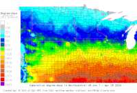
Also try the full-featured calculator/DD model | |
|
| |||||||||||||||||||||||||
|
South Dakota USA Weather Data, Plant Disease Risk and Degree-Day Models HADS Network - other tables for SD include: All Networks, CWOP/APRS, METAR, RAWS, see our homepage. | |||||||||||||||||||||||||
| |||||||||||||||||||||||||
| # | Location linked to hourly weather, plant disease models and forecasts using "Mypest Page" |
County |
Re- cent data QA |
Fore- cast based virt data |
Nearby station based virt data |
Station code, links to NWS recent weather |
Links to NWS fore- casts |
Net- work Elev. (ft) |
Lat./ Long. (Dec. Deg.) |
Max-min temperature data and degree-days (click radio button to calc.) |
10 yr avgs |
30 yr avgs |
nmme fcast |
cfs fcast |
||||||||||
|---|---|---|---|---|---|---|---|---|---|---|---|---|---|---|---|---|---|---|---|---|---|---|---|---|
| 1 | BEAVER Cr @ BUFFALO GA | Fall River |
|
na na |
na na |
|
|
3150 | 43.46667 -103.30556 |
2021
|
2020
|
2019
|
2018
|
2017
|
2016
|
AVG | AVG | nmme | cfs | |||||
| 2 | BELLE FOURCHE Rvr @ EL | Meade County |
|
na na |
na na |
|
|
2172 | 44.36944 -102.56556 |
2021
|
2020
|
2019
|
2018
|
2017
|
2016
|
AVG | AVG | nmme | cfs | |||||
| 3 | BIG SIOUX Rvr @ BROOKI | Moody |
|
na na |
na na |
|
|
1550 | 44.17972 -96.74833 |
2021
|
2020
|
2019
|
2018
|
2017
|
2016
|
AVG | AVG | nmme | cfs | |||||
| 4 | BIG SIOUX Rvr AT WATER | Codington Co |
|
na na |
na na |
|
|
1725 | 44.94250 -97.14556 |
2021
|
2020
|
2019
|
2018
|
2017
|
2016
|
AVG | AVG | nmme | cfs | |||||
| 5 | CHEYENNE Rvr AT EDGEMO | Fall River |
|
na na |
na na |
|
|
3414 | 43.30556 -103.82056 |
2021
|
2020
|
2019
|
2018
|
2017
|
2016
|
AVG | AVG | nmme | cfs | |||||
| 6 | DEERFld Res @ ROCHFORD | Pennington |
|
na na |
na na |
|
|
5908 | 44.02806 -103.78556 |
2021
|
2020
|
2019
|
2018
|
2017
|
2016
|
AVG | AVG | nmme | cfs | |||||
| 7 | JAMES RIVER AT HURON | Beadle |
|
na na |
na na |
|
|
1220 | 44.36333 -98.19889 |
2021
|
2020
|
2019
|
2018
|
2017
|
2016
|
AVG | AVG | nmme | cfs | |||||
| 8 | LITTLE WHITE Rvr @ MAR | Bennett |
|
na na |
na na |
|
|
3045 | 43.16667 -101.62944 |
2021
|
2020
|
2019
|
2018
|
2017
|
2016
|
AVG | AVG | nmme | cfs | |||||
| 9 | MISSOURI Rvr AT Ft PIE | Stanley |
|
na na |
na na |
|
|
1430 | 44.32667 -100.38389 |
2021
|
2020
|
2019
|
2018
|
2017
|
2016
|
AVG | AVG | nmme | cfs | |||||
| 10 | N Fk GRAND Rvr @ WHITE | Perkins Coun |
|
na na |
na na |
|
|
2316 | 45.80194 -102.36167 |
2021
|
2020
|
2019
|
2018
|
2017
|
2016
|
AVG | AVG | nmme | cfs | |||||
| 11 | OAK CREEK NEAR WAKPALA | Corson |
|
na na |
na na |
|
|
1690 | 45.71167 -100.55889 |
2021
|
2020
|
2019
|
2018
|
2017
|
2016
|
AVG | AVG | nmme | cfs | |||||
| 12 | PACTOLA Res @ RAPID Ct | Pennington C |
|
na na |
na na |
|
|
4550 | 44.07194 -103.48806 |
2021
|
2020
|
2019
|
2018
|
2017
|
2016
|
AVG | AVG | nmme | cfs | |||||
| 13 | RAPID Cr ABOVE PACTOLA | Pennington C |
|
na na |
na na |
|
|
4836 | 44.08444 -103.57972 |
2021
|
2020
|
2019
|
2018
|
2017
|
2016
|
AVG | AVG | nmme | cfs | |||||
| 14 | RAPID Cr ABOVE WRF @ R | Pennington C |
|
na na |
na na |
|
|
3011 | 44.02667 -103.10083 |
2021
|
nmme | cfs | ||||||||||||
| 15 | RAPID Cr BELOW PACTOLA | Pennington C |
|
na na |
na na |
|
|
4514 | 44.07667 -103.48167 | nmme | ||||||||||||||
| 16 | KEYAPAHA Rvr @ KEYAPAH | Tripp County |
|
na na |
na na |
|
|
2224 | 43.12917 -100.10667 |
2021
|
2020
|
2019
|
2018
|
2017
|
2016
|
AVG | AVG | nmme | cfs | |||||
| 17 | S Fk BAD Rvr @ COTTONW | Jackson Coun |
|
na na |
na na |
|
|
2267 | 43.96889 -101.76667 |
2021
|
2020
|
2019
|
2018
|
2017
|
2016
|
AVG | AVG | nmme | cfs | |||||
| 18 | SHADEHILL Res @ SHADEH | Perkins |
|
na na |
na na |
|
|
2250 | 45.75306 -102.20306 |
2021
|
2020
|
2019
|
2018
|
2017
|
2016
|
AVG | AVG | nmme | cfs | |||||
| 19 | SPEARFISH Cr @ LEAD 5S | Lawrence Cou |
|
na na |
na na |
|
|
5328 | 44.29917 -103.86806 | nmme | cfs | |||||||||||||
| 20 | VERMILLION Rvr AT VERM | Clay County |
|
na na |
na na |
|
|
1125 | 42.81694 -96.92389 |
2021
|
2020
|
2019
|
2018
|
2017
|
AVG | AVG | nmme | cfs | ||||||
| 21 | WHITE RVR NR NEBRASKA | Shannon |
|
na na |
na na |
|
|
3030 | 43.01306 -102.83528 |
2021
|
2020
|
2019
|
2018
|
2017
|
2016
|
AVG | AVG | nmme | cfs | |||||
[USPEST.ORG/WEA Home]
[Intro]
[US DD Mapmaker]
[Main Table Index]
[Links]


|