METAR Network - other tables for SD include: All Networks, CWOP/APRS, HADS, RAWS, see our homepage.
|
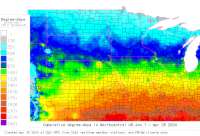
Also try the full-featured calculator/DD model | |
|
| |||||||||||||||||||||||||
|
South Dakota USA Weather Data, Plant Disease Risk and Degree-Day Models METAR Network - other tables for SD include: All Networks, CWOP/APRS, HADS, RAWS, see our homepage. | |||||||||||||||||||||||||
| |||||||||||||||||||||||||
| # | Location linked to hourly weather, plant disease models and forecasts using "Mypest Page" removed due to excessive bot activity |
County |
Re- cent data QA |
Fore- cast based virt data |
Nearby station based virt data |
Station code, links to NWS recent weather |
Links to NWS fore- casts |
Net- work Elev. (ft) |
Lat./ Long. (Dec. Deg.) |
Max-min temperature data and degree-days (click radio button to calc.) |
10 yr avgs |
30 yr avgs |
nmme fcast |
cfs fcast |
||||||||||
|---|---|---|---|---|---|---|---|---|---|---|---|---|---|---|---|---|---|---|---|---|---|---|---|---|
| 1 | Aberdeen Reg Apt | Brown |
|
na na |
na na |
|
|
1299 | 45.44306 -98.41306 |
2021
|
2020
|
2019
|
2018
|
2017
|
2016
|
AVG | AVG | nmme | cfs | |||||
| 2 | Brookings Muni Apt | Brookings |
|
na na |
na na |
|
|
1647 | 44.30000 -96.81667 |
2021
|
2020
|
2019
|
2018
|
2017
|
2016
|
AVG | AVG | nmme | cfs | |||||
| 3 | Buffalo | Harding |
|
na na |
na na |
|
|
3002 | 45.60417 -103.54639 |
2021
|
2020
|
2019
|
2018
|
2017
|
2016
|
AVG | AVG | nmme | cfs | |||||
| 4 | Chamberlain Muni Apt | Lyman |
|
na na |
na na |
|
|
1693 | 43.76667 -99.31806 |
2021
|
2020
|
2019
|
2018
|
2017
|
2016
|
AVG | AVG | nmme | cfs | |||||
| 5 | Custer County Airport | Pennington |
|
na na |
na na |
|
|
5600 | 43.73306 -103.61750 |
2021
|
2020
|
2019
|
2018
|
2017
|
2016
|
AVG | AVG | nmme | cfs | |||||
| 6 | Ellsworth AFB | Meade |
|
na na |
na na |
|
|
3278 | 44.15000 -103.10000 |
2021
|
2020
|
2019
|
2018
|
2017
|
2016
|
AVG | AVG | nmme | cfs | |||||
| 7 | Faith | Meade |
|
na na |
na na |
|
|
2582 | 45.03167 -102.01917 |
2021
|
2020
|
2019
|
2018
|
2017
|
2016
|
AVG | AVG | nmme | cfs | |||||
| 8 | Huron Regional Airport | Beadle |
|
na na |
na na |
|
|
1286 | 44.38806 -98.22806 |
2021
|
2020
|
2019
|
2018
|
2017
|
2016
|
AVG | AVG | nmme | cfs | |||||
| 9 | Madison Muni Apt | Lake |
|
na na |
na na |
|
|
1718 | 44.01639 -97.08556 |
2021
|
2020
|
2019
|
2018
|
2017
|
2016
|
AVG | AVG | nmme | cfs | |||||
| 10 | Mitchell Muni Apt | Davison |
|
na na |
na na |
|
|
1302 | 43.76667 -98.03306 |
2021
|
2020
|
2019
|
2018
|
2017
|
2016
|
AVG | AVG | nmme | cfs | |||||
| 11 | MoBrdg Muni Apt | Corson |
|
na na |
na na |
|
|
1713 | 45.55000 -100.40833 |
2021
|
2020
|
2019
|
2018
|
2017
|
2016
|
AVG | AVG | nmme | cfs | |||||
| 12 | Philip Airport | Haakon |
|
na na |
na na |
|
|
2208 | 44.05083 -101.60083 |
2021
|
2020
|
2019
|
2018
|
2017
|
2016
|
AVG | AVG | nmme | cfs | |||||
| 13 | Pierre Reg Apt | Stanley |
|
na na |
na na |
|
|
1742 | 44.38278 -100.28556 |
2021
|
2020
|
2019
|
2018
|
2017
|
2016
|
AVG | AVG | nmme | cfs | |||||
| 14 | Pine Ridge Airport | Shannon |
|
na na |
na na |
|
|
3330 | 43.02556 -102.52306 |
2021
|
2020
|
2019
|
2018
|
2017
|
2016
|
AVG | AVG | nmme | cfs | |||||
| 15 | Rapid Cty Reg Apt | Pennington |
|
na na |
na na |
|
|
3202 | 44.04556 -103.05389 |
2021
|
2020
|
2019
|
2018
|
2017
|
2016
|
AVG | AVG | nmme | cfs | |||||
| 16 | RedFld Muni Apt | Spink County |
|
na na |
na na |
|
|
1309 | 44.85639 -98.53111 | nmme | cfs | |||||||||||||
| 17 | Rosebud Sioux Tribal A | Todd County |
|
na na |
na na |
|
|
2724 | 43.25833 -100.85944 | nmme | ||||||||||||||
| 18 | Sioux Fls Foss Fld | Minnehaha |
|
na na |
na na |
|
|
1427 | 43.57667 -96.75333 |
2021
|
2020
|
2019
|
2018
|
2017
|
2016
|
AVG | AVG | nmme | cfs | |||||
| 19 | Sisseton Muni Apt | Roberts |
|
na na |
na na |
|
|
1161 | 45.66889 -96.99139 |
2021
|
2020
|
2019
|
2018
|
2017
|
2016
|
AVG | AVG | nmme | cfs | |||||
| 20 | Spearfish Clyde Ice | Lawrence |
|
na na |
na na |
|
|
3898 | 44.48306 -103.78306 |
2021
|
2020
|
2019
|
2018
|
2017
|
2016
|
AVG | AVG | nmme | cfs | |||||
| 21 | Watertown Muni Apt | Codington |
|
na na |
na na |
|
|
1745 | 44.90444 -97.14917 |
2021
|
2020
|
2019
|
2018
|
2017
|
2016
|
AVG | AVG | nmme | cfs | |||||
| 22 | Winner Bob Wiley Fld A | Tripp |
|
na na |
na na |
|
|
2031 | 43.39056 -99.84250 |
2021
|
2020
|
2019
|
2018
|
2017
|
2016
|
AVG | AVG | nmme | cfs | |||||
| 23 | Yankton Chan Gurney Mu | Yankton |
|
na na |
na na |
|
|
1306 | 42.91667 -97.38306 |
2021
|
2020
|
2019
|
2018
|
2017
|
2016
|
AVG | AVG | nmme | cfs | |||||
[USPEST.ORG/WEA Home]
[Intro]
[US DD Mapmaker]
[Main Table Index]
[Links]


|