METAR Network - other tables for OR include: All Networks, AGRIMET, CWOP/APRS, see our homepage.
|
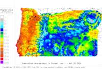
Also try the full-featured calculator/DD model (NW states only) |
|
| ||||||||||||||||||||
|
CropTime OSU Weather Data and Phenology/Degree-Day Models METAR Network - other tables for OR include: All Networks, AGRIMET, CWOP/APRS, see our homepage. | ||||||||||||||||||||
| ||||||||||||||||||||
| # | Location click to go to DD model interface |
County |
Station code, links to NWS recent weather |
Links to NWS fore- casts |
Net- work Elev. (ft) |
Lat./ Long. (Dec. Deg.) |
Max-min temperature data and degree-days (click radio button to calc.) |
30 yr avgs |
||||
|---|---|---|---|---|---|---|---|---|---|---|---|---|
| 1 | Aurora State Airport | Clackamas |
|
Zone
|
194 | 45.24889 -122.76556 |
2012
|
2011
|
2010
|
2009
|
AVG |
|
| 2 | Corvallis Muni Apt | Benton |
|
Zone
|
246 | 44.50000 -123.28306 |
2012
|
2011
|
2010
|
2009
|
AVG |
|
| 3 | Eugene Mahlon Sweet Fl | Lane |
|
Zone
|
364 | 44.13306 -123.21417 |
2012
|
2011
|
2010
|
2009
|
AVG |
|
| 4 | Florence Muni Apt | Lane |
|
Zone
|
52 | 43.98278 -124.11139 |
AVG |
|||||
| 5 | McMinnville Muni Apt | Yamhill |
|
Zone
|
157 | 45.19583 -123.13194 |
2012
|
2011
|
2010
|
2009
|
AVG |
|
| 6 | Medford Rogue Val Int | Jackson |
|
Zone
|
1329 | 42.38083 -122.87194 |
2012
|
2011
|
2010
|
2009
|
AVG |
|
| 7 | PtlandHillsboro Apt | Washington |
|
Zone
|
203 | 45.54806 -122.95417 |
2012
|
2011
|
2010
|
2009
|
AVG |
|
| 8 | PtlandTroutdale Apt | Multnomah |
|
Zone
|
36 | 45.55083 -122.40889 |
2012
|
2011
|
2010
|
2009
|
AVG |
|
| 9 | Roseburg Reg Apt | Douglas |
|
Zone
|
525 | 43.23389 -123.35583 |
2012
|
2011
|
2010
|
2009
|
AVG |
|
| 10 | Salem: McNary Field | Marion |
|
Zone
|
210 | 44.90778 -122.99500 |
2012
|
2011
|
2010
|
2009
|
AVG |
|
| 11 | Scappoose Industrial A | Columbia |
|
Zone
|
52 | 45.76917 -122.86194 |
2012
|
2011
|
2010
|
2009
|
AVG |
|
| 12 | Sexton Summit | Josephine |
|
Zone
|
3837 | 42.60028 -123.36417 |
2012
|
2011
|
2010
|
2009
|
AVG |
|
[USPEST.ORG/WEA Home]
[Feedback Survey]
[Intro]
[US DD Mapmaker]
[Main Table Index]
[Links]


|