AGWEATHERNET Network - other tables for WA include: All Networks, CWOP/APRS, METAR, see our homepage. Powered by WSU-AgWeatherNet
|
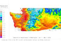
Also try the full-featured calculator/DD model (NW states only) |
|
| ||||||||||||||||||||
|
CropTime OSU Weather Data and Phenology/Degree-Day Models AGWEATHERNET Network - other tables for WA include: All Networks, CWOP/APRS, METAR, see our homepage. Powered by WSU-AgWeatherNet | ||||||||||||||||||||
| ||||||||||||||||||||
| # | Location click to go to DD model interface |
County |
Station code, links to NWS recent weather |
Links to NWS fore- casts |
Net- work Elev. (ft) |
Lat./ Long. (Dec. Deg.) |
Max-min temperature data and degree-days (click radio button to calc.) |
30 yr avgs |
||||
|---|---|---|---|---|---|---|---|---|---|---|---|---|
| 1 | Alderdale | Benton |
|
Zone
|
672 | 45.87806 -119.91250 |
2012
|
2011
|
2010
|
AVG |
||
| 2 | Badger Canyon | Benton |
|
Zone
|
853 | 46.17917 -119.27639 |
2012
|
2011
|
2010
|
AVG |
||
| 3 | Benton City West | Benton |
|
Zone
|
898 | 46.30139 -119.56750 |
2012
|
2011
|
2010
|
AVG |
||
| 4 | Benton City | Benton |
|
Zone
|
689 | 46.26806 -119.45139 |
2012
|
2011
|
2010
|
AVG |
||
| 5 | Boyd District | Douglas |
|
Zone
|
2021 | 47.88500 -120.07167 |
2012
|
2011
|
2010
|
AVG |
||
| 6 | Brewster Flat | Douglas |
|
Zone
|
1204 | 48.12667 -119.75778 |
2012
|
2011
|
2010
|
AVG |
||
| 7 | Brewster | Douglas |
|
Zone
|
892 | 48.05917 -119.87056 |
2012
|
2011
|
2010
|
AVG |
||
| 8 | Canoe Ridge | Benton |
|
Zone
|
892 | 45.88167 -119.75556 |
2012
|
2011
|
2010
|
AVG |
||
| 9 | Carlson | Benton |
|
Zone
|
1512 | 46.14306 -119.46056 |
2012
|
2011
|
2010
|
AVG |
||
| 10 | CBC Pasco | Benton |
|
Zone
|
410 | 46.25278 -119.12667 |
2012
|
2011
|
2010
|
AVG |
||
| 11 | Chelan South | Douglas |
|
Zone
|
1230 | 47.83667 -120.08778 |
2012
|
2011
|
2010
|
AVG |
||
| 12 | Chief Joe | Douglas |
|
Zone
|
1640 | 48.03056 -119.64306 |
2012
|
2011
|
2010
|
AVG |
||
| 13 | Chucker | Benton |
|
Zone
|
951 | 45.97278 -119.07889 |
2012
|
2011
|
2010
|
AVG |
||
| 14 | Coffin | Benton |
|
Zone
|
1263 | 46.04028 -119.30806 |
2012
|
2011
|
2010
|
AVG |
||
| 15 | Crane | Douglas |
|
Zone
|
1440 | 48.06556 -119.79750 |
2012
|
2011
|
2010
|
AVG |
||
| 16 | Desert Aire | Benton |
|
Zone
|
629 | 46.70917 -119.91667 |
2012
|
2011
|
2010
|
AVG |
||
| 17 | East Olympia | Thurston |
|
Zone
|
203 | 46.95028 -122.83528 |
2012
|
2011
|
2010
|
AVG |
||
| 18 | Eby | Benton |
|
Zone
|
1460 | 46.06556 -119.07528 |
2012
|
2011
|
2010
|
AVG |
||
| 19 | Finley | Benton |
|
Zone
|
508 | 46.13917 -119.05917 |
2012
|
2011
|
2010
|
AVG |
||
| 20 | Fir Island | Skagit |
|
Zone
|
0 | 48.35639 -122.42167 |
2012
|
2011
|
2010
|
AVG |
||
| 21 | FourMile | Benton |
|
Zone
|
692 | 45.98806 -119.32278 |
2012
|
2011
|
2010
|
AVG |
||
| 22 | Gramling | Benton |
|
Zone
|
1341 | 46.12417 -119.21889 |
2012
|
2011
|
2010
|
AVG |
||
| 23 | Horrigan | Benton |
|
Zone
|
938 | 46.07667 -119.76889 |
2012
|
2011
|
2010
|
AVG |
||
| 24 | Hundred Circles | Benton |
|
Zone
|
521 | 45.93417 -119.80528 |
2012
|
2011
|
2010
|
AVG |
||
| 25 | Huntsville | Columbia |
|
Zone
|
1640 | 46.30556 -118.11500 |
2012
|
2011
|
2010
|
AVG |
||
| 26 | Mabton East | Benton |
|
Zone
|
705 | 46.19917 -119.93000 |
2012
|
2011
|
2010
|
AVG |
||
| 27 | Mattawa | Benton |
|
Zone
|
853 | 46.70056 -119.79917 |
2012
|
2011
|
2010
|
AVG |
||
| 28 | McClure | Benton |
|
Zone
|
2454 | 46.37611 -119.72417 |
2012
|
2011
|
2010
|
AVG |
||
| 29 | McKinley Springs | Benton |
|
Zone
|
1092 | 46.00667 -119.91667 |
2012
|
2011
|
2010
|
AVG |
||
| 30 | McNary | Benton |
|
Zone
|
764 | 45.96889 -119.25750 |
2012
|
2011
|
2010
|
AVG |
||
| 31 | McWhorter | Benton |
|
Zone
|
1391 | 46.31667 -119.61667 |
2012
|
2011
|
2010
|
AVG |
||
| 32 | North Pasco | Benton |
|
Zone
|
889 | 46.38167 -119.24389 |
2012
|
2011
|
2010
|
AVG |
||
| 33 | Outlook | Benton |
|
Zone
|
1295 | 46.42167 -120.13139 |
2012
|
2011
|
2010
|
AVG |
||
| 34 | Paterson West | Benton |
|
Zone
|
606 | 45.93667 -119.66250 |
2012
|
2011
|
2010
|
AVG |
||
| 35 | Paterson | Benton |
|
Zone
|
423 | 45.93889 -119.48750 |
2012
|
2011
|
2010
|
AVG |
||
| 36 | Port of Sunnyside | Benton |
|
Zone
|
718 | 46.28306 -120.00917 |
2012
|
2011
|
2010
|
AVG |
||
| 37 | Roza | Benton |
|
Zone
|
1151 | 46.29167 -119.73250 |
2012
|
2011
|
2010
|
AVG |
||
| 38 | Sakuma | Skagit |
|
Zone
|
19 | 48.49667 -122.37806 |
2012
|
2011
|
2010
|
AVG |
||
| 39 | Snipes | Benton |
|
Zone
|
1046 | 46.29889 -119.91639 |
2012
|
2011
|
2010
|
AVG |
||
| 40 | St Andrews | Douglas |
|
Zone
|
2388 | 47.64778 -119.42028 |
2012
|
2011
|
2010
|
AVG |
||
| 41 | Station 2 | Benton |
|
Zone
|
606 | 45.96667 -119.45750 |
2012
|
2011
|
2010
|
AVG |
||
| 42 | Station 4 | Benton |
|
Zone
|
1230 | 46.04889 -119.41306 |
2012
|
2011
|
2010
|
AVG |
||
| 43 | Sunnyside | Benton |
|
Zone
|
1003 | 46.37639 -119.99639 |
2012
|
2011
|
2010
|
AVG |
||
| 44 | Triple S | Benton |
|
Zone
|
1519 | 46.21306 -119.50056 |
2012
|
2011
|
2010
|
AVG |
||
| 45 | Wheelhouse | Benton |
|
Zone
|
898 | 46.02528 -119.52750 |
2012
|
2011
|
2010
|
AVG |
||
| 46 | Whitcomb Island | Benton |
|
Zone
|
311 | 45.86028 -119.76417 |
2012
|
2011
|
2010
|
AVG |
||
| 47 | WSU Hamilton | Benton |
|
Zone
|
830 | 46.25056 -119.73889 |
2012
|
2011
|
2010
|
AVG |
||
| 48 | WSU HQ | Benton |
|
Zone
|
895 | 46.25667 -119.74028 |
2012
|
2011
|
2010
|
AVG |
||
| 49 | WSU Mt Vernon | Skagit |
|
Zone
|
22 | 48.43806 -122.38556 |
2012
|
2011
|
2010
|
AVG |
||
| 50 | WSU Sunrise | Douglas |
|
Zone
|
885 | 47.30806 -120.06806 |
2012
|
2011
|
2010
|
AVG |
||
| 51 | WSU TC | Benton |
|
Zone
|
400 | 46.32917 -119.26667 |
2012
|
2011
|
2010
|
AVG |
||
[USPEST.ORG/WEA Home]
[Feedback Survey]
[Intro]
[US DD Mapmaker]
[Main Table Index]
[Links]


|