All Available Networks - other tables for AR include: CWOP/APRS, METAR, RAWS, see our homepage.
|
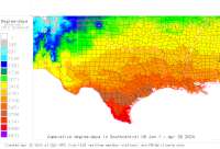
Also try the full-featured calculator/DD model | |
Disease Alert Movies: fireblight: 2010 2011 2012 2013 | ||
|
| |||||||||||||||||||||||||||
|
Arkansas USA Weather Data, Plant Disease Risk and Degree-Day Models All Available Networks - other tables for AR include: CWOP/APRS, METAR, RAWS, see our homepage. | |||||||||||||||||||||||||||
| |||||||||||||||||||||||||||
| # | Location linked to hourly weather, plant disease models and forecasts using "Mypest Page" |
County |
Re- cent data QA |
Fore- cast based virt data |
Nearby station based virt data |
Station code, links to NWS recent weather |
Links to NWS fore- casts |
Net- work Elev. (ft) |
Lat./ Long. (Dec. Deg.) |
Max-min temperature data and degree-days (click radio button to calc.) |
10 yr avgs |
30 yr avgs |
nmme fcast |
cfs fcast |
||||||||||||
|---|---|---|---|---|---|---|---|---|---|---|---|---|---|---|---|---|---|---|---|---|---|---|---|---|---|---|
| 1 | AGUSTA | Woodruff Cou |
|
na na |
na na |
|
|
217 | 35.26306 -91.30167 |
2021
|
2020
|
2019
|
2018
|
2017
|
2016
|
2015
|
2014
|
AVG | AVG | nmme | ||||||
| 2 | ALEX1 | Pulaski |
|
na na |
na na |
|
|
328 | 34.63167 -92.44278 |
2021
|
2020
|
2019
|
2018
|
2017
|
2016
|
2015
|
2014
|
2013
|
AVG | AVG | nmme | |||||
| 3 | ALEX2 | Pulaski Coun |
|
na na |
na na |
|
|
325 | 34.63167 -92.44250 |
2021
|
nmme | |||||||||||||||
| 4 | ALMA | Crawford Cou |
|
na na |
na na |
|
|
427 | 35.48194 -94.20056 |
2021
|
2020
|
2019
|
2018
|
2017
|
2016
|
2015
|
2014
|
AVG | AVG | nmme | ||||||
| 5 | ARIVER | Jefferson Co |
|
na na |
na na |
|
|
212 | 34.31472 -91.85583 |
2021
|
2020
|
2019
|
2018
|
2017
|
2016
|
2015
|
2014
|
AVG | AVG | |||||||
| 6 | ARMSTEAD MOUNTAIN | Van Buren |
|
na na |
na na |
|
|
960 | 35.57306 -92.81917 |
2021
|
2020
|
2019
|
2018
|
2017
|
2016
|
2015
|
2014
|
2013
|
|
AVG | AVG | nmme | ||||
| 7 | Batesville Reg Apt | Independence |
|
na na |
na na |
|
|
463 | 35.73306 -91.65000 |
2021
|
2020
|
2019
|
2018
|
2017
|
2016
|
2015
|
2014
|
2013
|
|
AVG | AVG | nmme | ||||
| 8 | N5LSN BAUXITE | Pulaski Coun |
|
na na |
na na |
|
|
426 | 34.50444 -92.49806 | nmme | ||||||||||||||||
| 9 | BECKS | Saint Franci |
|
na na |
na na |
|
|
219 | 34.98722 -90.85500 |
2021
|
2020
|
2019
|
2018
|
2017
|
2016
|
2015
|
2014
|
AVG | AVG | nmme | ||||||
| 10 | BEIRNE | Clark County |
|
na na |
na na |
|
|
210 | 33.87944 -93.23417 |
2021
|
2020
|
2019
|
2018
|
2017
|
2016
|
2015
|
2014
|
AVG | AVG | nmme | ||||||
| 11 | Benton DW2073 | Pulaski |
|
na na |
na na |
|
|
459 | 34.63472 -92.55667 |
2021
|
2020
|
2019
|
2018
|
2017
|
2016
|
2015
|
2014
|
2013
|
|
AVG | AVG | nmme | ||||
| 12 | Bentonville Muni AptLo | Benton |
|
na na |
na na |
|
|
1296 | 36.35000 -94.21667 |
2021
|
2020
|
2019
|
2018
|
2017
|
2016
|
2015
|
2014
|
2013
|
|
AVG | AVG | nmme | ||||
| 13 | BETHEL | Greene |
|
na na |
na na |
|
|
288 | 35.97250 -90.53556 |
2021
|
2020
|
2019
|
2018
|
2017
|
2016
|
2015
|
2014
|
2013
|
|
AVG | AVG | nmme | ||||
| 14 | BLANCHARD SPRINGS | Baxter |
|
na na |
na na |
|
|
1200 | 35.97417 -92.19417 |
2021
|
2020
|
2019
|
2018
|
2017
|
2016
|
2015
|
2014
|
2013
|
|
AVG | AVG | nmme | ||||
| 15 | BLKVLE | Pope County |
|
na na |
na na |
|
|
334 | 35.24167 -92.88500 |
2021
|
2020
|
2019
|
2018
|
2017
|
2016
|
2015
|
2014
|
AVG | AVG | nmme | ||||||
| 16 | BLUFF CITY | Nevada |
|
na na |
na na |
|
|
360 | 33.69194 -93.16222 |
2021
|
2020
|
2019
|
2018
|
2017
|
2016
|
2015
|
2014
|
2013
|
|
AVG | AVG | nmme | ||||
| 17 | Blytheville Muni Apt | Mississippi |
|
na na |
na na |
|
|
256 | 35.93889 -89.83222 |
2021
|
2020
|
2019
|
2018
|
2017
|
2016
|
2015
|
2014
|
2013
|
|
AVG | AVG | nmme | ||||
| 18 | BOONEVILLE | Logan |
|
na na |
na na |
|
|
343 | 35.14278 -93.89472 |
2021
|
2020
|
2019
|
2018
|
2017
|
2016
|
2015
|
2014
|
2013
|
|
AVG | AVG | nmme | ||||
| 19 | BRADLY | Lafayette Co |
|
na na |
na na |
|
|
269 | 33.23778 -93.61944 |
2021
|
2020
|
2019
|
2018
|
2017
|
2016
|
2015
|
2014
|
AVG | AVG | nmme | ||||||
| 20 | BRNKLY | Monroe |
|
na na |
na na |
|
|
191 | 34.82167 -91.22583 |
2021
|
2020
|
2019
|
2018
|
2017
|
2016
|
2015
|
2014
|
2013
|
|
AVG | AVG | nmme | ||||
| 21 | BUFFALO RIVER AT PONCA | Newton Count |
|
na na |
na na |
|
|
1056 | 36.02250 -93.35444 |
2021
|
2020
|
2019
|
2018
|
2017
|
2016
|
2015
|
AVG | AVG | nmme | |||||||
| 22 | Caddo Valley | Hot Spring |
|
na na |
na na |
|
|
232 | 34.17944 -93.09861 |
2021
|
2020
|
2019
|
2018
|
2017
|
2016
|
2015
|
2014
|
2013
|
AVG | AVG | nmme | |||||
| 23 | Camden Harrell Field | Ouachita |
|
na na |
na na |
|
|
131 | 33.61667 -92.76667 |
2021
|
2020
|
2019
|
2018
|
2017
|
2016
|
2015
|
2014
|
2013
|
|
AVG | AVG | nmme | ||||
| 24 | CAMDEN | Ouachita Cou |
|
na na |
na na |
|
|
122 | 33.64889 -92.77750 |
2021
|
2020
|
2019
|
2018
|
2017
|
2016
|
2015
|
2014
|
AVG | AVG | nmme | ||||||
| 25 | CAMPBL | Independence |
|
na na |
na na |
|
|
236 | 35.65889 -91.24722 |
2021
|
2020
|
2019
|
2018
|
2017
|
2016
|
2015
|
2014
|
AVG | AVG | nmme | ||||||
| 26 | CHERRY | Cross County |
|
na na |
na na |
|
|
278 | 35.39556 -90.75417 |
2021
|
2020
|
2019
|
2018
|
2017
|
2016
|
2015
|
2014
|
AVG | AVG | nmme | ||||||
| 27 | Clinton Mem AirFld | Van Buren |
|
na na |
na na |
|
|
514 | 35.59778 -92.45139 |
2021
|
2020
|
2019
|
2018
|
2017
|
2016
|
2015
|
2014
|
2013
|
|
AVG | AVG | nmme | ||||
| 28 | COMPTON | Newton |
|
na na |
na na |
|
|
2365 | 36.06750 -93.35583 |
2021
|
2020
|
2019
|
2018
|
2017
|
2016
|
2015
|
2014
|
2013
|
|
AVG | AVG | nmme | ||||
| 29 | ConwayCantrell Fld | Faulkner Cou |
|
na na |
na na |
|
|
276 | 35.01972 -92.55500 |
2021
|
nmme | |||||||||||||||
| 30 | CONWAY | Faulkner Cou |
|
na na |
na na |
|
|
283 | 35.02889 -92.41444 |
2021
|
2020
|
2019
|
2018
|
2017
|
2016
|
2015
|
2014
|
AVG | AVG | nmme | ||||||
| 31 | Corning Muni Apt | Clay County |
|
na na |
na na |
|
|
292 | 36.40389 -90.64778 |
2021
|
2020
|
2019
|
2018
|
2017
|
2016
|
2015
|
2014
|
AVG | AVG | nmme | ||||||
| 32 | CRN SITE @ BATESVILLE | Independence |
|
na na |
na na |
|
|
455 | 35.82000 -91.78083 |
2021
|
2020
|
2019
|
2018
|
2017
|
2016
|
2015
|
2014
|
2013
|
|
AVG | AVG | nmme | ||||
| 33 | CROOKED Cr AT YELLVILL | Marion |
|
na na |
na na |
|
|
567 | 36.22306 -92.67944 |
2021
|
2020
|
2019
|
2018
|
2017
|
2016
|
2015
|
2014
|
2013
|
|
AVG | AVG | nmme | ||||
| 34 | De Queen J Lynn Helms | Sevier |
|
na na |
na na |
|
|
354 | 34.04667 -94.39917 |
2021
|
2020
|
2019
|
2018
|
2017
|
2016
|
2015
|
2014
|
2013
|
|
AVG | AVG | nmme | ||||
| 35 | DEQUEEN DAM TAILWATER | Sevier Count |
|
na na |
na na |
|
|
482 | 34.09806 -94.38056 |
2021
|
nmme | |||||||||||||||
| 36 | DERMOT | Chicot |
|
na na |
na na |
|
|
143 | 33.46167 -91.44639 |
2021
|
2020
|
2019
|
2018
|
2017
|
2016
|
2015
|
2014
|
2013
|
|
AVG | AVG | nmme | ||||
| 37 | DEVILS KNOB | Johnson |
|
na na |
na na |
|
|
2100 | 35.61389 -93.53806 |
2021
|
2020
|
2019
|
2018
|
2017
|
2016
|
2015
|
2014
|
2013
|
|
AVG | AVG | nmme | ||||
| 38 | Dexter B Florence Mem | Clark County |
|
na na |
na na |
|
|
182 | 34.09972 -93.06583 |
2021
|
2020
|
2019
|
2018
|
2017
|
2016
|
2015
|
2014
|
AVG | AVG | nmme | ||||||
| 39 | DNLDSN | Hot Spring C |
|
na na |
na na |
|
|
250 | 34.28889 -92.88000 |
2021
|
2020
|
2019
|
2018
|
2017
|
2016
|
2015
|
2014
|
AVG | AVG | nmme | ||||||
| 40 | Ben Lomond DW7854 | Howard Count |
|
na na |
na na |
|
|
350 | 33.84250 -94.13667 |
2021
|
2020
|
2019
|
2018
|
2017
|
2016
|
2015
|
2014
|
AVG | AVG | nmme | ||||||
| 41 | Jacksonville DW8400 | Faulkner Cou |
|
na na |
na na |
|
|
249 | 34.86917 -92.17694 |
2021
|
2020
|
2019
|
2018
|
2017
|
2016
|
2015
|
2014
|
AVG | AVG | |||||||
| 42 | El Dorado Hwy 167 & 82 | Union County |
|
na na |
na na |
|
|
249 | 33.18667 -92.63444 | |||||||||||||||||
| 43 | El Dorado S Arkansas R | Union |
|
na na |
na na |
|
|
276 | 33.22056 -92.81306 |
2021
|
2020
|
2019
|
2018
|
2017
|
2016
|
2015
|
2014
|
2013
|
|
AVG | AVG | nmme | ||||
| 44 | ELLIOT | Ouachita Cou |
|
na na |
na na |
|
|
230 | 33.45694 -92.82861 |
2021
|
2020
|
2019
|
2018
|
2017
|
2016
|
2015
|
2014
|
AVG | AVG | nmme | ||||||
| 45 | K5KVN Elm Springs | Benton Count |
|
na na |
na na |
|
|
1230 | 36.20778 -94.22722 |
2021
|
2020
|
2019
|
2018
|
2017
|
2016
|
2015
|
2014
|
AVG | AVG | |||||||
| 46 | EMMET | Hempstead Co |
|
na na |
na na |
|
|
278 | 33.69528 -93.51500 |
2021
|
2020
|
2019
|
2018
|
2017
|
2016
|
2015
|
2014
|
AVG | AVG | nmme | ||||||
| 47 | ENTRGY | Jefferson Co |
|
na na |
na na |
|
|
349 | 34.38583 -92.16417 |
2021
|
2020
|
2019
|
2018
|
2017
|
2016
|
2015
|
2014
|
AVG | AVG | nmme | ||||||
| 48 | EVENING SHADE | Sharp |
|
na na |
na na |
|
|
540 | 36.10583 -91.56556 |
2021
|
2020
|
2019
|
2018
|
2017
|
2016
|
2015
|
2014
|
2013
|
|
AVG | AVG | nmme | ||||
| 49 | Horseshoe Bend EW0095 | Izard County |
|
na na |
na na |
|
|
793 | 36.22222 -91.72139 |
2021
|
2020
|
2019
|
2018
|
2017
|
2016
|
2015
|
2014
|
AVG | AVG | nmme | ||||||
| 50 | Clarksville EW1127 | Johnson Coun |
|
na na |
na na |
|
|
394 | 35.46111 -93.52944 |
2021
|
2020
|
2019
|
2018
|
2017
|
2016
|
2015
|
2014
|
AVG | AVG | nmme | ||||||
| 51 | Hot Springs EW1823 | Saline Count |
|
na na |
na na |
|
|
427 | 34.46194 -92.95611 |
2021
|
2020
|
2019
|
2018
|
2017
|
2016
|
2015
|
AVG | AVG | nmme | |||||||
| 52 | Conway EW4210 | Faulkner Cou |
|
na na |
na na |
|
|
419 | 35.11917 -92.43639 |
2021
|
2020
|
2019
|
2018
|
2017
|
2016
|
2015
|
AVG | AVG | nmme | |||||||
| 53 | Little Rock EW5286 | Pulaski Coun |
|
na na |
na na |
|
|
768 | 34.76611 -92.54972 |
2021
|
2020
|
2019
|
2018
|
2017
|
2016
|
2015
|
AVG | AVG | nmme | |||||||
| 54 | Conway EW6681 | Faulkner Cou |
|
na na |
na na |
|
|
285 | 35.05833 -92.53444 |
2021
|
2020
|
2019
|
2018
|
2016
|
2015
|
AVG | AVG | nmme | ||||||||
| 55 | Gassville EW6956 | Marion Count |
|
na na |
na na |
|
|
1115 | 36.25750 -92.48667 |
2021
|
2020
|
2019
|
2018
|
2017
|
2016
|
2015
|
AVG | AVG | ||||||||
| 56 | Harrison EW7754 | Boone County |
|
na na |
na na |
|
|
1086 | 36.21167 -92.97194 |
2021
|
2020
|
2019
|
2018
|
2017
|
2016
|
2015
|
AVG | AVG | nmme | |||||||
| 57 | Hot Sprs Vlg EW8261 | Saline Count |
|
na na |
na na |
|
|
1673 | 34.62444 -92.84528 |
2021
|
2020
|
2019
|
2018
|
2017
|
AVG | AVG | nmme | |||||||||
| 58 | Benton EW8415 | Pulaski Coun |
|
na na |
na na |
|
|
355 | 34.61917 -92.53500 |
2021
|
2020
|
2019
|
2018
|
2017
|
AVG | AVG | nmme | |||||||||
| 59 | Tontitown EW8832 | Benton Count |
|
na na |
na na |
|
|
4229 | 36.15833 -94.25694 |
2021
|
2020
|
2019
|
2018
|
2017
|
AVG | AVG | ||||||||||
| 60 | Bentonville EW9366 | Benton Count |
|
na na |
na na |
|
|
1259 | 36.30694 -94.21861 |
2021
|
2020
|
2019
|
2018
|
2017
|
AVG | AVG | nmme | |||||||||
| 61 | Hensley EW9770 | Pulaski Coun |
|
na na |
na na |
|
|
311 | 34.53556 -92.35833 |
2021
|
2020
|
2019
|
2018
|
2017
|
AVG | AVG | ||||||||||
| 62 | FAIROK | Woodruff Cou |
|
na na |
na na |
|
|
220 | 35.14472 -91.07667 |
2021
|
2020
|
2019
|
2018
|
2017
|
2016
|
2015
|
2014
|
AVG | AVG | nmme | ||||||
| 63 | FARGO | Woodruff |
|
na na |
na na |
|
|
213 | 34.99611 -91.15583 |
2021
|
2020
|
2019
|
2018
|
2017
|
2016
|
2015
|
2014
|
2013
|
AVG | AVG | nmme | |||||
| 64 | Fayetteville Drake Fld | Washington |
|
na na |
na na |
|
|
1250 | 36.01028 -94.16778 |
2021
|
2020
|
2019
|
2018
|
2017
|
2016
|
2015
|
2014
|
2013
|
|
AVG | AVG | nmme | ||||
| 65 | FayettevilleSpringdale | Benton |
|
na na |
na na |
|
|
1286 | 36.28167 -94.30667 |
2021
|
2020
|
2019
|
2018
|
2017
|
2016
|
2015
|
2014
|
2013
|
|
AVG | AVG | nmme | ||||
| 66 | FELSENTHAL | Union |
|
na na |
na na |
|
|
105 | 33.15556 -92.19083 |
2021
|
2020
|
2019
|
2018
|
2017
|
2016
|
2015
|
2014
|
2013
|
|
AVG | AVG | nmme | ||||
| 67 | Flippin Marion Co Reg | Marion |
|
na na |
na na |
|
|
719 | 36.30000 -92.58306 |
2021
|
2020
|
2019
|
2018
|
2017
|
2016
|
2015
|
2014
|
2013
|
|
AVG | AVG | nmme | ||||
| 68 | Ft Smith Reg Apt | Sebastian |
|
na na |
na na |
|
|
466 | 35.33333 -94.36472 |
2021
|
2020
|
2019
|
2018
|
2017
|
2016
|
2015
|
2014
|
2013
|
|
AVG | AVG | nmme | ||||
| 69 | FW0173 Holiday Island | Benton Count |
|
na na |
na na |
|
|
1246 | 36.39861 -94.20861 |
2021
|
2020
|
2019
|
nmme | |||||||||||||
| 70 | FW0798 Alma | Crawford Cou |
|
na na |
na na |
|
|
446 | 35.49222 -94.24861 |
2021
|
2020
|
2019
|
nmme | |||||||||||||
| 71 | FW0807 Sage | Izard County |
|
na na |
na na |
|
|
685 | 36.07917 -91.77611 |
2021
|
2020
|
2019
|
nmme | |||||||||||||
| 72 | FW0859 Ash Flat | Sharp County |
|
na na |
na na |
|
|
561 | 36.24056 -91.59194 |
2021
|
2020
|
2019
|
2018
|
nmme | ||||||||||||
| 73 | FW2044 Hot Springs | Saline Count |
|
na na |
na na |
|
|
714 | 34.57306 -92.99972 |
2021
|
2020
|
2019
|
2018
|
nmme | ||||||||||||
| 74 | FW2142 Little Rock | Pulaski Coun |
|
na na |
na na |
|
|
582 | 34.79917 -92.40528 |
2021
|
2020
|
2019
|
2018
|
|||||||||||||
| 75 | FW2200 Bentonville | Benton Count |
|
na na |
na na |
|
|
1329 | 36.41000 -94.29361 |
2021
|
2020
|
2019
|
nmme | |||||||||||||
| 76 | FW2445 Hot Sprs Vlg | Saline Count |
|
na na |
na na |
|
|
610 | 34.66028 -92.90278 |
2021
|
2020
|
2019
|
nmme | |||||||||||||
| 77 | FW2711 Springdale | Benton Count |
|
na na |
na na |
|
|
1302 | 36.20306 -94.16139 | |||||||||||||||||
| 78 | FW3233 Searcy | White County |
|
na na |
na na |
|
|
338 | 35.23917 -91.75417 |
2021
|
2020
|
2019
|
nmme | |||||||||||||
| 79 | FW3334 Pocahontas | Randolph Cou |
|
na na |
na na |
|
|
295 | 36.28528 -90.97361 |
2021
|
2020
|
2019
|
nmme | |||||||||||||
| 80 | FW4831 Batesville | Independence |
|
na na |
na na |
|
|
360 | 35.74028 -91.58833 |
2021
|
2020
|
2019
|
nmme | |||||||||||||
| 81 | FW5402 N Little Rock | Pulaski Coun |
|
na na |
na na |
|
|
305 | 34.84667 -92.37250 |
2021
|
2020
|
2019
|
||||||||||||||
| 82 | FW5818 Little Rock | Pulaski Coun |
|
na na |
na na |
|
|
570 | 34.71667 -92.55167 |
2021
|
2020
|
2019
|
nmme | |||||||||||||
| 83 | FW6777 Little Rock | Pulaski Coun |
|
na na |
na na |
|
|
656 | 34.78056 -92.49861 |
2021
|
nmme | |||||||||||||||
| 84 | FW6907 Holiday Island | Carroll Coun |
|
na na |
na na |
|
|
1387 | 36.46417 -93.73833 |
2021
|
nmme | |||||||||||||||
| 85 | FW8046 Bentonville | Benton Count |
|
na na |
na na |
|
|
1282 | 36.38278 -94.20889 |
2021
|
nmme | |||||||||||||||
| 86 | FW8395 Fort Smith | Crawford Cou |
|
na na |
na na |
|
|
492 | 35.35417 -94.36694 |
2021
|
nmme | |||||||||||||||
| 87 | FW8878 Bentonville | Benton Count |
|
na na |
na na |
|
|
1279 | 36.33444 -94.23278 |
2021
|
nmme | |||||||||||||||
| 88 | FW9143 Belleville | Logan County |
|
na na |
na na |
|
|
377 | 35.08806 -93.45611 |
2021
|
nmme | |||||||||||||||
| 89 | FW9729 Jacksonville | Lonoke Count |
|
na na |
na na |
|
|
288 | 34.88722 -92.09139 |
2021
|
nmme | |||||||||||||||
| 90 | GOULD | Arkansas Cou |
|
na na |
na na |
|
|
171 | 33.96667 -91.54722 |
2021
|
2020
|
2019
|
2018
|
2017
|
2016
|
2015
|
2014
|
AVG | AVG | nmme | ||||||
| 91 | GRADY | Arkansas Cou |
|
na na |
na na |
|
|
192 | 34.07833 -91.69694 |
2021
|
2020
|
2019
|
2018
|
2017
|
2016
|
2015
|
2014
|
AVG | AVG | nmme | ||||||
| 92 | Gravel Ridge DW2612 | Faulkner |
|
na na |
na na |
|
|
459 | 34.90111 -92.21278 |
2021
|
2020
|
2019
|
2018
|
2017
|
2016
|
2015
|
2014
|
2013
|
|
AVG | AVG | nmme | ||||
| 93 | Greenbrier CW0364 | Faulkner Cou |
|
na na |
na na |
|
|
558 | 35.28444 -92.39611 |
2021
|
2020
|
2019
|
2018
|
2017
|
AVG | AVG | nmme | |||||||||
| 94 | GRNWAY | Dunklin Coun |
|
na na |
na na |
|
|
294 | 36.27000 -90.28306 |
2021
|
2020
|
2019
|
2018
|
2017
|
2016
|
2015
|
2014
|
AVG | AVG | nmme | ||||||
| 95 | GUMSPR | Clark County |
|
na na |
na na |
|
|
221 | 34.06139 -93.08944 |
2021
|
2020
|
2019
|
2018
|
2017
|
2016
|
2015
|
2014
|
AVG | AVG | nmme | ||||||
| 96 | GURNSY | Hempstead Co |
|
na na |
na na |
|
|
266 | 33.63611 -93.69667 |
2021
|
2020
|
2019
|
2018
|
2017
|
2016
|
2015
|
2014
|
AVG | AVG | nmme | ||||||
| 97 | GUY | Faulkner |
|
na na |
na na |
|
|
610 | 35.32667 -92.27583 |
2021
|
2020
|
2019
|
2018
|
2017
|
2016
|
2015
|
2014
|
2013
|
|
AVG | AVG | nmme | ||||
| 98 | GW0119 Little Rock | Pulaski Coun |
|
na na |
na na |
|
|
521 | 34.78917 -92.39361 |
2021
|
||||||||||||||||
| 99 | GW1228 PINE BLUFF | Jefferson Co |
|
na na |
na na |
|
|
249 | 34.15194 -92.01361 | nmme | ||||||||||||||||
| 100 | GW1321 EUREKA SPRINGS | Carroll Coun |
|
na na |
na na |
|
|
1466 | 36.37750 -93.73861 | nmme | ||||||||||||||||
| 101 | GW1419 BEECH GROVE | Greene Count |
|
na na |
na na |
|
|
282 | 36.19028 -90.62806 | nmme | ||||||||||||||||
| 102 | GW2382 GIBSON | Faulkner Cou |
|
na na |
na na |
|
|
354 | 34.89222 -92.24361 | |||||||||||||||||
| 103 | GW2926 Austin | Lonoke Count |
|
na na |
na na |
|
|
354 | 34.98361 -91.97694 | nmme | ||||||||||||||||
| 104 | GW3094 Avoca | Benton Count |
|
na na |
na na |
|
|
1302 | 36.37083 -94.02528 | nmme | ||||||||||||||||
| 105 | GW3283 Vilonia | Faulkner Cou |
|
na na |
na na |
|
|
324 | 35.08056 -92.21861 | nmme | ||||||||||||||||
| 106 | GW3475 LITTLE ROCK | Pulaski Coun |
|
na na |
na na |
|
|
538 | 34.75972 -92.43917 | |||||||||||||||||
| 107 | GW3481 PARAGOULD | Greene Count |
|
na na |
na na |
|
|
265 | 36.03278 -90.49167 | nmme | ||||||||||||||||
| 108 | GW3659 JACKSONVILLE | Faulkner Cou |
|
na na |
na na |
|
|
324 | 34.87833 -92.14750 | |||||||||||||||||
| 109 | GW4032 MOUNTAIN HOME | Baxter Count |
|
na na |
na na |
|
|
948 | 36.35889 -92.40889 | nmme | ||||||||||||||||
| 110 | GW4198 YELLVILLE | Marion Count |
|
na na |
na na |
|
|
885 | 36.18361 -92.67583 | nmme | ||||||||||||||||
| 111 | HARRIS | Poinsett Cou |
|
na na |
na na |
|
|
250 | 35.65028 -90.70917 |
2021
|
2020
|
2019
|
2018
|
2017
|
2016
|
2015
|
2014
|
AVG | AVG | nmme | ||||||
| 112 | Harrison AJ5C | Boone |
|
na na |
na na |
|
|
1280 | 36.26278 -93.14583 |
2021
|
2020
|
2019
|
2018
|
2017
|
2016
|
2015
|
2014
|
2013
|
|
AVG | AVG | nmme | ||||
| 113 | Harrison Boone Co Apt | Boone |
|
na na |
na na |
|
|
1365 | 36.26167 -93.15444 |
2021
|
2020
|
2019
|
2018
|
2017
|
2016
|
2015
|
2014
|
2013
|
|
AVG | AVG | nmme | ||||
| 114 | HASKEL | Pulaski Coun |
|
na na |
na na |
|
|
295 | 34.49694 -92.63389 |
2021
|
2020
|
2019
|
2018
|
2017
|
2016
|
2015
|
2014
|
AVG | AVG | nmme | ||||||
| 115 | HEBERT | Ouachita Cou |
|
na na |
na na |
|
|
144 | 33.52528 -92.89333 |
2021
|
2020
|
2019
|
2018
|
2017
|
2016
|
2015
|
2014
|
AVG | AVG | nmme | ||||||
| 116 | HENSLE | Pulaski |
|
na na |
na na |
|
|
252 | 34.57194 -92.21083 |
2021
|
2020
|
2019
|
2018
|
2017
|
2016
|
2015
|
2014
|
2013
|
|
AVG | AVG | nmme | ||||
| 117 | HETH | Crittenden C |
|
na na |
na na |
|
|
209 | 35.08944 -90.40000 |
2021
|
2020
|
2019
|
2018
|
2017
|
2016
|
2015
|
2014
|
AVG | AVG | nmme | ||||||
| 118 | Holiday Island CW7925 | Carroll |
|
na na |
na na |
|
|
1115 | 36.49361 -93.72222 |
2021
|
2020
|
2019
|
2018
|
2017
|
2016
|
2015
|
2014
|
2013
|
|
AVG | AVG | nmme | ||||
| 119 | HOMAN | Hempstead |
|
na na |
na na |
|
|
264 | 33.56444 -93.85861 |
2021
|
2020
|
2019
|
2018
|
2017
|
2016
|
2015
|
2014
|
2013
|
|
AVG | AVG | nmme | ||||
| 120 | Hot Spring Hwy 70 & 70 | Saline Count |
|
na na |
na na |
|
|
492 | 34.50417 -92.97472 | nmme | ||||||||||||||||
| 121 | Hot Sprs Mem Fld Apt | Garland |
|
na na |
na na |
|
|
541 | 34.47806 -93.09583 |
2021
|
2020
|
2019
|
2018
|
2017
|
2016
|
2015
|
2014
|
2013
|
|
AVG | AVG | nmme | ||||
| 122 | Hot Sprs Vlg DW5679 | Saline |
|
na na |
na na |
|
|
540 | 34.64500 -92.90806 |
2021
|
2020
|
2019
|
2018
|
2017
|
2016
|
2015
|
2014
|
2013
|
|
AVG | AVG | nmme | ||||
| 123 | HOYT | Johnson Coun |
|
na na |
na na |
|
|
367 | 35.42750 -93.58167 |
2021
|
2020
|
2019
|
2018
|
2017
|
2016
|
2015
|
2014
|
AVG | AVG | nmme | ||||||
| 124 | HUMPRY | Jefferson |
|
na na |
na na |
|
|
192 | 34.38639 -91.76694 |
2021
|
2020
|
2019
|
2018
|
2017
|
2016
|
2015
|
2014
|
2013
|
|
AVG | AVG | nmme | ||||
| 125 | Hwy 167 Thornton | Cleveland Co |
|
na na |
na na |
|
|
377 | 33.79083 -92.46778 | nmme | ||||||||||||||||
| 126 | Hwy 412 at Beaver Lake | Benton Count |
|
na na |
na na |
|
|
1158 | 36.17111 -94.01583 | |||||||||||||||||
| 127 | Hwy 5 S E Of Mt View | Stone County |
|
na na |
na na |
|
|
1112 | 35.79778 -91.98333 | nmme | ||||||||||||||||
| 128 | Hwy 612 Springdale | Benton Count |
|
na na |
na na |
|
|
1312 | 36.23667 -94.16083 | nmme | ||||||||||||||||
| 129 | Hwy 62 Henderson | Baxter Count |
|
na na |
na na |
|
|
594 | 36.37028 -92.23472 | nmme | ||||||||||||||||
| 130 | Hwy 65 Clinton at Arch | Van Buren Co |
|
na na |
na na |
|
|
545 | 35.60472 -92.45861 | nmme | ||||||||||||||||
| 131 | Hwy 65 Cricket Creek | Boone County |
|
na na |
na na |
|
|
1145 | 36.46500 -93.21889 | nmme | ||||||||||||||||
| 132 | Hwy 71 at Rxr Overpass | Sevier Count |
|
na na |
na na |
|
|
617 | 34.13056 -94.31417 | nmme | ||||||||||||||||
| 133 | Hwy 71 Y City | Scott County |
|
na na |
na na |
|
|
696 | 34.76139 -94.07556 | nmme | ||||||||||||||||
| 134 | Hwy 165 Pendleton | Arkansas Cou |
|
na na |
na na |
|
|
171 | 33.97500 -91.38444 | nmme | ||||||||||||||||
| 135 | Hwy 21 & Hwy 16 Edwar | Newton Count |
|
na na |
na na |
|
|
2218 | 35.84806 -93.36167 | nmme | ||||||||||||||||
| 136 | Hwy 82Ouachita Rvr B | Ashley Count |
|
na na |
na na |
|
|
82 | 33.15056 -92.10389 | nmme | ||||||||||||||||
| 137 | I 55 And Hwy 150 Overp | Mississippi |
|
na na |
na na |
|
|
246 | 35.98639 -89.87528 | nmme | ||||||||||||||||
| 138 | I 555 And I 55 Interch | Mississippi |
|
na na |
na na |
|
|
223 | 35.39139 -90.27306 | nmme | ||||||||||||||||
| 139 | I30 Red River | Hempstead Co |
|
na na |
na na |
|
|
266 | 33.60500 -93.81556 | nmme | ||||||||||||||||
| 140 | I40 Big Piney Creek | Johnson Coun |
|
na na |
na na |
|
|
351 | 35.34694 -93.32972 | nmme | ||||||||||||||||
| 141 | I430 & I630 Big Rock | Pulaski Coun |
|
na na |
na na |
|
|
420 | 34.74667 -92.39083 | |||||||||||||||||
| 142 | I440 at Rixey Road | Pulaski Coun |
|
na na |
na na |
|
|
253 | 34.82389 -92.15139 | |||||||||||||||||
| 143 | I49 Doddridge | Miller Count |
|
na na |
na na |
|
|
246 | 33.08167 -93.89861 | nmme | ||||||||||||||||
| 144 | I540 Fort Smith | Crawford Cou |
|
na na |
na na |
|
|
404 | 35.41917 -94.35194 | nmme | ||||||||||||||||
| 145 | I30 Okolona at The Lit | Clark County |
|
na na |
na na |
|
|
230 | 33.89889 -93.30306 | nmme | ||||||||||||||||
| 146 | I430 Rvr Brdg Nb Pole | Pulaski Coun |
|
na na |
na na |
|
|
240 | 34.79833 -92.37806 | |||||||||||||||||
| 147 | I430 Rvr Brdg Sb Pole | Pulaski Coun |
|
na na |
na na |
|
|
240 | 34.80278 -92.37056 | |||||||||||||||||
| 148 | I440 Arkansas Rvr Brdg | Pulaski Coun |
|
na na |
na na |
|
|
253 | 34.71778 -92.18250 | |||||||||||||||||
| 149 | I49 Bobby Hopper Tunne | Washington C |
|
na na |
na na |
|
|
1457 | 35.77750 -94.18639 | nmme | ||||||||||||||||
| 150 | JAX1 | Lonoke |
|
na na |
na na |
|
|
258 | 34.89806 -92.07278 |
2021
|
2020
|
2019
|
2018
|
2017
|
2016
|
2015
|
2014
|
2013
|
|
AVG | AVG | nmme | ||||
| 151 | JAX2 | Lonoke Count |
|
na na |
na na |
|
|
269 | 34.89806 -92.07278 |
2021
|
nmme | |||||||||||||||
| 152 | JESSIEVILLE | Garland |
|
na na |
na na |
|
|
675 | 34.69167 -93.21972 |
2021
|
2020
|
2019
|
2018
|
2017
|
2016
|
2015
|
2014
|
2013
|
|
AVG | AVG | nmme | ||||
| 153 | JIFFY1 | Independence |
|
na na |
na na |
|
|
228 | 35.56333 -91.35583 |
2021
|
2020
|
2019
|
2018
|
2017
|
2016
|
2015
|
2014
|
2013
|
|
AVG | AVG | nmme | ||||
| 154 | JIFFY2 | Independence |
|
na na |
na na |
|
|
220 | 35.56333 -91.35583 |
2021
|
nmme | |||||||||||||||
| 155 | JNSBRO | Craighead Co |
|
na na |
na na |
|
|
285 | 35.83611 -90.77083 |
2021
|
2020
|
2019
|
2018
|
2017
|
2016
|
2015
|
2014
|
AVG | AVG | nmme | ||||||
| 156 | Jonesboro Muni Apt | Craighead |
|
na na |
na na |
|
|
259 | 35.83694 -90.64306 |
2021
|
2020
|
2019
|
2018
|
2017
|
2016
|
2015
|
2014
|
2013
|
|
AVG | AVG | nmme | ||||
| 157 | KENSE1 | White |
|
na na |
na na |
|
|
216 | 35.24583 -91.64944 |
2021
|
2020
|
2019
|
2018
|
2017
|
2016
|
2015
|
2014
|
2013
|
AVG | AVG | nmme | |||||
| 158 | KENSE1 | White County |
|
na na |
na na |
|
|
224 | 35.24583 -91.64944 |
2021
|
nmme | |||||||||||||||
| 159 | KNOBEL | Clay |
|
na na |
na na |
|
|
290 | 36.29611 -90.63889 |
2021
|
2020
|
2019
|
2018
|
2017
|
2016
|
2015
|
2014
|
2013
|
|
AVG | AVG | nmme | ||||
| 160 | KNOXVL | Johnson |
|
na na |
na na |
|
|
394 | 35.38139 -93.36694 |
2021
|
2020
|
2019
|
2018
|
2017
|
2016
|
2015
|
2014
|
2013
|
|
AVG | AVG | nmme | ||||
| 161 | LANSNG | Crittenden |
|
na na |
na na |
|
|
225 | 35.25278 -90.38722 |
2021
|
2020
|
2019
|
2018
|
2017
|
2016
|
2015
|
2014
|
2013
|
|
AVG | AVG | nmme | ||||
| 162 | Little Flock CW4438 | Benton |
|
na na |
na na |
|
|
1283 | 36.38611 -94.14472 |
2021
|
2020
|
2019
|
2018
|
2017
|
2016
|
2015
|
2014
|
2013
|
|
AVG | AVG | nmme | ||||
| 163 | Little Rock Adams Fld | Pulaski |
|
na na |
na na |
|
|
259 | 34.72667 -92.23583 |
2021
|
2020
|
2019
|
2018
|
2017
|
2016
|
2015
|
2014
|
2013
|
|
AVG | AVG | nmme | ||||
| 164 | Little Rock AFB | Faulkner |
|
na na |
na na |
|
|
312 | 34.91667 -92.15000 |
2021
|
2020
|
2019
|
2018
|
2017
|
2016
|
2015
|
2014
|
2013
|
|
AVG | AVG | nmme | ||||
| 165 | Lk MAUMELLE AT MOUTH O | Perry County |
|
na na |
na na |
|
|
288 | 34.87389 -92.63389 |
2021
|
2020
|
2019
|
2018
|
2017
|
2016
|
2015
|
AVG | AVG | nmme | |||||||
| 166 | MAMELE | Faulkner Cou |
|
na na |
na na |
|
|
291 | 34.85722 -92.35306 |
2021
|
2020
|
2019
|
2018
|
2017
|
2016
|
2015
|
AVG | AVG | ||||||||
| 167 | MAMMOTH SPRING AT MAMM | Oregon |
|
na na |
na na |
|
|
500 | 36.49806 -91.53556 |
2021
|
2020
|
2019
|
2018
|
2017
|
2016
|
2015
|
2014
|
2013
|
AVG | AVG | nmme | |||||
| 168 | MARDUK | Greene Count |
|
na na |
na na |
|
|
273 | 36.13917 -90.41889 |
2021
|
2020
|
2019
|
2018
|
2017
|
2016
|
2015
|
2014
|
AVG | AVG | nmme | ||||||
| 169 | MARIANNA | Lee |
|
na na |
na na |
|
|
253 | 34.75583 -90.72194 |
2021
|
2020
|
2019
|
2018
|
2017
|
2016
|
2015
|
2014
|
2013
|
|
AVG | AVG | nmme | ||||
| 170 | MCKINY | Miller Count |
|
na na |
na na |
|
|
358 | 33.38556 -93.88861 |
2021
|
2020
|
2019
|
2018
|
2017
|
2016
|
2015
|
2014
|
AVG | AVG | nmme | ||||||
| 171 | MCNEIL | Columbia Cou |
|
na na |
na na |
|
|
217 | 33.38083 -93.13611 |
2021
|
2020
|
2019
|
2018
|
2017
|
2016
|
2015
|
2014
|
AVG | AVG | nmme | ||||||
| 172 | MCRAE1 | White |
|
na na |
na na |
|
|
224 | 35.15556 -91.76722 |
2021
|
2020
|
2019
|
2018
|
2017
|
2016
|
2015
|
2014
|
2013
|
|
AVG | AVG | nmme | ||||
| 173 | MCRAE2 | White County |
|
na na |
na na |
|
|
223 | 35.15556 -91.76722 |
2021
|
nmme | |||||||||||||||
| 174 | Mena InterMtn Muni Apt | Polk |
|
na na |
na na |
|
|
1079 | 34.54528 -94.20250 |
2021
|
2020
|
2019
|
2018
|
2017
|
2016
|
2015
|
2014
|
2013
|
|
AVG | AVG | nmme | ||||
| 175 | MENIFE | Conway Count |
|
na na |
na na |
|
|
289 | 35.14944 -92.59917 |
2021
|
2020
|
2019
|
2018
|
2017
|
2016
|
2015
|
2014
|
AVG | AVG | nmme | ||||||
| 176 | MINTRN | Lawrence |
|
na na |
na na |
|
|
260 | 35.97500 -91.02722 |
2021
|
2020
|
2019
|
2018
|
2017
|
2016
|
2015
|
2014
|
2013
|
|
AVG | AVG | nmme | ||||
| 177 | Monticello Muni AptEll | Drew |
|
na na |
na na |
|
|
269 | 33.63806 -91.75083 |
2021
|
2020
|
2019
|
2018
|
2017
|
2016
|
2015
|
2014
|
2013
|
|
AVG | AVG | nmme | ||||
| 178 | MORTON | Woodruff Cou |
|
na na |
na na |
|
|
227 | 35.24778 -91.09528 |
2021
|
2020
|
2019
|
2018
|
2017
|
2016
|
2015
|
2014
|
AVG | AVG | nmme | ||||||
| 179 | MOSCOW | Jefferson Co |
|
na na |
na na |
|
|
210 | 34.17333 -91.85444 |
2021
|
2020
|
2019
|
2018
|
2017
|
2016
|
2015
|
2014
|
AVG | AVG | |||||||
| 180 | Mount Ida | Montgomery |
|
na na |
na na |
|
|
702 | 34.55000 -93.58306 |
2021
|
2020
|
2019
|
2018
|
2017
|
2016
|
2015
|
2014
|
2013
|
|
AVG | AVG | nmme | ||||
| 181 | Mountain Home DW2282 | Baxter |
|
na na |
na na |
|
|
820 | 36.39278 -92.30139 |
2021
|
2020
|
2019
|
2018
|
2017
|
2016
|
2015
|
2014
|
2013
|
|
AVG | AVG | nmme | ||||
| 182 | Mtn Home Baxter Co Reg | Marion |
|
na na |
na na |
|
|
925 | 36.37056 -92.47167 |
2021
|
2020
|
2019
|
2018
|
2017
|
2016
|
2015
|
2014
|
2013
|
|
AVG | AVG | nmme | ||||
| 183 | N Little Rock DW6071 | Pulaski |
|
na na |
na na |
|
|
499 | 34.82417 -92.25194 |
2021
|
2020
|
2019
|
2018
|
2017
|
2016
|
2015
|
2014
|
2013
|
|
AVG | AVG | nmme | ||||
| 184 | NORPLT | Calhoun Coun |
|
na na |
na na |
|
|
117 | 33.34472 -92.68250 |
2021
|
2020
|
2019
|
2018
|
2017
|
2016
|
2015
|
2014
|
AVG | AVG | |||||||
| 185 | NPt Muni Apt | Jackson |
|
na na |
na na |
|
|
240 | 35.63750 -91.17583 |
2021
|
2020
|
2019
|
2018
|
2017
|
2016
|
2015
|
2014
|
2013
|
|
AVG | AVG | nmme | ||||
| 186 | ODEN | Montgomery |
|
na na |
na na |
|
|
896 | 34.62417 -93.80583 |
2021
|
2020
|
2019
|
2018
|
2017
|
2016
|
2015
|
2014
|
2013
|
|
AVG | AVG | nmme | ||||
| 187 | OKEAN | Randolph |
|
na na |
na na |
|
|
275 | 36.14917 -90.84306 |
2021
|
2020
|
2019
|
2018
|
2017
|
2016
|
2015
|
2014
|
2013
|
|
AVG | AVG | nmme | ||||
| 188 | OTWELL | Poinsett Cou |
|
na na |
na na |
|
|
251 | 35.66556 -90.87250 |
2021
|
2020
|
2019
|
2018
|
2017
|
2016
|
2015
|
2014
|
AVG | AVG | nmme | ||||||
| 189 | OZARK | Franklin Cou |
|
na na |
na na |
|
|
392 | 35.47500 -93.81333 |
2021
|
2020
|
2019
|
2018
|
2017
|
2016
|
2015
|
2014
|
AVG | AVG | nmme | ||||||
| 190 | PERLA | Hot Spring |
|
na na |
na na |
|
|
336 | 34.36972 -92.77056 |
2021
|
2020
|
2019
|
2018
|
2017
|
2016
|
2015
|
2014
|
2013
|
|
AVG | AVG | nmme | ||||
| 191 | PIGGOT | Dunklin Coun |
|
na na |
na na |
|
|
287 | 36.40139 -90.17750 |
2021
|
2020
|
2019
|
2018
|
2017
|
2016
|
2015
|
2014
|
AVG | AVG | nmme | ||||||
| 192 | Pine Bluff Grider Fld | Jefferson |
|
na na |
na na |
|
|
207 | 34.17472 -91.93444 |
2021
|
2020
|
2019
|
2018
|
2017
|
2016
|
2015
|
2014
|
2013
|
|
AVG | AVG | nmme | ||||
| 193 | POINSETT | Poinsett |
|
na na |
na na |
|
|
389 | 35.56806 -90.71167 |
2021
|
2020
|
2019
|
2018
|
2017
|
2016
|
2015
|
2014
|
2013
|
|
AVG | AVG | nmme | ||||
| 194 | PRESCO | Clark |
|
na na |
na na |
|
|
307 | 33.81000 -93.37167 |
2021
|
2020
|
2019
|
2018
|
2017
|
2016
|
2015
|
2014
|
2013
|
|
AVG | AVG | nmme | ||||
| 195 | PRESLY | Crittenden |
|
na na |
na na |
|
|
224 | 35.17056 -90.16639 |
2021
|
2020
|
2019
|
2018
|
2017
|
2016
|
2015
|
2014
|
2013
|
|
AVG | AVG | nmme | ||||
| 196 | RIOVIS | White |
|
na na |
na na |
|
|
212 | 35.29333 -91.48944 |
2021
|
2020
|
2019
|
2018
|
2017
|
2016
|
2015
|
2014
|
2013
|
|
AVG | AVG | nmme | ||||
| 197 | RISON | Cleveland |
|
na na |
na na |
|
|
204 | 33.94556 -92.20139 |
2021
|
2020
|
2019
|
2018
|
2017
|
2016
|
2015
|
2014
|
2013
|
|
AVG | AVG | nmme | ||||
| 198 | RNDPND | Saint Franci |
|
na na |
na na |
|
|
211 | 35.05000 -90.63500 |
2021
|
2020
|
2019
|
2018
|
2017
|
2016
|
2015
|
2014
|
AVG | AVG | nmme | ||||||
| 199 | ROE | Monroe Count |
|
na na |
na na |
|
|
182 | 34.66472 -91.33556 |
2021
|
2020
|
2019
|
2018
|
2017
|
2016
|
2015
|
2014
|
AVG | AVG | nmme | ||||||
| 200 | Rogers Muni AptCarter | Benton |
|
na na |
na na |
|
|
1358 | 36.36667 -94.10000 |
2021
|
2020
|
2019
|
2018
|
2017
|
2016
|
2015
|
2014
|
2013
|
|
AVG | AVG | nmme | ||||
| 201 | RONE | Jefferson Co |
|
na na |
na na |
|
|
283 | 34.12972 -92.08889 |
2021
|
2020
|
2019
|
2018
|
2017
|
2016
|
2015
|
2014
|
AVG | AVG | nmme | ||||||
| 202 | RUSIVL | Pope County |
|
na na |
na na |
|
|
347 | 35.28833 -93.15278 |
2021
|
2020
|
2019
|
2018
|
2017
|
2016
|
2015
|
2014
|
AVG | AVG | nmme | ||||||
| 203 | RUSSEL | Jackson |
|
na na |
na na |
|
|
236 | 35.36083 -91.51000 |
2021
|
2020
|
2019
|
2018
|
2017
|
2016
|
2015
|
2014
|
2013
|
AVG | AVG | nmme | |||||
| 204 | N5OSI Russellville | Pope County |
|
na na |
na na |
|
|
367 | 35.25167 -93.14444 |
2021
|
2020
|
2019
|
2018
|
2017
|
2016
|
2015
|
AVG | AVG | nmme | |||||||
| 205 | Russellville Reg Apt | Pope |
|
na na |
na na |
|
|
404 | 35.25889 -93.09306 |
2021
|
2020
|
2019
|
2018
|
2017
|
2016
|
2015
|
2014
|
2013
|
|
AVG | AVG | nmme | ||||
| 206 | Saline Co Reg Apt | Pulaski Coun |
|
na na |
na na |
|
|
389 | 34.59028 -92.47917 |
2021
|
nmme | |||||||||||||||
| 207 | SALINE | Dallas Count |
|
na na |
na na |
|
|
198 | 33.83639 -92.36639 |
2021
|
2020
|
2019
|
2018
|
2017
|
2016
|
2015
|
2014
|
AVG | AVG | nmme | ||||||
| 208 | Searcy Muni Apt | White |
|
na na |
na na |
|
|
266 | 35.21167 -91.73694 |
2021
|
2020
|
2019
|
2018
|
2017
|
2016
|
2015
|
2014
|
2013
|
|
AVG | AVG | nmme | ||||
| 209 | SHERIDAN | Grant |
|
na na |
na na |
|
|
234 | 34.32083 -92.35167 |
2021
|
2020
|
2019
|
2018
|
2017
|
2016
|
2015
|
2014
|
2013
|
|
AVG | AVG | nmme | ||||
| 210 | Siloam Sprs Smith Fld | Benton |
|
na na |
na na |
|
|
1194 | 36.20000 -94.48306 |
2021
|
2020
|
2019
|
2018
|
2017
|
2016
|
2015
|
2014
|
2013
|
|
AVG | AVG | nmme | ||||
| 211 | SILVER HILL | Searcy |
|
na na |
na na |
|
|
930 | 35.97028 -92.74639 |
2021
|
2020
|
2019
|
2018
|
2017
|
2016
|
2015
|
2014
|
2013
|
|
AVG | AVG | nmme | ||||
| 212 | SMTHDL | Cross County |
|
na na |
na na |
|
|
223 | 35.26194 -90.65722 |
2021
|
2020
|
2019
|
2018
|
2017
|
2016
|
2015
|
2014
|
AVG | AVG | nmme | ||||||
| 213 | Springdale Municipal | Benton |
|
na na |
na na |
|
|
1352 | 36.18306 -94.11667 |
2021
|
2020
|
2019
|
2018
|
2017
|
2016
|
2015
|
2014
|
2013
|
|
AVG | AVG | nmme | ||||
| 214 | SPRTLK | Miller Count |
|
na na |
na na |
|
|
229 | 33.35444 -93.66889 |
2021
|
2020
|
2019
|
2018
|
2017
|
2016
|
2015
|
2014
|
AVG | AVG | nmme | ||||||
| 215 | STAMPS | Lafayette |
|
na na |
na na |
|
|
263 | 33.35639 -93.43000 |
2021
|
2020
|
2019
|
2018
|
2017
|
2016
|
2015
|
2014
|
2013
|
|
AVG | AVG | nmme | ||||
| 216 | STGRTN | Prairie |
|
na na |
na na |
|
|
210 | 34.57500 -91.45917 |
2021
|
2020
|
2019
|
2018
|
2017
|
2016
|
2015
|
2014
|
2013
|
|
AVG | AVG | nmme | ||||
| 217 | STGRTS | Arkansas Cou |
|
na na |
na na |
|
|
203 | 34.46333 -91.60278 |
2021
|
2020
|
2019
|
2018
|
2017
|
2016
|
2015
|
2014
|
AVG | AVG | nmme | ||||||
| 218 | STRICKLER | Washington |
|
na na |
na na |
|
|
1709 | 35.86833 -94.29722 |
2021
|
2020
|
2019
|
2018
|
2017
|
2016
|
2015
|
2014
|
2013
|
|
AVG | AVG | nmme | ||||
| 219 | Stuttgart Muni Apt | Prairie |
|
na na |
na na |
|
|
223 | 34.60000 -91.56667 |
2021
|
2020
|
2019
|
2018
|
2017
|
2016
|
2015
|
2014
|
2013
|
|
AVG | AVG | nmme | ||||
| 220 | SUNSHN | Ashley Count |
|
na na |
na na |
|
|
125 | 33.21444 -91.51972 |
2021
|
2020
|
2019
|
2018
|
2017
|
2016
|
2015
|
2014
|
AVG | AVG | nmme | ||||||
| 221 | Texarkana RegWebb Fld | Miller |
|
na na |
na na |
|
|
387 | 33.45583 -93.98722 |
2021
|
2020
|
2019
|
2018
|
2017
|
2016
|
2015
|
2014
|
2013
|
|
AVG | AVG | nmme | ||||
| 222 | THRNTN | Calhoun Coun |
|
na na |
na na |
|
|
303 | 33.76472 -92.52750 |
2021
|
2020
|
2019
|
2018
|
2017
|
2016
|
2015
|
2014
|
AVG | AVG | nmme | ||||||
| 223 | TILTON | Cross County |
|
na na |
na na |
|
|
225 | 35.31278 -91.01556 |
2021
|
2020
|
2019
|
2018
|
2017
|
2016
|
2015
|
2014
|
AVG | AVG | nmme | ||||||
| 224 | K5KVN2 TONTITOWN | Benton Count |
|
na na |
na na |
|
|
1217 | 36.13556 -94.21556 | |||||||||||||||||
| 225 | TRIMBLE MTN | Benton Count |
|
na na |
na na |
|
|
1585 | 36.46972 -93.92333 |
2021
|
nmme | |||||||||||||||
| 226 | TUKRMN | Jackson |
|
na na |
na na |
|
|
248 | 35.77889 -91.16389 |
2021
|
2020
|
2019
|
2018
|
2017
|
2016
|
2015
|
2014
|
2013
|
|
AVG | AVG | nmme | ||||
| 227 | US 63 Hwy Black Rock | Lawrence Cou |
|
na na |
na na |
|
|
269 | 36.10139 -91.09889 | nmme | ||||||||||||||||
| 228 | UAM | Drew |
|
na na |
na na |
|
|
183 | 33.58667 -91.80556 |
2021
|
2020
|
2019
|
2018
|
2017
|
2016
|
2015
|
2014
|
2013
|
|
AVG | AVG | nmme | ||||
| 229 | UAPB DeWitt | Arkansas |
|
na na |
na na |
|
|
197 | 34.28000 -91.35000 |
2021
|
2020
|
2019
|
2018
|
2017
|
2016
|
2015
|
2014
|
2013
|
|
AVG | AVG | nmme | ||||
| 230 | UAPB POINT REMOVE | Pope |
|
na na |
na na |
|
|
315 | 35.21000 -92.92000 |
2021
|
2020
|
2019
|
2018
|
2017
|
2016
|
2015
|
2014
|
2013
|
|
AVG | AVG | nmme | ||||
| 231 | UAPBEARLE | Crittenden |
|
na na |
na na |
|
|
213 | 35.28000 -90.45000 |
2021
|
2020
|
2019
|
2018
|
2017
|
2016
|
2015
|
2014
|
2013
|
|
AVG | AVG | nmme | ||||
| 232 | UAPBMARIANNA | Lee |
|
na na |
na na |
|
|
217 | 34.78000 -90.81972 |
2021
|
2020
|
2019
|
2018
|
2017
|
2016
|
2015
|
2014
|
2013
|
|
AVG | AVG | nmme | ||||
| 233 | Us 67 at White River | Jackson Coun |
|
na na |
na na |
|
|
210 | 35.46611 -91.35278 | nmme | ||||||||||||||||
| 234 | VIKIN1 | Jefferson Co |
|
na na |
na na |
|
|
240 | 34.25194 -92.05111 |
2021
|
nmme | |||||||||||||||
| 235 | W Memphis Muni Apt | Crittenden |
|
na na |
na na |
|
|
213 | 35.13306 -90.23306 |
2021
|
2020
|
2019
|
2018
|
2017
|
2016
|
2015
|
2014
|
2013
|
|
AVG | AVG | nmme | ||||
| 236 | W6NJB SIDNEY | Sharp County |
|
na na |
na na |
|
|
662 | 36.00972 -91.66917 | nmme | ||||||||||||||||
| 237 | Walnut Ridge Reg Apt | Randolph |
|
na na |
na na |
|
|
272 | 36.13306 -90.91667 |
2021
|
2020
|
2019
|
2018
|
2017
|
2016
|
2015
|
2014
|
2013
|
|
AVG | AVG | nmme | ||||
| 238 | WARD1 | White County |
|
na na |
na na |
|
|
230 | 35.03250 -91.94306 |
2021
|
2020
|
2019
|
2018
|
2017
|
2016
|
2015
|
2014
|
AVG | AVG | nmme | ||||||
| 239 | WARD2 | White County |
|
na na |
na na |
|
|
240 | 35.03250 -91.94306 |
2021
|
nmme | |||||||||||||||
| 240 | WHTLEY | Woodruff Cou |
|
na na |
na na |
|
|
208 | 34.92167 -91.07806 |
2021
|
2020
|
2019
|
2018
|
2017
|
2016
|
2015
|
2014
|
AVG | AVG | nmme | ||||||
| 241 | WITSPN | Hot Spring C |
|
na na |
na na |
|
|
202 | 34.15833 -92.98944 |
2021
|
2020
|
2019
|
2018
|
2017
|
2016
|
2015
|
2014
|
AVG | AVG | nmme | ||||||
| 242 | WLDNBG | Poinsett Cou |
|
na na |
na na |
|
|
237 | 35.51250 -90.96083 |
2021
|
2020
|
2019
|
2018
|
2017
|
2016
|
2015
|
2014
|
AVG | AVG | nmme | ||||||
| 243 | WNCSTR | Desha County |
|
na na |
na na |
|
|
162 | 33.77667 -91.47667 |
2021
|
2020
|
2019
|
2018
|
2017
|
2016
|
2015
|
2014
|
AVG | AVG | nmme | ||||||
| 244 | WYNNE | Cross County |
|
na na |
na na |
|
|
222 | 35.23250 -90.89028 |
2021
|
2020
|
2019
|
2018
|
2017
|
2016
|
2015
|
2014
|
AVG | AVG | nmme | ||||||
[USPEST.ORG/WEA Home]
[Intro]
[US DD Mapmaker]
[Main Table Index]
[Links]


|