RAWS Network - other tables for KY include: All Networks, CWOP/APRS, KYDOT, METAR, see our homepage.
|
Also try the full-featured calculator/DD model | |
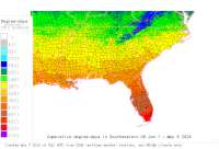
Disease Alert Movies: fireblight: 2010 2011 2012 2013 | ||
|
| |||||||||||||||||||||||||||
|
Kentucky USA Weather Data, Plant Disease Risk and Degree-Day Models RAWS Network - other tables for KY include: All Networks, CWOP/APRS, KYDOT, METAR, see our homepage. | |||||||||||||||||||||||||||
| |||||||||||||||||||||||||||
| # | Location linked to hourly weather, plant disease models and forecasts using "Mypest Page" |
County |
Re- cent data QA |
Fore- cast based virt data |
Nearby station based virt data |
Station code, links to NWS recent weather |
Links to NWS fore- casts |
Net- work Elev. (ft) |
Lat./ Long. (Dec. Deg.) |
Max-min temperature data and degree-days (click radio button to calc.) |
10 yr avgs |
30 yr avgs |
nmme fcast |
cfs fcast |
||||||||||||
|---|---|---|---|---|---|---|---|---|---|---|---|---|---|---|---|---|---|---|---|---|---|---|---|---|---|---|
| 1 | ALPINE | Cumberland |
|
na na |
na na |
|
|
853 | 36.79556 -85.38028 |
2021
|
2020
|
2019
|
2018
|
2017
|
2016
|
2015
|
2014
|
2013
|
|
AVG | AVG | nmme | ||||
| 2 | BIG SANDY | Johnson |
|
na na |
na na |
|
|
1180 | 37.75000 -82.63306 |
2021
|
2020
|
2019
|
2018
|
2017
|
2016
|
2015
|
2014
|
2013
|
|
AVG | AVG | nmme | ||||
| 3 | CRITTENDEN | Grant |
|
na na |
na na |
|
|
935 | 38.76917 -84.60167 |
2021
|
2020
|
2019
|
2018
|
2017
|
2016
|
2015
|
2014
|
2013
|
|
AVG | AVG | nmme | ||||
| 4 | FCRG55 | Christian Co |
|
na na |
na na |
|
|
601 | 36.65500 -87.49472 | nmme | ||||||||||||||||
| 5 | GREENVILLE | Muhlenberg |
|
na na |
na na |
|
|
552 | 37.26694 -87.20278 |
2021
|
2020
|
2019
|
2018
|
2017
|
2016
|
2015
|
2014
|
2013
|
|
AVG | AVG | nmme | ||||
| 6 | HOUCHIN MEADOW | Edmonson |
|
na na |
na na |
|
|
774 | 37.13167 -86.14806 |
2021
|
2020
|
2019
|
2018
|
2017
|
2016
|
2015
|
2014
|
2013
|
|
AVG | AVG | nmme | ||||
| 7 | JACKSON CO AP | Breathitt |
|
na na |
na na |
|
|
1388 | 37.59194 -83.31778 |
2021
|
2020
|
2019
|
2018
|
2017
|
2016
|
2015
|
2014
|
2013
|
|
AVG | AVG | nmme | ||||
| 8 | KOOMER | Powell |
|
na na |
na na |
|
|
1300 | 37.78083 -83.63222 |
2021
|
2020
|
2019
|
2018
|
2017
|
2016
|
2015
|
2014
|
2013
|
|
AVG | AVG | nmme | ||||
| 9 | KYLBL | Trigg |
|
na na |
na na |
|
|
649 | 36.77639 -88.06306 |
2021
|
2020
|
2019
|
2018
|
2017
|
2016
|
2015
|
2014
|
2013
|
|
AVG | AVG | nmme | ||||
| 10 | PEABODY | Clay |
|
na na |
na na |
|
|
1465 | 37.13806 -83.57944 |
2021
|
2020
|
2019
|
2018
|
2017
|
2016
|
2015
|
2014
|
2013
|
|
AVG | AVG | nmme | ||||
| 11 | SOMERSET | Pulaski |
|
na na |
na na |
|
|
921 | 37.05278 -84.61333 |
2021
|
2020
|
2019
|
2018
|
2017
|
2016
|
2015
|
2014
|
2013
|
|
AVG | AVG | nmme | ||||
| 12 | TRIANGLE MTN | Rowan |
|
na na |
na na |
|
|
1360 | 38.17556 -83.40639 |
2021
|
2020
|
2019
|
2018
|
2017
|
2016
|
2015
|
2014
|
2013
|
|
AVG | AVG | nmme | ||||
| 13 | YELLOW CREEK | Bell |
|
na na |
na na |
|
|
1090 | 36.60333 -83.69583 |
2021
|
2020
|
2019
|
2018
|
2017
|
2016
|
2015
|
2014
|
2013
|
|
AVG | AVG | nmme | ||||
[USPEST.ORG/WEA Home]
[Intro]
[US DD Mapmaker]
[Main Table Index]
[Links]


|