RAWS Network - other tables for VA include: All Networks, CWOP/APRS, HADS, METAR, VADOT, see our homepage.
|
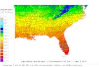
Also try the full-featured calculator/DD model | |
|
| |||||||||||||||||||||||||
|
Virginia USA Weather Data, Plant Disease Risk and Degree-Day Models RAWS Network - other tables for VA include: All Networks, CWOP/APRS, HADS, METAR, VADOT, see our homepage. | |||||||||||||||||||||||||
| |||||||||||||||||||||||||
| # | Location linked to hourly weather, plant disease models and forecasts using "Mypest Page" removed due to excessive bot activity |
County |
Re- cent data QA |
Fore- cast based virt data |
Nearby station based virt data |
Station code, links to NWS recent weather |
Links to NWS fore- casts |
Net- work Elev. (ft) |
Lat./ Long. (Dec. Deg.) |
Max-min temperature data and degree-days (click radio button to calc.) |
10 yr avgs |
30 yr avgs |
nmme fcast |
cfs fcast |
||||||||||
|---|---|---|---|---|---|---|---|---|---|---|---|---|---|---|---|---|---|---|---|---|---|---|---|---|
| 1 | APPOMATTOX | Buckingham C |
|
na na |
na na |
|
|
773 | 37.39194 -78.79694 |
2021
|
2020
|
2019
|
2018
|
2017
|
2016
|
AVG | AVG | nmme | cfs | |||||
| 2 | BACK BAY | Virginia Bea |
|
na na |
na na |
|
|
5 | 36.67167 -75.91639 |
2021
|
2020
|
2019
|
2018
|
2017
|
2016
|
AVG | AVG | nmme | cfs | |||||
| 3 | CRAIGLLEY | Botetourt |
|
na na |
na na |
|
|
1266 | 37.52194 -80.07944 |
2021
|
2020
|
2019
|
2018
|
2017
|
2016
|
AVG | AVG | nmme | cfs | |||||
| 4 | FAPH DELOS | Caroline Cou |
|
na na |
na na |
|
|
196 | 38.09556 -77.27194 |
2021
|
2020
|
2019
|
2018
|
2017
|
2016
|
AVG | AVG | nmme | cfs | |||||
| 5 | FAPH EODTC | Caroline Cou |
|
na na |
na na |
|
|
80 | 38.13194 -77.18444 |
2021
|
2020
|
2019
|
2018
|
2017
|
2016
|
AVG | AVG | nmme | cfs | |||||
| 6 | FAPH NORTH1 | King George |
|
na na |
na na |
|
|
201 | 38.18944 -77.29833 |
2021
|
2020
|
2019
|
2018
|
2017
|
2016
|
AVG | AVG | nmme | cfs | |||||
| 7 | FAPH QD 1 | Caroline Cou |
|
na na |
na na |
|
|
116 | 38.07417 -77.32278 |
2021
|
2020
|
2019
|
2018
|
2017
|
2016
|
AVG | AVG | nmme | cfs | |||||
| 8 | FAPH SOUTH 1 | Caroline Cou |
|
na na |
na na |
|
|
206 | 38.04250 -77.23694 |
2021
|
2020
|
2019
|
2018
|
2017
|
2016
|
AVG | AVG | nmme | cfs | |||||
| 9 | FORTLLEY | Shenandoah |
|
na na |
na na |
|
|
800 | 38.84417 -78.41528 |
2021
|
2020
|
2019
|
2018
|
2017
|
2016
|
AVG | AVG | nmme | cfs | |||||
| 10 | GDRPORT-QD | Chesapeake C |
|
na na |
na na |
|
|
20 | 36.56139 -76.40417 |
2021
|
2020
|
2019
|
2018
|
AVG | AVG | nmme | cfs | |||||||
| 11 | GDR | Suffolk City |
|
na na |
na na |
|
|
38 | 36.61306 -76.55417 |
2021
|
2020
|
2019
|
2018
|
2017
|
2016
|
AVG | AVG | nmme | cfs | |||||
| 12 | GLENPED | Rockbridge C |
|
na na |
na na |
|
|
865 | 37.62639 -79.51250 |
2021
|
2020
|
2019
|
2018
|
2017
|
2016
|
AVG | AVG | nmme | cfs | |||||
| 13 | HEADQUARTERS | Shenandoah C |
|
na na |
na na |
|
|
1200 | 38.66667 -78.37000 |
2021
|
2020
|
2019
|
2018
|
2017
|
2016
|
AVG | AVG | nmme | cfs | |||||
| 14 | JAMES RIVER | Charles City |
|
na na |
na na |
|
|
50 | 37.25917 -77.14056 |
2021
|
2020
|
2019
|
2018
|
2017
|
2016
|
AVG | AVG | nmme | cfs | |||||
| 15 | LIME KILN | Bath |
|
na na |
na na |
|
|
2580 | 37.98639 -79.75917 |
2021
|
2020
|
2019
|
2018
|
2017
|
2016
|
AVG | AVG | nmme | cfs | |||||
| 16 | PRINCE WILLIAM | Prince Willi |
|
na na |
na na |
|
|
35 | 38.56417 -77.37083 |
2021
|
2020
|
2019
|
2018
|
2017
|
2016
|
AVG | AVG | nmme | cfs | |||||
| 17 | SAWMILL RIDGE | Augusta |
|
na na |
na na |
|
|
2080 | 38.10000 -78.78444 |
2021
|
2020
|
2019
|
2018
|
2017
|
2016
|
AVG | AVG | nmme | cfs | |||||
| 18 | STONY FORK | Bland |
|
na na |
na na |
|
|
2540 | 37.01083 -81.17833 |
2021
|
2020
|
2019
|
2018
|
2017
|
2016
|
AVG | AVG | nmme | cfs | |||||
| 19 | WISE | Wise |
|
na na |
na na |
|
|
2530 | 36.96806 -82.55944 |
2021
|
2020
|
2019
|
2018
|
2017
|
2016
|
AVG | AVG | nmme | cfs | |||||
[USPEST.ORG/WEA Home]
[Intro]
[US DD Mapmaker]
[Main Table Index]
[Links]


|