CALTRANS Network - other tables for CA include: All Networks, CWOP/APRS, CARB, CIMIS, CLR, CNRFC, DRI, HADS, METAR, RAWS, PESTCAST, see our homepage.
|
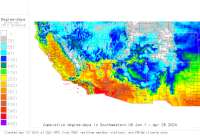
Also try the full-featured calculator/DD model | |
|
| |||||||||||||||||||||||||
|
California USA Weather Data, Plant Disease Risk and Degree-Day Models CALTRANS Network - other tables for CA include: All Networks, CWOP/APRS, CARB, CIMIS, CLR, CNRFC, DRI, HADS, METAR, RAWS, PESTCAST, see our homepage. | |||||||||||||||||||||||||
| |||||||||||||||||||||||||
| # | Location linked to hourly weather, plant disease models and forecasts using "Mypest Page" removed due to excessive bot activity |
County |
Re- cent data QA |
Fore- cast based virt data |
Nearby station based virt data |
Station code, links to NWS recent weather |
Links to NWS fore- casts |
Net- work Elev. (ft) |
Lat./ Long. (Dec. Deg.) |
Max-min temperature data and degree-days (click radio button to calc.) |
10 yr avgs |
30 yr avgs |
nmme fcast |
cfs fcast |
||||||||||
|---|---|---|---|---|---|---|---|---|---|---|---|---|---|---|---|---|---|---|---|---|---|---|---|---|
| 1 | 50EB Rvrton Barn RWIS | Placer Count |
|
na na |
na na |
|
|
3231 | 38.77361 -120.47083 | nmme | cfs | |||||||||||||
| 2 | 99NB at Dillard Road | Sacramento C |
|
na na |
na na |
|
|
39 | 38.34222 -121.33444 | nmme | cfs | |||||||||||||
| 3 | Anderson Grade | Siskiyou |
|
na na |
na na |
|
|
2963 | 41.79056 -122.58833 |
2021
|
2020
|
2019
|
2018
|
2017
|
2016
|
AVG | AVG | nmme | cfs | |||||
| 4 | Antlers | Shasta |
|
na na |
na na |
|
|
1080 | 40.88472 -122.38250 |
2021
|
2020
|
2019
|
2018
|
2017
|
2016
|
AVG | AVG | nmme | cfs | |||||
| 5 | Black Butte Summit | Siskiyou |
|
na na |
na na |
|
|
3945 | 41.35444 -122.35250 |
2021
|
2020
|
2019
|
2018
|
2017
|
2016
|
AVG | AVG | nmme | cfs | |||||
| 6 | Bogard Rest Area | Lassen |
|
na na |
na na |
|
|
5659 | 40.58556 -121.08806 |
2021
|
2020
|
2019
|
2018
|
2017
|
2016
|
AVG | AVG | nmme | cfs | |||||
| 7 | Brannan Island Rd | Sacramento C |
|
na na |
na na |
|
|
-12 | 38.13583 -121.60917 |
2021
|
2020
|
2019
|
2018
|
2016
|
AVG | AVG | nmme | cfs | ||||||
| 8 | Buckhorn Sandhouse | Trinity |
|
na na |
na na |
|
|
2707 | 40.65444 -122.75444 |
2021
|
2020
|
2019
|
2018
|
2017
|
2016
|
AVG | AVG | nmme | cfs | |||||
| 9 | Collier | Siskiyou Cou |
|
na na |
na na |
|
|
2148 | 41.85167 -122.57000 |
2021
|
nmme | cfs | ||||||||||||
| 10 | Doyle | Lassen Count |
|
na na |
na na |
|
|
4285 | 40.00056 -120.08528 |
2021
|
2020
|
2019
|
2018
|
2017
|
2016
|
AVG | AVG | nmme | cfs | |||||
| 11 | Dunsmuir | Siskiyou |
|
na na |
na na |
|
|
2500 | 41.21000 -122.27444 |
2021
|
2020
|
2019
|
2018
|
2017
|
2016
|
AVG | AVG | nmme | cfs | |||||
| 12 | Fredonyer Pass East | Lassen |
|
na na |
na na |
|
|
4695 | 40.39000 -120.79000 |
2021
|
2020
|
2019
|
2018
|
2017
|
2016
|
AVG | AVG | nmme | cfs | |||||
| 13 | Fredonyer Pass Summit | Lassen |
|
na na |
na na |
|
|
5701 | 40.36028 -120.86528 |
2021
|
2020
|
2019
|
2018
|
2017
|
2016
|
AVG | AVG | nmme | cfs | |||||
| 14 | Hatchet Mountain | Shasta |
|
na na |
na na |
|
|
4366 | 40.85194 -121.76194 |
2021
|
2020
|
2019
|
2018
|
2017
|
2016
|
AVG | AVG | nmme | cfs | |||||
| 15 | Hilt | Siskiyou |
|
na na |
na na |
|
|
3188 | 41.99250 -122.60861 |
2021
|
2020
|
2019
|
2018
|
2017
|
2016
|
AVG | AVG | nmme | cfs | |||||
| 16 | Hornbrook | Siskiyou |
|
na na |
na na |
|
|
2280 | 41.91028 -122.56778 |
2021
|
2020
|
2019
|
2018
|
2017
|
2016
|
AVG | AVG | nmme | cfs | |||||
| 17 | Hwy 267 at Brockway Su | Nevada Count |
|
na na |
na na |
|
|
7194 | 39.26056 -120.07167 |
2021
|
nmme | cfs | ||||||||||||
| 18 | Hwy 267 at Truckee Byp | Nevada Count |
|
na na |
na na |
|
|
5866 | 39.33417 -120.16306 |
2021
|
nmme | cfs | ||||||||||||
| 19 | Hwy 5 at Richards | Yolo County |
|
na na |
na na |
|
|
36 | 38.59833 -121.50444 |
2021
|
2020
|
2019
|
2018
|
2017
|
2016
|
AVG | AVG | nmme | cfs | |||||
| 20 | Hwy 80 at Blue Canyon | Nevada Count |
|
na na |
na na |
|
|
5314 | 39.28333 -120.70306 |
2021
|
2020
|
2019
|
2018
|
2017
|
2016
|
AVG | AVG | nmme | ||||||
| 21 | Hwy 80 at Bryte Bend | Yolo County |
|
na na |
na na |
|
|
19 | 38.60278 -121.54444 | nmme | cfs | |||||||||||||
| 22 | Hwy 80 at Chiles | Yolo County |
|
na na |
na na |
|
|
29 | 38.56333 -121.63889 |
2021
|
nmme | cfs | ||||||||||||
| 23 | Hwy 80 at West Capitol | Yolo County |
|
na na |
na na |
|
|
13 | 38.57389 -121.58167 |
2021
|
nmme | cfs | ||||||||||||
| 24 | Hwy 89 at Rampart | Nevada Count |
|
na na |
na na |
|
|
6250 | 39.16528 -120.17750 |
2021
|
nmme | cfs | ||||||||||||
| 25 | I10 - East of SR-62 | San Bernardi |
|
na na |
na na |
|
|
974 | 33.91278 -116.59778 |
2021
|
nmme | cfs | ||||||||||||
| 26 | I5 - North of SR-12 | Sacramento C |
|
na na |
na na |
|
|
6 | 38.12056 -121.39944 |
2021
|
nmme | cfs | ||||||||||||
| 27 | I580 - Hansen Road | San Joaquin |
|
na na |
na na |
|
|
255 | 37.70694 -121.51500 | nmme | ||||||||||||||
| 28 | I580 - I-205 | San Joaquin |
|
na na |
na na |
|
|
301 | 37.74139 -121.57167 |
2021
|
nmme | cfs | ||||||||||||
| 29 | I580 - West of SR-132 | San Joaquin |
|
na na |
na na |
|
|
278 | 37.65028 -121.42139 |
2021
|
nmme | cfs | ||||||||||||
| 30 | I10 E of Dillon Road | Riverside Co |
|
na na |
na na |
|
|
10 | 33.71417 -116.16417 | nmme | cfs | |||||||||||||
| 31 | I101 Mile E of Indian | San Bernardi |
|
na na |
na na |
|
|
646 | 33.89389 -116.52028 |
2021
|
nmme | cfs | ||||||||||||
| 32 | I10Next to CMS in Bly | La Paz Count |
|
na na |
na na |
|
|
269 | 33.60806 -114.55000 | nmme | cfs | |||||||||||||
| 33 | I10W of Date Palm Dri | Riverside Co |
|
na na |
na na |
|
|
406 | 33.85139 -116.46222 |
2021
|
nmme | cfs | ||||||||||||
| 34 | I10W of Haugen-Lehman | San Bernardi |
|
na na |
na na |
|
|
1358 | 33.92333 -116.69917 |
2021
|
nmme | cfs | ||||||||||||
| 35 | I1503 Mile N of SR-1 | San Bernardi |
|
na na |
na na |
|
|
3179 | 34.31500 -117.47889 |
2021
|
nmme | cfs | ||||||||||||
| 36 | I1511 Miles S of Oak | San Bernardi |
|
na na |
na na |
|
|
4281 | 34.35028 -117.44472 |
2021
|
nmme | cfs | ||||||||||||
| 37 | I1522 Miles S of Oak | San Bernardi |
|
na na |
na na |
|
|
4094 | 34.34333 -117.46083 |
2021
|
nmme | cfs | ||||||||||||
| 38 | I15Desert Oasis Rest | San Bernardi |
|
na na |
na na |
|
|
1807 | 34.80000 -116.52194 | nmme | cfs | |||||||||||||
| 39 | I15Next to CMS In Bak | San Bernardi |
|
na na |
na na |
|
|
948 | 35.25583 -116.08417 |
2021
|
nmme | cfs | ||||||||||||
| 40 | I40Barstow Mntc Yard | San Bernardi |
|
na na |
na na |
|
|
2129 | 34.88611 -116.99694 |
2021
|
nmme | cfs | ||||||||||||
| 41 | I535 Miles S of SR-1 | Fresno Count |
|
na na |
na na |
|
|
456 | 36.20944 -120.21528 | nmme | ||||||||||||||
| 42 | I5Del Puerto Canyon | Stanislaus C |
|
na na |
na na |
|
|
265 | 37.46722 -121.18333 |
2021
|
nmme | cfs | ||||||||||||
| 43 | I5I-205 Paradise Cut | San Joaquin |
|
na na |
na na |
|
|
13 | 37.76944 -121.32833 |
2021
|
nmme | cfs | ||||||||||||
| 44 | I5S of Eight Mile Rd | Sacramento C |
|
na na |
na na |
|
|
6 | 38.04639 -121.36861 | nmme | cfs | |||||||||||||
| 45 | I5Wley Rest Area | San Joaquin |
|
na na |
na na |
|
|
314 | 37.58250 -121.32194 | nmme | cfs | |||||||||||||
| 46 | Janesville | Lassen Count |
|
na na |
na na |
|
|
4172 | 40.29389 -120.50833 |
2021
|
2020
|
2019
|
2018
|
2017
|
2016
|
AVG | AVG | nmme | cfs | |||||
| 47 | Mer 99 SO La Grand | Mariposa Cou |
|
na na |
na na |
|
|
201 | 37.21306 -120.36250 |
2021
|
2020
|
2019
|
2018
|
2017
|
2016
|
AVG | AVG | nmme | cfs | |||||
| 48 | Mer 99 SO Mariposa Way | Stanislaus C |
|
na na |
na na |
|
|
192 | 37.24472 -120.40278 |
2021
|
2020
|
2019
|
2018
|
2017
|
2016
|
AVG | AVG | nmme | cfs | |||||
| 49 | North Weed | Siskiyou Cou |
|
na na |
na na |
|
|
3445 | 41.42833 -122.39861 |
2021
|
2020
|
2019
|
2018
|
2017
|
2016
|
AVG | AVG | nmme | cfs | |||||
| 50 | Obrien | Shasta Count |
|
na na |
na na |
|
|
1388 | 40.80722 -122.32222 | nmme | cfs | |||||||||||||
| 51 | Oregon Mountain Summit | Trinity |
|
na na |
na na |
|
|
2854 | 40.73917 -122.98028 |
2021
|
2020
|
2019
|
2018
|
2017
|
2016
|
AVG | AVG | nmme | cfs | |||||
| 52 | Rt 152 San Luis | Merced Count |
|
na na |
na na |
|
|
264 | 37.06194 -121.06000 |
2021
|
2020
|
2019
|
2018
|
2017
|
2016
|
AVG | AVG | nmme | cfs | |||||
| 53 | Rt 99 @ Crosstown | San Joaquin |
|
na na |
na na |
|
|
31 | 37.96139 -121.24139 |
2021
|
2020
|
2019
|
2018
|
2017
|
2016
|
AVG | AVG | nmme | cfs | |||||
| 54 | Rt 99 @ Freemont | San Joaquin |
|
na na |
na na |
|
|
26 | 37.97417 -121.24722 |
2021
|
2020
|
2019
|
2018
|
2017
|
2016
|
AVG | AVG | nmme | cfs | |||||
| 55 | Rt 99 @ Hammer Lane | San Joaquin |
|
na na |
na na |
|
|
30 | 38.02000 -121.25861 |
2021
|
2020
|
2019
|
2018
|
2017
|
AVG | nmme | cfs | |||||||
| 56 | Rt 99 @ Wilson Way | San Joaquin |
|
na na |
na na |
|
|
33 | 38.00306 -121.25694 |
2021
|
2020
|
2019
|
2018
|
2017
|
AVG | AVG | nmme | cfs | ||||||
| 57 | Rt 99 Keyes | San Joaquin |
|
na na |
na na |
|
|
93 | 37.55944 -120.91972 |
2021
|
2020
|
2019
|
2018
|
2017
|
2016
|
AVG | AVG | nmme | cfs | |||||
| 58 | Rt 99 Livingston | Stanislaus C |
|
na na |
na na |
|
|
141 | 37.37444 -120.68333 |
2021
|
2020
|
2019
|
2018
|
2017
|
2016
|
AVG | AVG | nmme | cfs | |||||
| 59 | Rt 99 Ripon | San Joaquin |
|
na na |
na na |
|
|
67 | 37.74639 -121.13250 |
2021
|
2020
|
2019
|
2018
|
2017
|
2016
|
AVG | AVG | nmme | cfs | |||||
| 60 | Rt 99 Turlock | Stanislaus C |
|
na na |
na na |
|
|
112 | 37.46444 -120.82472 |
2021
|
2020
|
2019
|
2018
|
2017
|
2016
|
AVG | AVG | nmme | cfs | |||||
| 61 | S Clara Cnty 152 Jct 1 | Santa Clara |
|
na na |
na na |
|
|
300 | 36.97694 -121.38083 |
2021
|
2020
|
2019
|
2018
|
2017
|
2016
|
AVG | AVG | nmme | cfs | |||||
| 62 | Sims Rd | Siskiyou Cou |
|
na na |
na na |
|
|
1821 | 41.07778 -122.35556 |
2021
|
2020
|
2019
|
2018
|
2017
|
2016
|
AVG | AVG | nmme | cfs | |||||
| 63 | SJ 12 Tower Park Way | Sacramento C |
|
na na |
na na |
|
|
-14 | 38.11528 -121.48500 |
2021
|
2020
|
2019
|
2018
|
2017
|
2016
|
AVG | AVG | nmme | cfs | |||||
| 64 | SJ 120 EO Airport Way | San Joaquin |
|
na na |
na na |
|
|
31 | 37.78306 -121.24361 |
2021
|
2020
|
2019
|
2018
|
2017
|
2016
|
AVG | AVG | nmme | cfs | |||||
| 65 | SJ 120 EO Main St | San Joaquin |
|
na na |
na na |
|
|
39 | 37.78333 -121.21111 |
2021
|
2020
|
2019
|
2018
|
2017
|
AVG | nmme | cfs | |||||||
| 66 | SJ 120 JCT Rte 5 R143 | San Joaquin |
|
na na |
na na |
|
|
37 | 37.78667 -121.30417 |
2021
|
2020
|
2019
|
2018
|
2017
|
2016
|
AVG | AVG | nmme | cfs | |||||
| 67 | SJ 120 McKinley Ave UC | San Joaquin |
|
na na |
na na |
|
|
29 | 37.78472 -121.27056 |
2021
|
2020
|
2019
|
2018
|
2017
|
2016
|
AVG | AVG | nmme | cfs | |||||
| 68 | SJ 5 NO Lathrop Rd | San Joaquin |
|
na na |
na na |
|
|
18 | 37.83778 -121.28611 |
2021
|
2020
|
2019
|
2018
|
2017
|
2016
|
AVG | AVG | nmme | cfs | |||||
| 69 | SJ 5 NO Mathews Rd | San Joaquin |
|
na na |
na na |
|
|
17 | 37.88250 -121.27889 |
2021
|
2020
|
2019
|
2018
|
2017
|
2016
|
AVG | AVG | nmme | cfs | |||||
| 70 | SJ 5 NO Roth Rd | San Joaquin |
|
na na |
na na |
|
|
25 | 37.85750 -121.28139 |
2021
|
2020
|
2019
|
2018
|
2017
|
2016
|
AVG | AVG | nmme | cfs | |||||
| 71 | SJ 5 NO Rte 120 | San Joaquin |
|
na na |
na na |
|
|
28 | 37.79083 -121.30083 |
2021
|
2020
|
2019
|
2018
|
2017
|
2016
|
AVG | AVG | nmme | cfs | |||||
| 72 | SJ 5 SO Louise Ave | San Joaquin |
|
na na |
na na |
|
|
26 | 37.81139 -121.29556 |
2021
|
2020
|
2019
|
2018
|
2017
|
2016
|
AVG | AVG | nmme | cfs | |||||
| 73 | Snowmans Summit | Siskiyou |
|
na na |
na na |
|
|
4478 | 41.26889 -122.21139 |
2021
|
2020
|
2019
|
2018
|
2017
|
2016
|
AVG | AVG | nmme | cfs | |||||
| 74 | Spring Garden Overhead | Lassen |
|
na na |
na na |
|
|
3860 | 39.91167 -120.81167 |
2021
|
2020
|
2019
|
2018
|
2017
|
2016
|
AVG | AVG | nmme | cfs | |||||
| 75 | SR138-015 Mile E of | San Bernardi |
|
na na |
na na |
|
|
4793 | 34.38833 -117.57444 |
2021
|
nmme | cfs | ||||||||||||
| 76 | SR14 - InyoKern | Kern County |
|
na na |
na na |
|
|
3018 | 35.64167 -117.88250 | nmme | cfs | |||||||||||||
| 77 | SR152-Dinosaur Pt | Merced Count |
|
na na |
na na |
|
|
1371 | 37.06694 -121.21583 |
2021
|
nmme | cfs | ||||||||||||
| 78 | SR178-Kern Canyon Roa | Kern County |
|
na na |
na na |
|
|
751 | 35.39861 -118.87944 |
2021
|
nmme | cfs | ||||||||||||
| 79 | SR198-Just W of SR-99 | Fresno Count |
|
na na |
na na |
|
|
298 | 36.32694 -119.41556 |
2021
|
nmme | cfs | ||||||||||||
| 80 | SR2-Wrightwood Fire S | San Bernardi |
|
na na |
na na |
|
|
5921 | 34.35944 -117.62917 |
2021
|
nmme | cfs | ||||||||||||
| 81 | SR203 - US-395 | Mono County |
|
na na |
na na |
|
|
7339 | 37.64083 -118.91833 | nmme | ||||||||||||||
| 82 | SR219-E of Pentecost | San Joaquin |
|
na na |
na na |
|
|
104 | 37.71111 -121.00083 |
2021
|
nmme | cfs | ||||||||||||
| 83 | SR219-W of Morrow Roa | San Joaquin |
|
na na |
na na |
|
|
91 | 37.71111 -121.03806 |
2021
|
nmme | cfs | ||||||||||||
| 84 | SR41-S Joaquin Rvr | Madera Count |
|
na na |
na na |
|
|
285 | 36.87444 -119.79306 |
2021
|
nmme | cfs | ||||||||||||
| 85 | SR58-Tehachapi -Broom | Kern County |
|
na na |
na na |
|
|
3136 | 35.20056 -118.52167 | nmme | cfs | |||||||||||||
| 86 | SR58-Tehachapi Summit | Kern County |
|
na na |
na na |
|
|
4071 | 35.12528 -118.41056 | nmme | cfs | |||||||||||||
| 87 | SR58-W of Cottonwood | Kern County |
|
na na |
na na |
|
|
406 | 35.35250 -118.98389 |
2021
|
nmme | cfs | ||||||||||||
| 88 | SR99 - Fresno River | Madera Count |
|
na na |
na na |
|
|
278 | 36.97028 -120.07250 |
2021
|
nmme | cfs | ||||||||||||
| 89 | SR99 - Griffith Road | Stanislaus C |
|
na na |
na na |
|
|
124 | 37.45444 -120.80306 |
2021
|
2020
|
2019
|
2018
|
2016
|
AVG | AVG | nmme | cfs | ||||||
| 90 | SR99 - SR-120 | San Joaquin |
|
na na |
na na |
|
|
39 | 37.77833 -121.18389 |
2021
|
nmme | cfs | ||||||||||||
| 91 | SR99-Buchanan Hollow | Mariposa Cou |
|
na na |
na na |
|
|
213 | 37.19722 -120.34306 |
2021
|
nmme | cfs | ||||||||||||
| 92 | SR99-N of Jack Tone R | San Joaquin |
|
na na |
na na |
|
|
64 | 37.75944 -121.15444 |
2021
|
nmme | cfs | ||||||||||||
| 93 | SR99-N of Kiernan Rd | San Joaquin |
|
na na |
na na |
|
|
72 | 37.70889 -121.08139 |
2021
|
nmme | cfs | ||||||||||||
| 94 | SR99-N of Shanks Road | Stanislaus C |
|
na na |
na na |
|
|
120 | 37.44250 -120.78889 | nmme | cfs | |||||||||||||
| 95 | SR99-N of Whinton | Stanislaus C |
|
na na |
na na |
|
|
120 | 37.39111 -120.73778 | nmme | cfs | |||||||||||||
| 96 | SR139 Perez | Modoc County |
|
na na |
na na |
|
|
4480 | 41.60389 -121.20694 |
2021
|
2020
|
2019
|
2018
|
2017
|
2016
|
AVG | AVG | nmme | cfs | |||||
| 97 | US395 - Bradys | Kern County |
|
na na |
na na |
|
|
2522 | 35.72333 -117.86917 | nmme | cfs | |||||||||||||
| 98 | US395 - Conway Summit | Mono County |
|
na na |
na na |
|
|
8146 | 38.08778 -119.18139 | nmme | cfs | |||||||||||||
| 99 | US395 - Crestview | Mono County |
|
na na |
na na |
|
|
7519 | 37.75111 -118.98306 | nmme | cfs | |||||||||||||
| 100 | US395 - Obsidian Dome | Mono County |
|
na na |
na na |
|
|
8031 | 37.77472 -119.01389 | nmme | cfs | |||||||||||||
| 101 | US395 - Red Hill | Mono County |
|
na na |
na na |
|
|
6971 | 38.05833 -119.16694 | nmme | cfs | |||||||||||||
| 102 | US395 - Sage Flat | Nye County |
|
na na |
na na |
|
|
3959 | 36.20500 -117.97972 | nmme | cfs | |||||||||||||
| 103 | US395 - SR-158 | Mineral Coun |
|
na na |
na na |
|
|
6866 | 37.89833 -119.09361 | nmme | cfs | |||||||||||||
| 104 | US395 - Toms Place | Mono County |
|
na na |
na na |
|
|
7037 | 37.56194 -118.67722 | nmme | cfs | |||||||||||||
| 105 | US395 - Windmill | Mono County |
|
na na |
na na |
|
|
6879 | 37.53417 -118.63528 | nmme | cfs | |||||||||||||
| 106 | US395-Coso Rest Area | Nye County |
|
na na |
na na |
|
|
3389 | 36.04583 -117.94667 | nmme | cfs | |||||||||||||
| 107 | US395-Dunmovin Hill - | Nye County |
|
na na |
na na |
|
|
3497 | 36.08639 -117.96111 | nmme | cfs | |||||||||||||
| 108 | US395-Lee Vining Hill | Mineral Coun |
|
na na |
na na |
|
|
8976 | 37.96500 -119.14528 | nmme | cfs | |||||||||||||
| 109 | US395-McGee Cr Road | Mono County |
|
na na |
na na |
|
|
6906 | 37.58778 -118.78389 | nmme | cfs | |||||||||||||
| 110 | US395-SR-108 Sonora J | Mono County |
|
na na |
na na |
|
|
6902 | 38.35111 -119.44972 | nmme | cfs | |||||||||||||
| 111 | US6-CA NV Stline | Mono County |
|
na na |
na na |
|
|
5472 | 37.84194 -118.47833 | nmme | cfs | |||||||||||||
| 112 | US6-Matthieu Hill Sum | Mono County |
|
na na |
na na |
|
|
5209 | 37.75500 -118.45528 | nmme | ||||||||||||||
| 113 | Vollmers | Shasta Count |
|
na na |
na na |
|
|
1330 | 40.94167 -122.42667 |
2021
|
2020
|
2019
|
2018
|
2017
|
2016
|
AVG | AVG | nmme | cfs | |||||
| 114 | WO SR 33 Vernalis | San Joaquin |
|
na na |
na na |
|
|
133 | 37.63778 -121.31389 |
2021
|
nmme | cfs | ||||||||||||
| 115 | Weed Airport | Siskiyou |
|
na na |
na na |
|
|
2921 | 41.47250 -122.45278 |
2021
|
2020
|
2019
|
2018
|
2017
|
2016
|
AVG | AVG | nmme | cfs | |||||
[USPEST.ORG/WEA Home]
[Intro]
[US DD Mapmaker]
[Main Table Index]
[Links]


|