APRSWXNET Network - other tables for ND include: All Networks, METAR, NDDOT, RAWS, see our homepage.
|
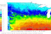
Also try the full-featured calculator/DD model | |
|
| |||||||||||||||||||||||||
|
North Dakota USA Weather Data, Plant Disease Risk and Degree-Day Models APRSWXNET Network - other tables for ND include: All Networks, METAR, NDDOT, RAWS, see our homepage. | |||||||||||||||||||||||||
| |||||||||||||||||||||||||
| # | Location linked to hourly weather, plant disease models and forecasts using "Mypest Page" removed due to excessive bot activity |
County |
Re- cent data QA |
Fore- cast based virt data |
Nearby station based virt data |
Station code, links to NWS recent weather |
Links to NWS fore- casts |
Net- work Elev. (ft) |
Lat./ Long. (Dec. Deg.) |
Max-min temperature data and degree-days (click radio button to calc.) |
10 yr avgs |
30 yr avgs |
nmme fcast |
cfs fcast |
||||||||||
|---|---|---|---|---|---|---|---|---|---|---|---|---|---|---|---|---|---|---|---|---|---|---|---|---|
| 1 | Alexander DW2470 | McKenzie |
|
na na |
na na |
|
|
2359 | 47.87083 -103.64194 |
2021
|
2020
|
2019
|
2018
|
2017
|
2016
|
AVG | AVG | nmme | cfs | |||||
| 2 | Bismarck CW2059 | Burleigh |
|
na na |
na na |
|
|
1913 | 46.90194 -100.78500 |
2021
|
2020
|
2019
|
2018
|
2017
|
2016
|
AVG | AVG | nmme | cfs | |||||
| 3 | KC0AFB BISMARCK | Burleigh Cou |
|
na na |
na na |
|
|
1876 | 46.90306 -100.79028 | nmme | cfs | |||||||||||||
| 4 | Cathay0B1 | Wells |
|
na na |
na na |
|
|
1594 | 47.57528 -99.41667 |
2021
|
2020
|
2019
|
2018
|
2017
|
2016
|
AVG | AVG | nmme | cfs | |||||
| 5 | Devils Lake DW5459 | Ramsey Count |
|
na na |
na na |
|
|
1427 | 48.10000 -98.90000 |
2021
|
2020
|
2019
|
nmme | cfs | ||||||||||
| 6 | Hannover DW6873 | Mercer Count |
|
na na |
na na |
|
|
2162 | 47.10389 -101.44472 |
2021
|
2020
|
2019
|
2018
|
2017
|
2016
|
AVG | AVG | nmme | cfs | |||||
| 7 | Newburg DW7576 | Bottineau Co |
|
na na |
na na |
|
|
1495 | 48.78222 -100.92694 |
2021
|
2020
|
2019
|
2018
|
2017
|
2016
|
AVG | AVG | nmme | cfs | |||||
| 8 | Grand Forks DW8241 | Grand Forks |
|
na na |
na na |
|
|
846 | 47.88750 -97.16472 |
2021
|
2020
|
2019
|
2018
|
2017
|
2016
|
AVG | AVG | nmme | cfs | |||||
| 9 | Eldridge CW9696 | Stutsman |
|
na na |
na na |
|
|
1648 | 46.84389 -98.93389 |
2021
|
2020
|
2019
|
2018
|
2017
|
2016
|
AVG | AVG | nmme | cfs | |||||
| 10 | Dresden EW3711 | Cavalier Cou |
|
na na |
na na |
|
|
1608 | 48.82528 -98.48194 |
2021
|
nmme | cfs | ||||||||||||
| 11 | Williston EW6205 | Williams Cou |
|
na na |
na na |
|
|
1877 | 48.15000 -103.62278 |
2021
|
2020
|
2019
|
2018
|
2017
|
AVG | nmme | cfs | |||||||
| 12 | Bottineau EW6998 | Bottineau Co |
|
na na |
na na |
|
|
1689 | 48.83611 -100.41222 |
2021
|
2020
|
2019
|
nmme | cfs | ||||||||||
| 13 | Killdeer EW7711 | McKenzie Cou |
|
na na |
na na |
|
|
2322 | 47.36972 -102.76361 |
2021
|
2020
|
2019
|
nmme | cfs | ||||||||||
| 14 | Medora EW7744 | Billings Cou |
|
na na |
na na |
|
|
8398 | 46.91778 -103.64694 |
2021
|
2020
|
2019
|
2018
|
2017
|
2016
|
AVG | AVG | nmme | cfs | |||||
| 15 | Mandan EW9213 | Morton Count |
|
na na |
na na |
|
|
1971 | 46.62556 -100.72472 |
2021
|
2020
|
2019
|
2018
|
2017
|
AVG | AVG | nmme | cfs | ||||||
| 16 | Fargo DW6537 | Cass |
|
na na |
na na |
|
|
909 | 46.89778 -96.78528 |
2021
|
2020
|
2019
|
2018
|
AVG | AVG | nmme | cfs | |||||||
| 17 | FW1401 Harwood | Cass County |
|
na na |
na na |
|
|
890 | 46.98361 -96.88028 |
2021
|
2020
|
2019
|
2018
|
nmme | cfs | |||||||||
| 18 | FW3137 Fargo | Cass County |
|
na na |
na na |
|
|
905 | 46.79583 -96.89444 |
2021
|
2020
|
2019
|
2018
|
nmme | cfs | |||||||||
| 19 | FW6805 Lake Tschida | Morton Count |
|
na na |
na na |
|
|
2066 | 46.60583 -101.83194 |
2021
|
nmme | cfs | ||||||||||||
| 20 | FW7163 Raub | McLean Count |
|
na na |
na na |
|
|
1991 | 47.70194 -102.07833 |
2021
|
nmme | cfs | ||||||||||||
| 21 | Glenburn CW9862 | Ward |
|
na na |
na na |
|
|
1575 | 48.45278 -101.21889 |
2021
|
2020
|
2019
|
2018
|
2017
|
2016
|
AVG | AVG | nmme | cfs | |||||
| 22 | GW0702 Flasher | Morton Count |
|
na na |
na na |
|
|
1955 | 46.45667 -101.22917 |
2021
|
nmme | cfs | ||||||||||||
| 23 | GW2709 Minot AFB | Ward County |
|
na na |
na na |
|
|
1620 | 48.41944 -101.31194 | nmme | cfs | |||||||||||||
| 24 | GW3576 GRAND FORKS | Grand Forks |
|
na na |
na na |
|
|
830 | 47.86861 -97.02528 | nmme | cfs | |||||||||||||
| 25 | Minot DW4772 | Ward |
|
na na |
na na |
|
|
1755 | 48.21444 -101.32500 |
2021
|
2020
|
2019
|
2018
|
2017
|
2016
|
AVG | AVG | nmme | cfs | |||||
[USPEST.ORG/WEA Home]
[Intro]
[US DD Mapmaker]
[Main Table Index]
[Links]


|